Admiralty, 2000, Softcover, Book Condition: Very Good, Dust Jacket Condition: No, Revised
Crisp and clean black and white chart with two vertical folds. Nautical Chart No. 3802 Cuba - South Coast, Golfo de Guacanayabo, Punta Gua to Santa Cruz del Sur. Copyright 1963 with small corrections to 2000. Scale 1:100,000. Area Covered: Cuba (part), Cayos Mate, San Juan Anchorage, Canal Meia Luna, Canal de Cuatro Reales, Cayo Rabihorcado, Gran Bajo de Buena Esperanza, Canal Pitajaya, Cayos de Manzanillo, Campechuela, Calicito, Manzanillo, Rio Cauto, Bahia Birama, Cayos Sevilla, Paso Chinchorro, Santa Cruz del Sur Size: 72x124. Item Type: Map. Quantity Available: 1. Shipped Weight: under 1 kg. Pictures of this item not already displayed here available upon request. Inventory No: 45517094048. EU buyers are likely to be charged import VAT and handling charges by the courier/postal service before delivery. Please contact us before ordering to help minimise these charges. Sometimes total costs are less by ordering at abebooks and selecting to pay by paypal.

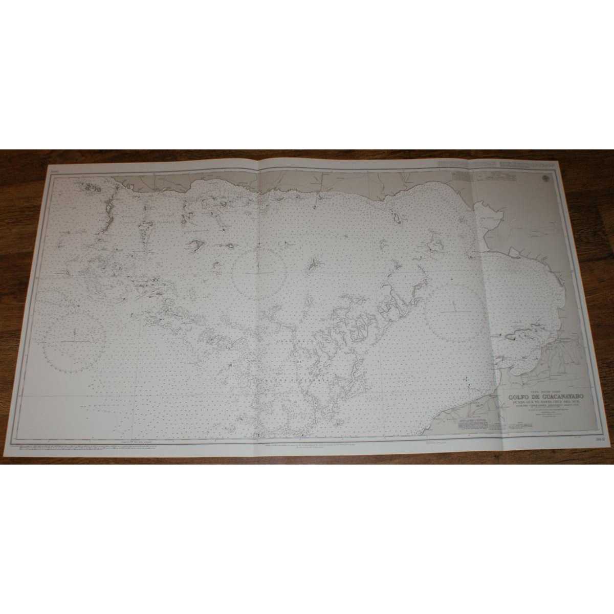
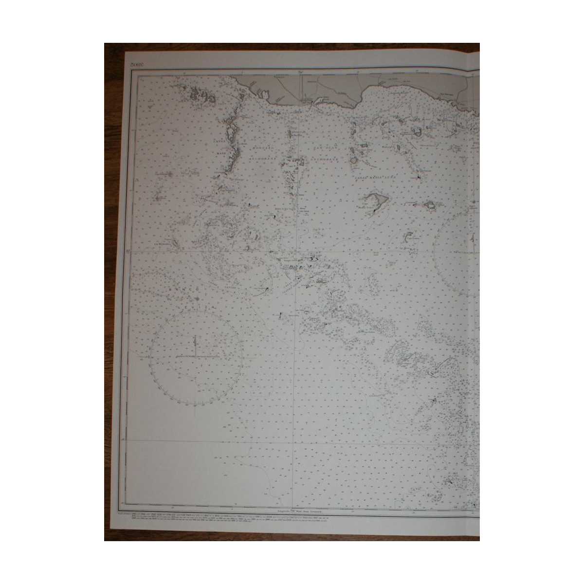
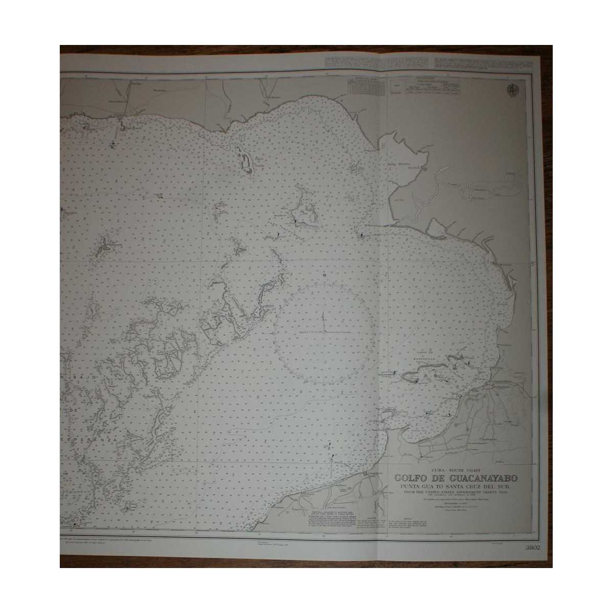
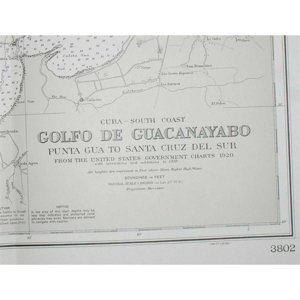


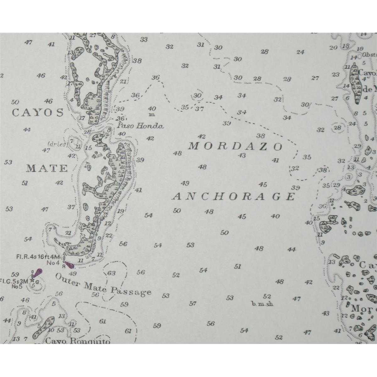
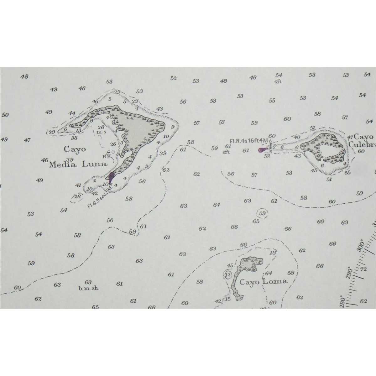
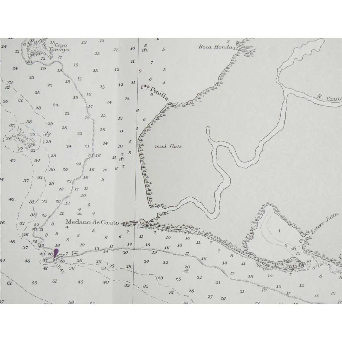
Crisp and clean black and white chart with two vertical folds. Nautical Chart No. 3802 Cuba - South Coast, Golfo de Guacanayabo, Punta Gua to Santa Cruz del Sur. Copyright 1963 with small corrections to 2000. Scale 1:100,000. Area Covered: Cuba (part), Cayos Mate, San Juan Anchorage, Canal Meia Luna, Canal de Cuatro Reales, Cayo Rabihorcado, Gran Bajo de Buena Esperanza, Canal Pitajaya, Cayos de Manzanillo, Campechuela, Calicito, Manzanillo, Rio Cauto, Bahia Birama, Cayos Sevilla, Paso Chinchorro, Santa Cruz del Sur Size: 72x124. Item Type: Map. Quantity Available: 1. Shipped Weight: under 1 kg. Pictures of this item not already displayed here available upon request. Inventory No: 45517094048. EU buyers are likely to be charged import VAT and handling charges by the courier/postal service before delivery. Please contact us before ordering to help minimise these charges. Sometimes total costs are less by ordering at abebooks and selecting to pay by paypal.