
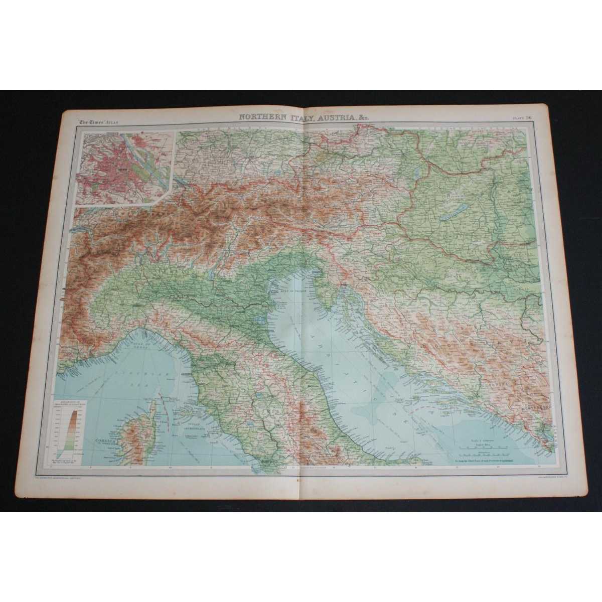
Title:Map of "Northern Italy, Austria, etc." from 1920 Times Atlas (Plate 36) including Turin, Milan, Verona, Trieste, Venice, Florence, Ravenna, Bologna, Rome, Munich, Vienna, Budapest, Salzberg, Elba, etc
Author:The Times and J. G. Bartholomew
Publisher:The Times, London, 1920
Edition:First
Binding:Softcover
Condition:Very Good
Dust Jacket:No
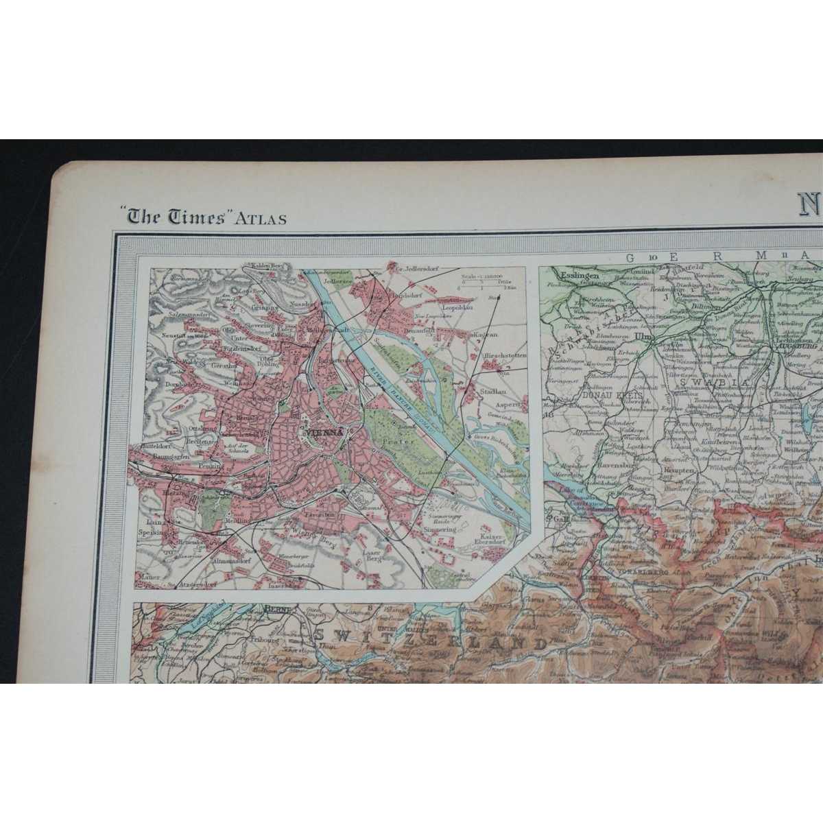
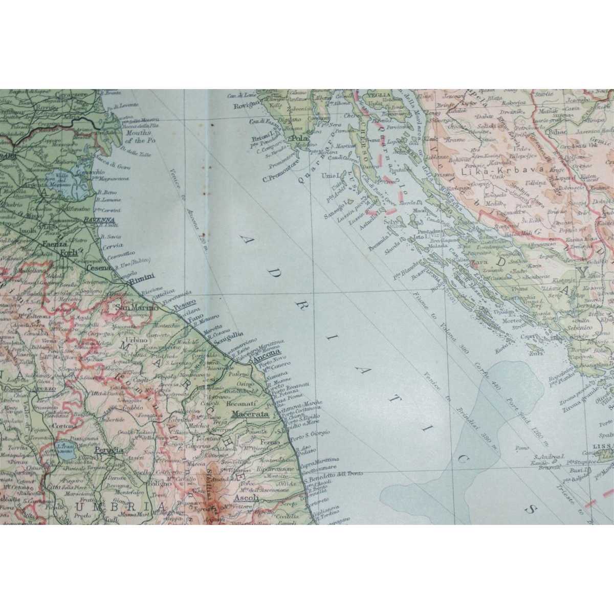
Disbound single sheet with vertical centre fold from the 1920 "The Times Survey Atlas of the World". Map is in colour and suitable for framing. Colour is according to contour, boundaries of countries or regions are in red. Map at scale 1:2,000,000 with small inset plan of Vienna at 1:150,000. Map covers northern Italy, the northern half of Corsica, Austria, Liechtenstein,and parts of modern day Croatia, Slovenia, Bosnia and Herzegovina, Hungary, Montenegro, Germany, Switzerland and Slovakia. Map includes Turin, Milan, Verona, Trieste, Venice, Florence, Ravenna, Bologna, Rome, Munich, Vienna, Budapest, Salzberg, Elba, and parts of the Ligurian and Adriatic Seas, etc. Slightly darkened edges with occasional light foxing in margins and along centre fold. Edges at bottom corners are very slightly roughened. Sheet is otherwise clean, crisp and bright. Size: 46cm x 58cm approx. Quantity Available: 1. Shipped Weight: under 1 kg. Pictures of this item not already displayed here available upon request. Inventory No: 45020044004. EU buyers are likely to be charged import VAT and handling charges by the courier/postal service before delivery. Please contact us before ordering to help minimise these charges. Sometimes total costs are less by ordering at abebooks and selecting to pay by paypal.