Geographia Ltd, 1920, Hardcover (linen backed), Book Condition: Good, Dust Jacket Condition: N/A., Presumed First Edn
an undated coloured map on 30 linen-backed folded panels in green cloth covers showing the major roads (colour-coded 'A', 'B' & 'Other') with their official Ministry of Transport numbers; inset around the edge of the map are city-centre mini road maps for the larger cities & towns; near the top is a 'Distance By Road, Rail And Air' chart which shows also the difference between road & rail distances & the saving in comparison by air travel. n/a.. Item Type: Map. minor marking to covers. Gilt titles front (faded). Bumping & wear to corners of covers. Quantity Available: 1. Shipped Weight: Under 1 kilo. Category: Geography & Maps; Road Maps; England; Wales; Britain/UK; Geography & Maps. Inventory No: 3120.


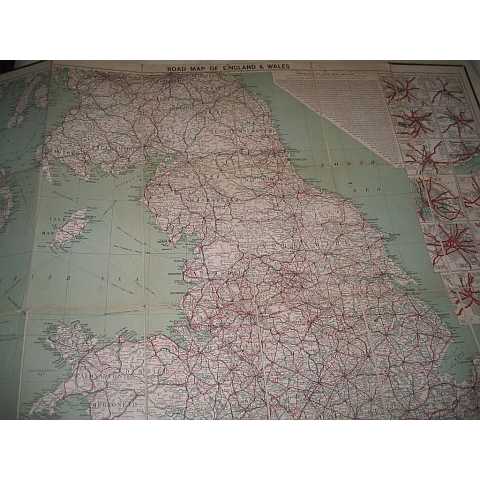
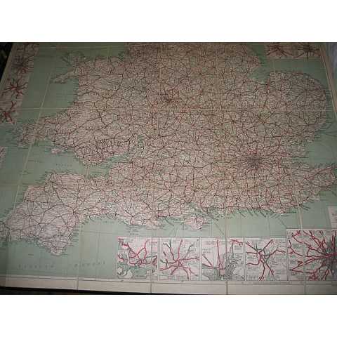
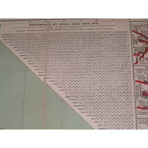
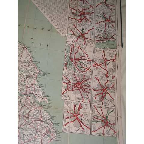
an undated coloured map on 30 linen-backed folded panels in green cloth covers showing the major roads (colour-coded 'A', 'B' & 'Other') with their official Ministry of Transport numbers; inset around the edge of the map are city-centre mini road maps for the larger cities & towns; near the top is a 'Distance By Road, Rail And Air' chart which shows also the difference between road & rail distances & the saving in comparison by air travel. n/a.. Item Type: Map. minor marking to covers. Gilt titles front (faded). Bumping & wear to corners of covers. Quantity Available: 1. Shipped Weight: Under 1 kilo. Category: Geography & Maps; Road Maps; England; Wales; Britain/UK; Geography & Maps. Inventory No: 3120.