Texas & Pacific Railway Company, 1873, Softcover (Saddle-stitched), Book Condition: Fair Condition, First Edition
Includes a fold-out 23" x 18" color "Map of the State of Texas showing the Line and Lands of the Texas Pacific Railway, Reserved and Donated by the State of Texas". This map is dated 1873, and also shows the population of each Texas county. At that time, Washington County was the most populous Texas county with 23,104! There is also a Table of Distances on the map. The map is in excellent condition, except for one small (1") tear along one of the folds at the bottom. The front cover (paper) map are detached from the other pages. Size: 8mo - over 7 3/4" - 9 3/4" tall. 48 pp. Page edges are a bit tattered and worn, but none of the tears reach the text. Ex-library with minimal markings. Quantity Available: 1. Shipped Weight: Under 1 pound. Category: Railways; History::Texas History; United States; 19th century; Pictures of this item not already displayed here available upon request. Inventory No: 001296.


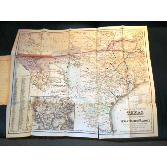
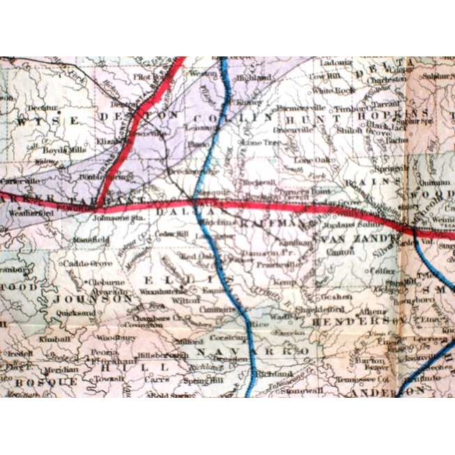
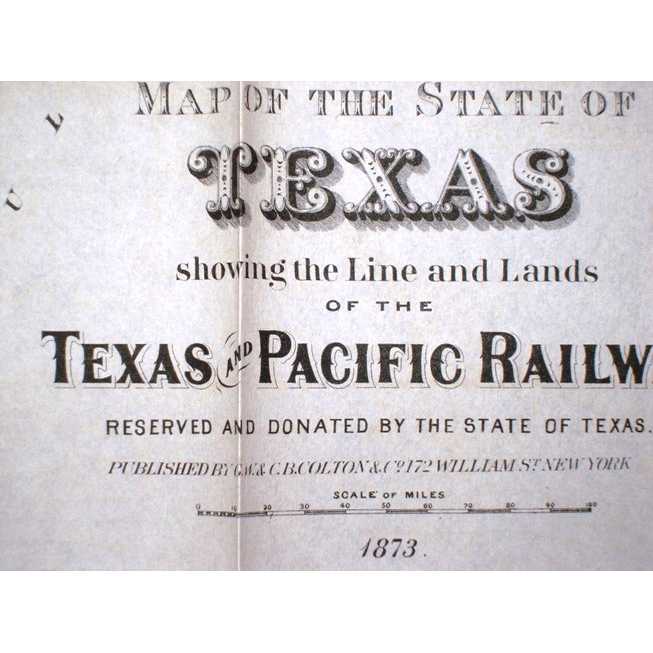
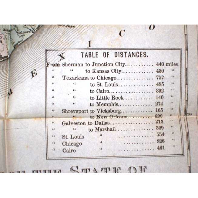
Includes a fold-out 23" x 18" color "Map of the State of Texas showing the Line and Lands of the Texas Pacific Railway, Reserved and Donated by the State of Texas". This map is dated 1873, and also shows the population of each Texas county. At that time, Washington County was the most populous Texas county with 23,104! There is also a Table of Distances on the map. The map is in excellent condition, except for one small (1") tear along one of the folds at the bottom. The front cover (paper) map are detached from the other pages. Size: 8mo - over 7 3/4" - 9 3/4" tall. 48 pp. Page edges are a bit tattered and worn, but none of the tears reach the text. Ex-library with minimal markings. Quantity Available: 1. Shipped Weight: Under 1 pound. Category: Railways; History::Texas History; United States; 19th century; Pictures of this item not already displayed here available upon request. Inventory No: 001296.