Bookzangle Bookshop
Browsing "Geography & Maps" from All Booksellers
2,139 items in this category.Sorted by Highest Price First
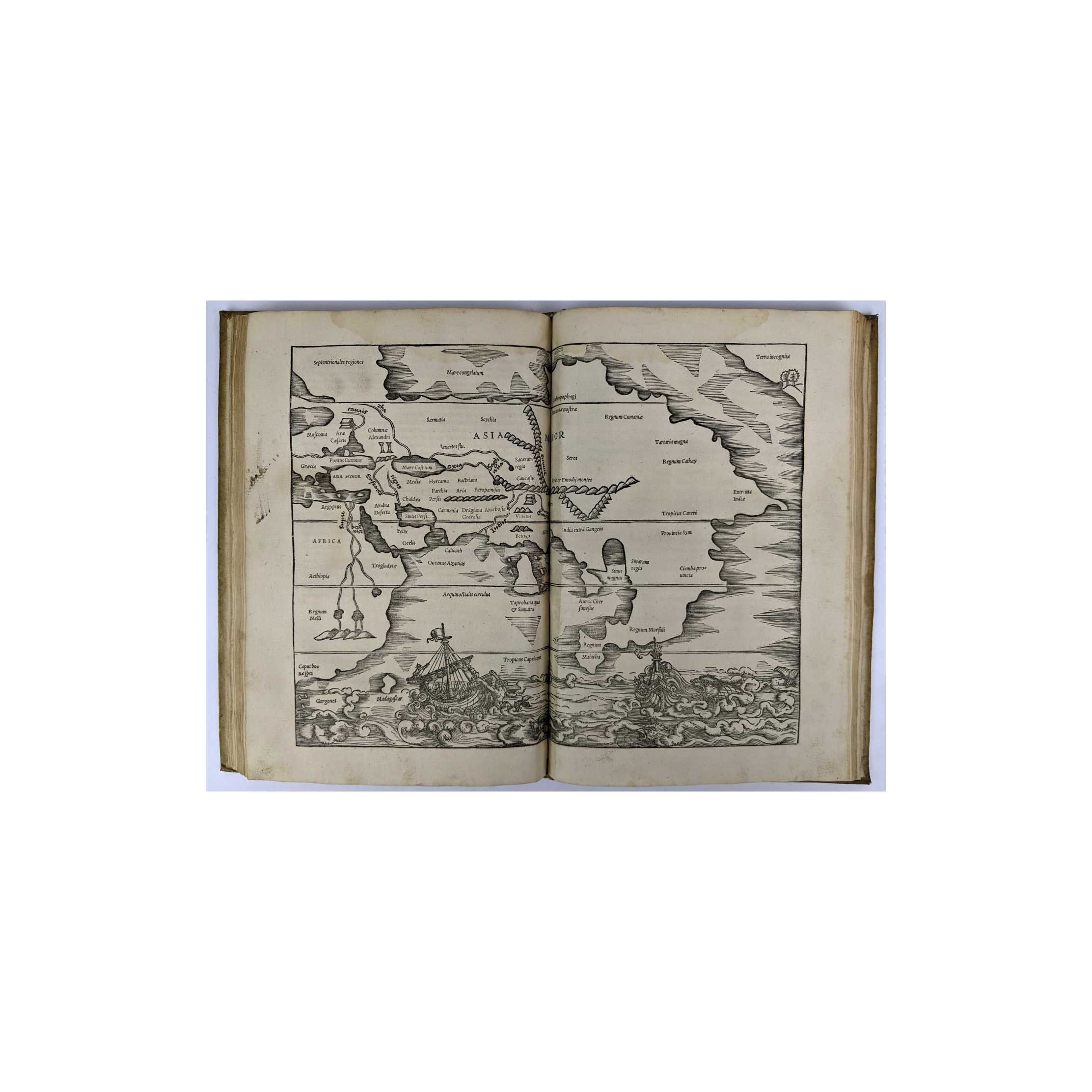
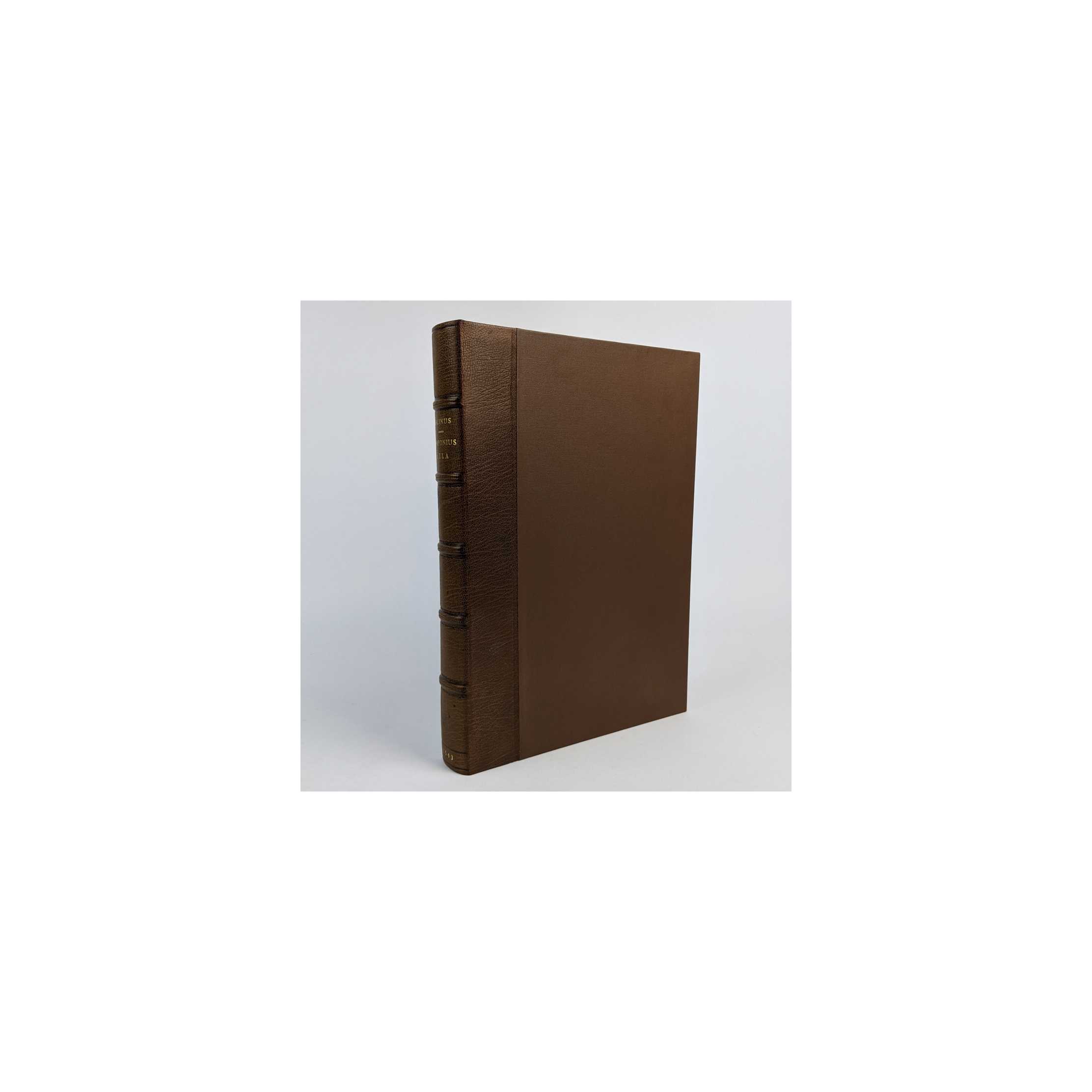
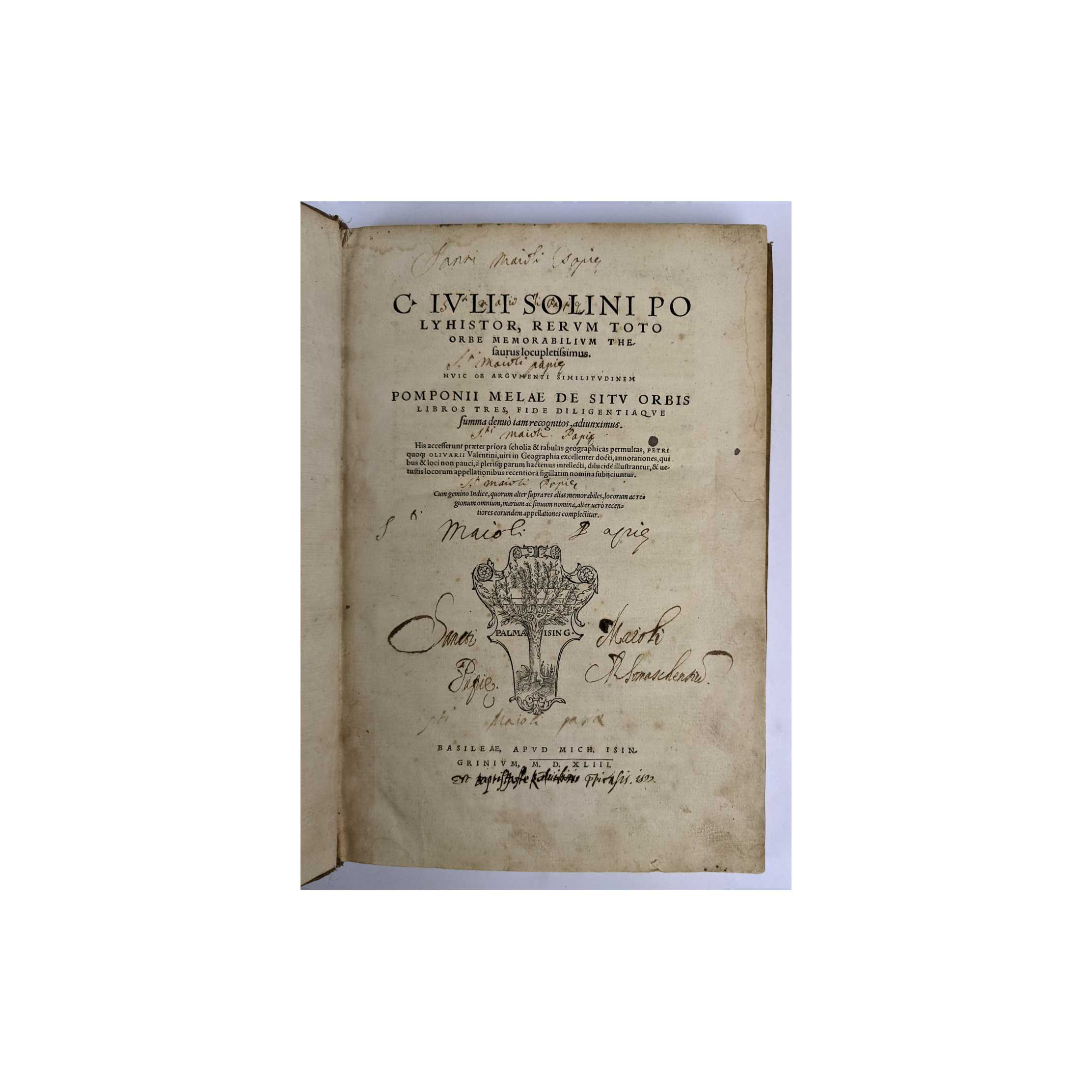
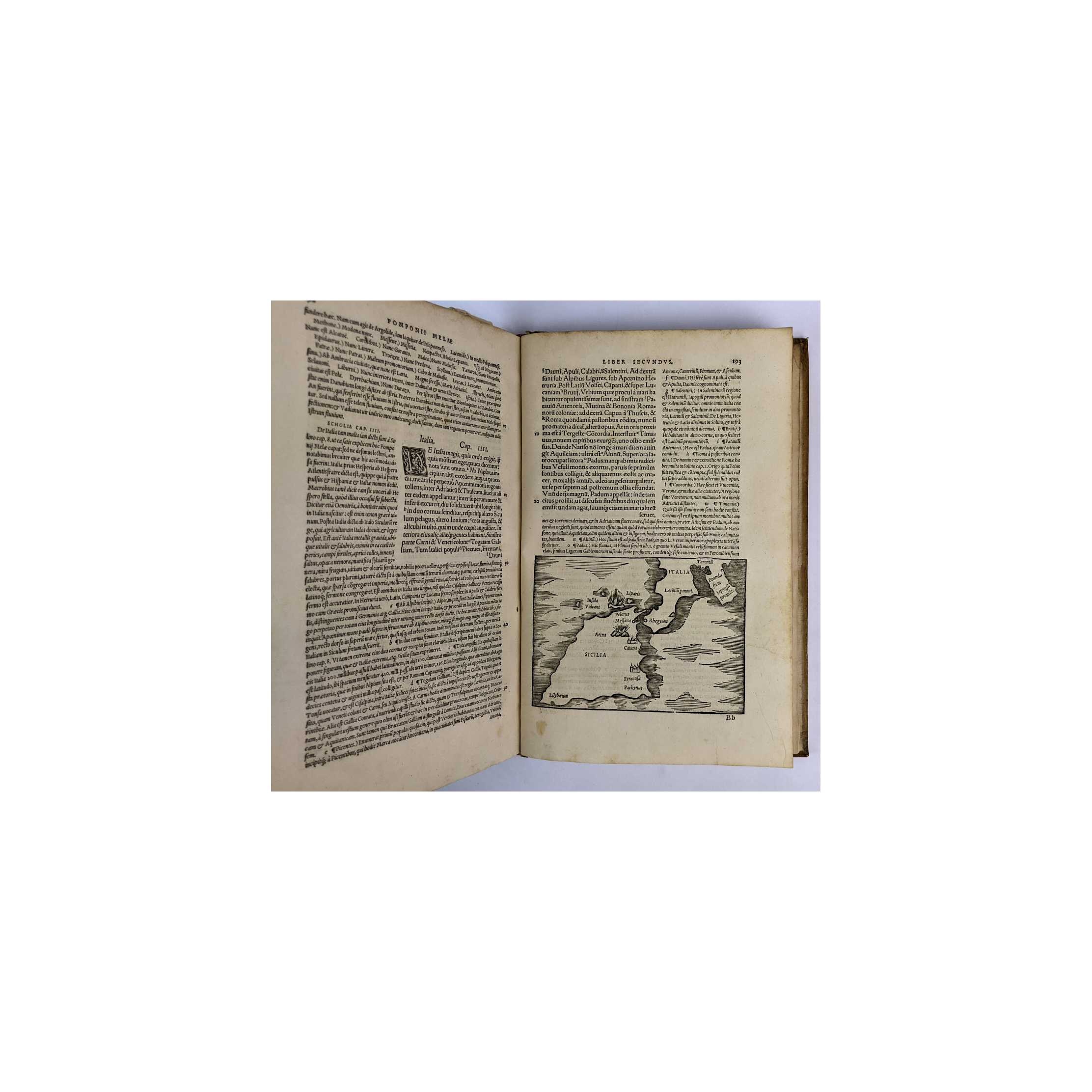
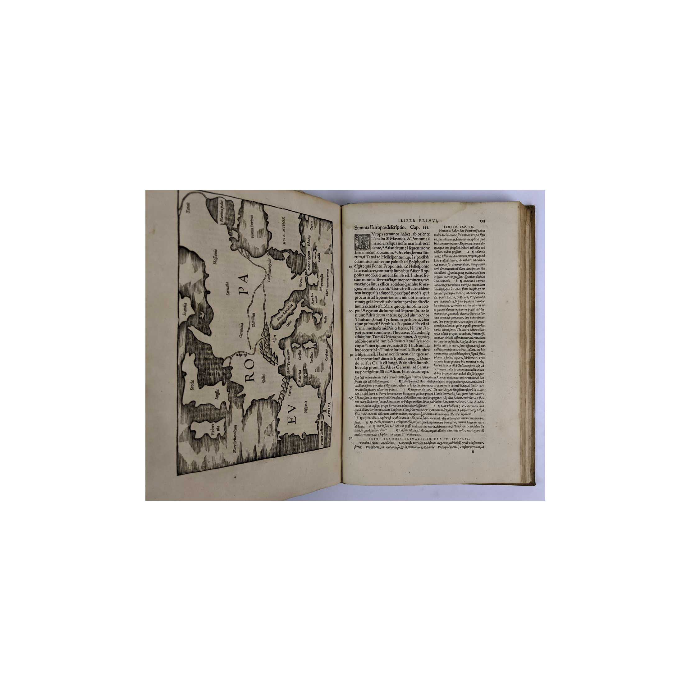
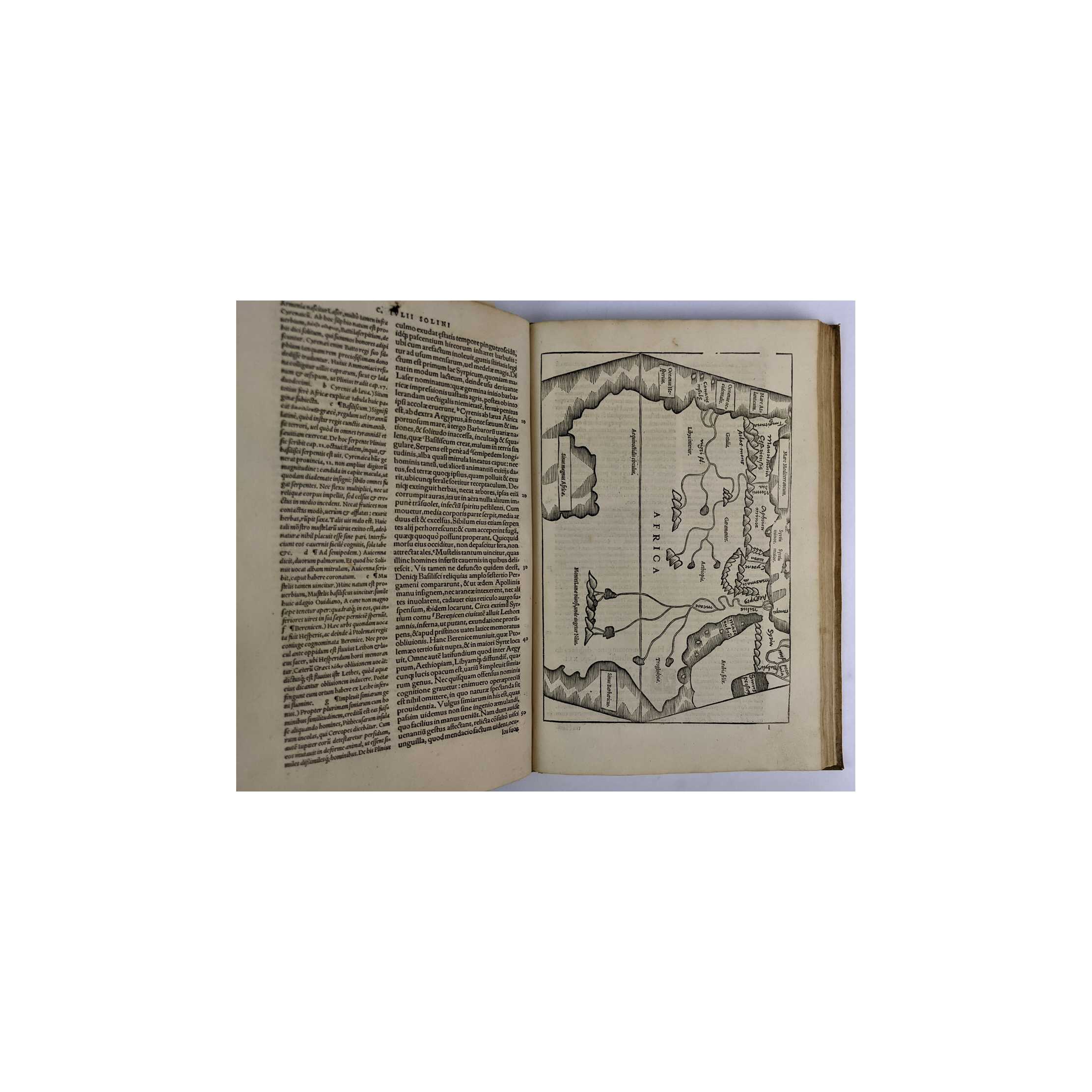
Title:Polyhistor, Rerum Toto Orbe Memorabilium Thesaurus Locupletissimus
Author:Julius C. Solinus
Price:AUD$6,000.00 (about USD$3,898.20)
Shipping:AUD$25.00 (about USD$16.30)
(To United States of America)
(To United States of America)
Item ID:LU00-0033490
Quantity:1
Publisher:Michael Isingrin, Basel, 1543
Edition:Second
Binding:Hardcover
Condition:Good


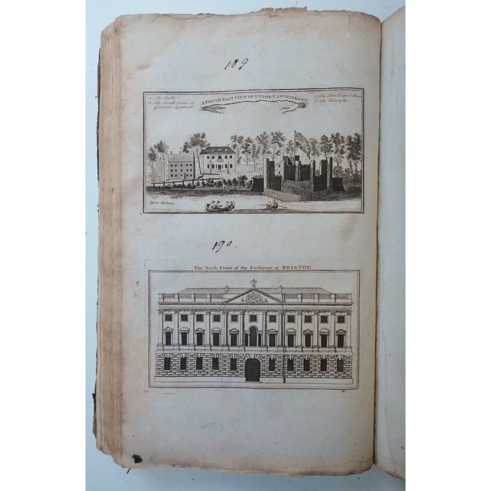
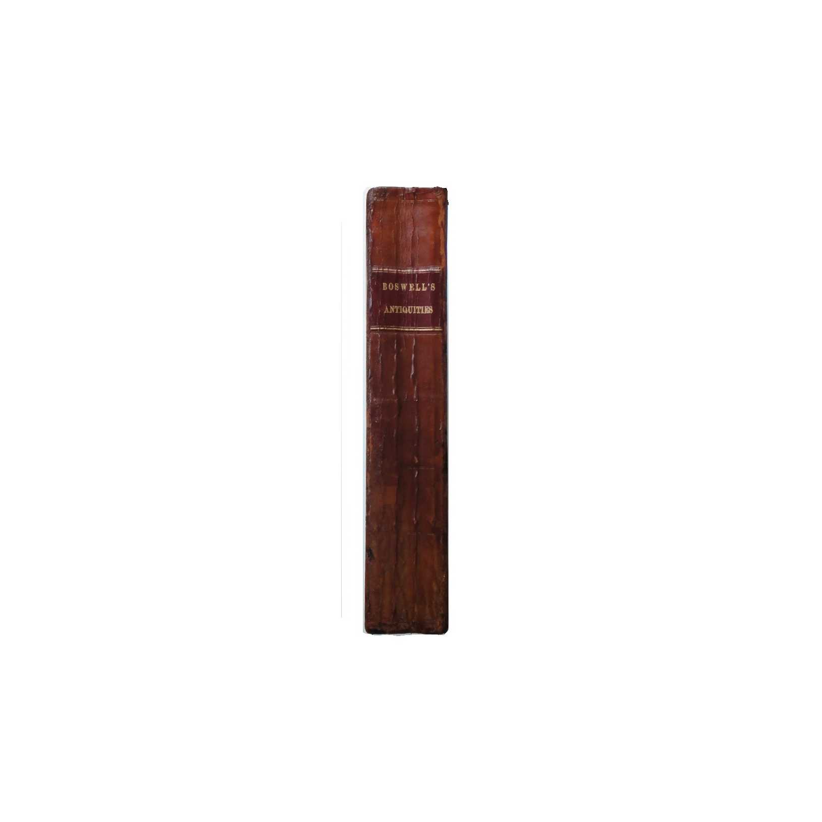
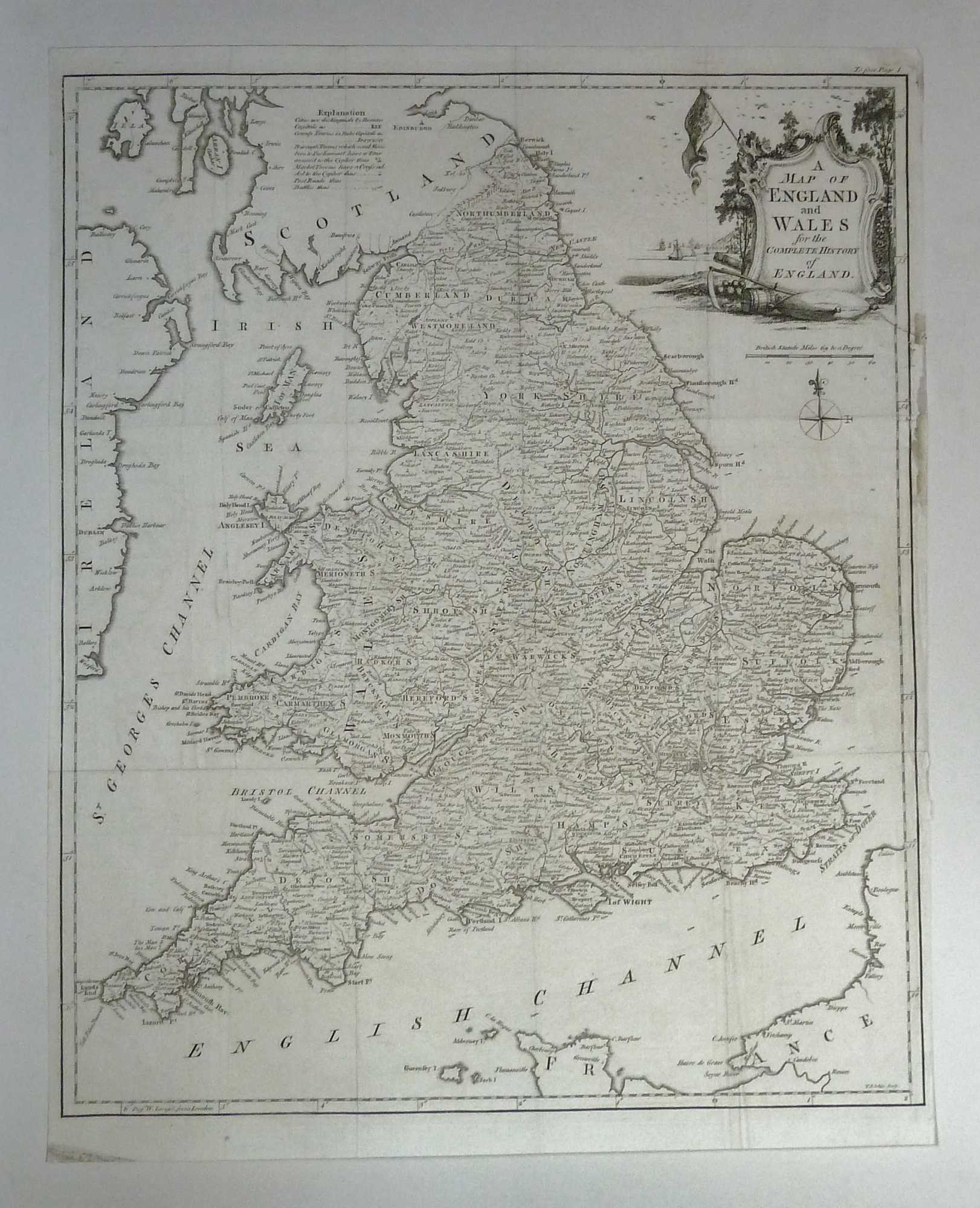
Title:The Antiquities of England and Wales Displayed 46 Maps
Author:Boswell, Henry
Price:GBP£1,599.00 (about USD$1,992.10)
Shipping:GBP£15.70 (about USD$19.50)
(To United States of America)
(To United States of America)
Item ID:M002-04447
Quantity:1
Publisher:Alex Hogg, London, 1795
Edition:First
Binding:Hardcover
Condition:Good
Alex Hogg, 1795, Hardcover, Book Condition: Good, First
Includes 116 leaves (two loose/damaged) of half- or one-sixth-page illustrative plates (approx. 260 images in total), 21 full-page illustrative plates, and 46 full-page county maps by Kitchin & Conder. Some tears along inside of pages but mostly clear and well-preserved throughout, with some waviness and minor edge/corner wear. Covers are not original, with some repair and reinforcement and new paste-downs to give a firm and secure binding. Boards are ... More Text...
Includes 116 leaves (two loose/damaged) of half- or one-sixth-page illustrative plates (approx. 260 images in total), 21 full-page illustrative plates, and 46 full-page county maps by Kitchin & Conder. Some tears along inside of pages but mostly clear and well-preserved throughout, with some waviness and minor edge/corner wear. Covers are not original, with some repair and reinforcement and new paste-downs to give a firm and secure binding. Boards are ... More Text...
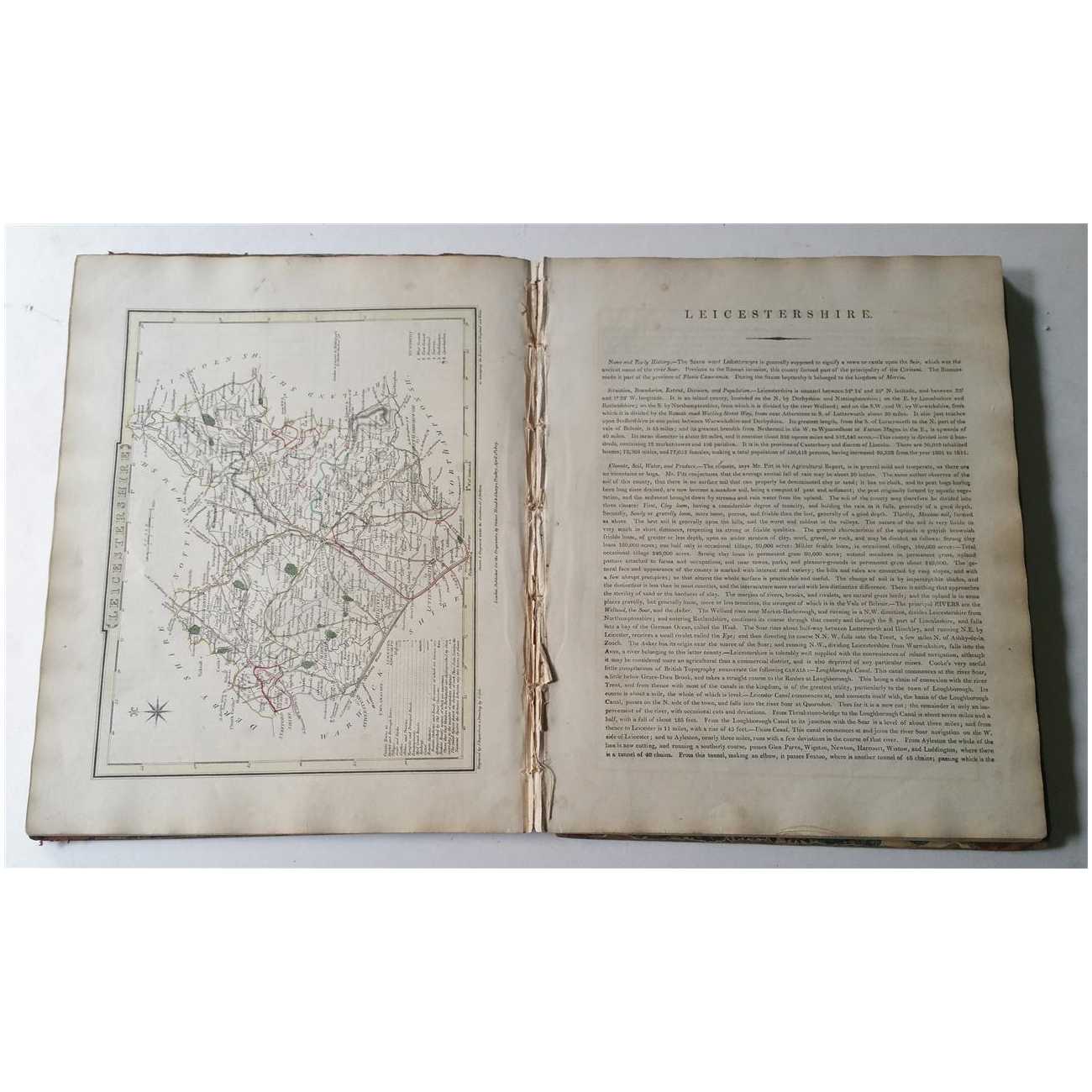
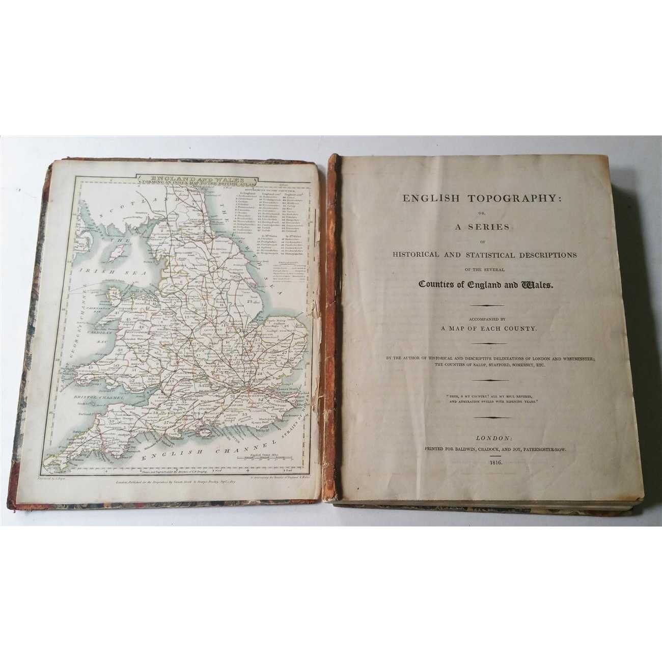
Title:English Topography: A Series of Historical & Statistical Descriptions (1816)
Author:Nightingale, Joseph
Price:GBP£1,345.00 (about USD$1,675.60)
Shipping:GBP£15.70 (about USD$19.50)
(To United States of America)
(To United States of America)
Item ID:M002-19848
Quantity:1
Publisher:Baldwin, Cradock & Joy, UK, 1816
Edition:1816
Binding:Hardcover
Condition:Good
Baldwin, Cradock & Joy, 1816, Hardcover, Book Condition: Good, 1816
A used but internally very presentable copy, complete with 56 hand-coloured maps, some scattered marginal foxing and browning around page edges, general light rippling along page edges. Book block is held together by fragments of original binding, beginning to split near middle but otherwise reasonably secure, and with very little by way of edge wear, nicks or creases. Original 1/8 leather binding is largely perished, with front and rear ... More Text...
A used but internally very presentable copy, complete with 56 hand-coloured maps, some scattered marginal foxing and browning around page edges, general light rippling along page edges. Book block is held together by fragments of original binding, beginning to split near middle but otherwise reasonably secure, and with very little by way of edge wear, nicks or creases. Original 1/8 leather binding is largely perished, with front and rear ... More Text...
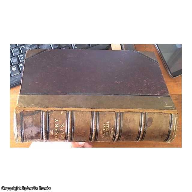

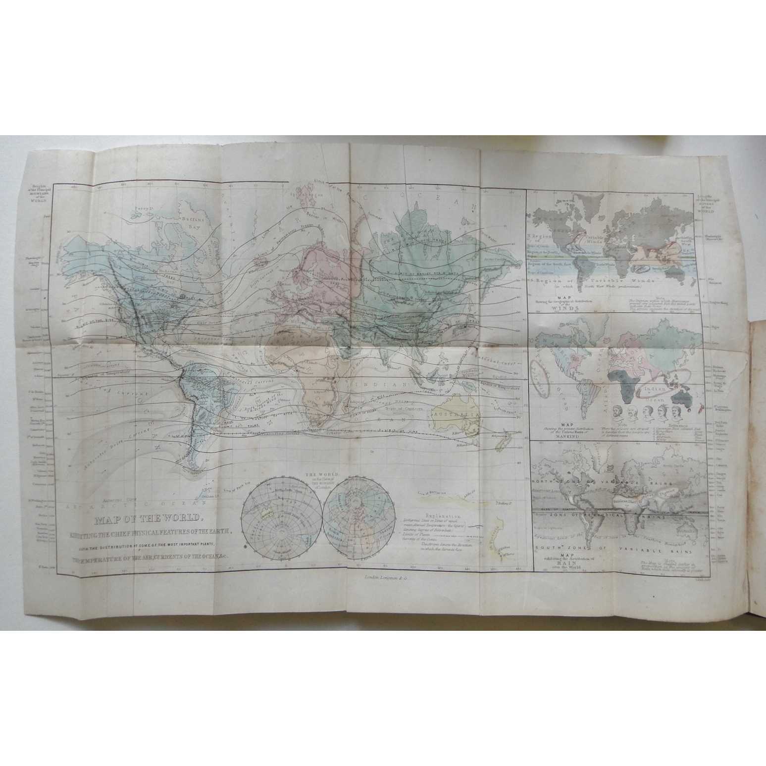
Title:The Library Atlas; Consisting of One Hundred Maps Modern, Historical, and Classical Geography, &c
Author:James Bryce Bryce (Viscount), William Francis Collier, Leonhard Schmitz
Price:AUD$2,475.00 (about USD$1,608.00)
Shipping:AUD$55.00 (about USD$35.80) [Min]
(To United States of America)
(To United States of America)
Item ID:SB00-0281449
Quantity:1
Publisher:William Collins, Sons, & Company, London, Glasgow, and Edinburgh, 1875
Edition:Unstated
Binding:Hardcover (Half Leather)
Condition:Good
William Collins, Sons, & Company, 1875, Hardcover (Half Leather), Book Condition: Good, Unstated
The Library Atlas; Consisting of One Hundred Maps Modern, Historical, and Classical Geography, &c.; With Descriptive Letterpress Of Modern Geography by James Bryce; Historical Geography by William F Collier; and Classical Geography byLeonhardSchmitz with Copious Indices All 98 maps are present along with two astronomical maps and two diagrams. maps are present, errata slip tipped in contents page, no year of ... More Text...
The Library Atlas; Consisting of One Hundred Maps Modern, Historical, and Classical Geography, &c.; With Descriptive Letterpress Of Modern Geography by James Bryce; Historical Geography by William F Collier; and Classical Geography byLeonhardSchmitz with Copious Indices All 98 maps are present along with two astronomical maps and two diagrams. maps are present, errata slip tipped in contents page, no year of ... More Text...

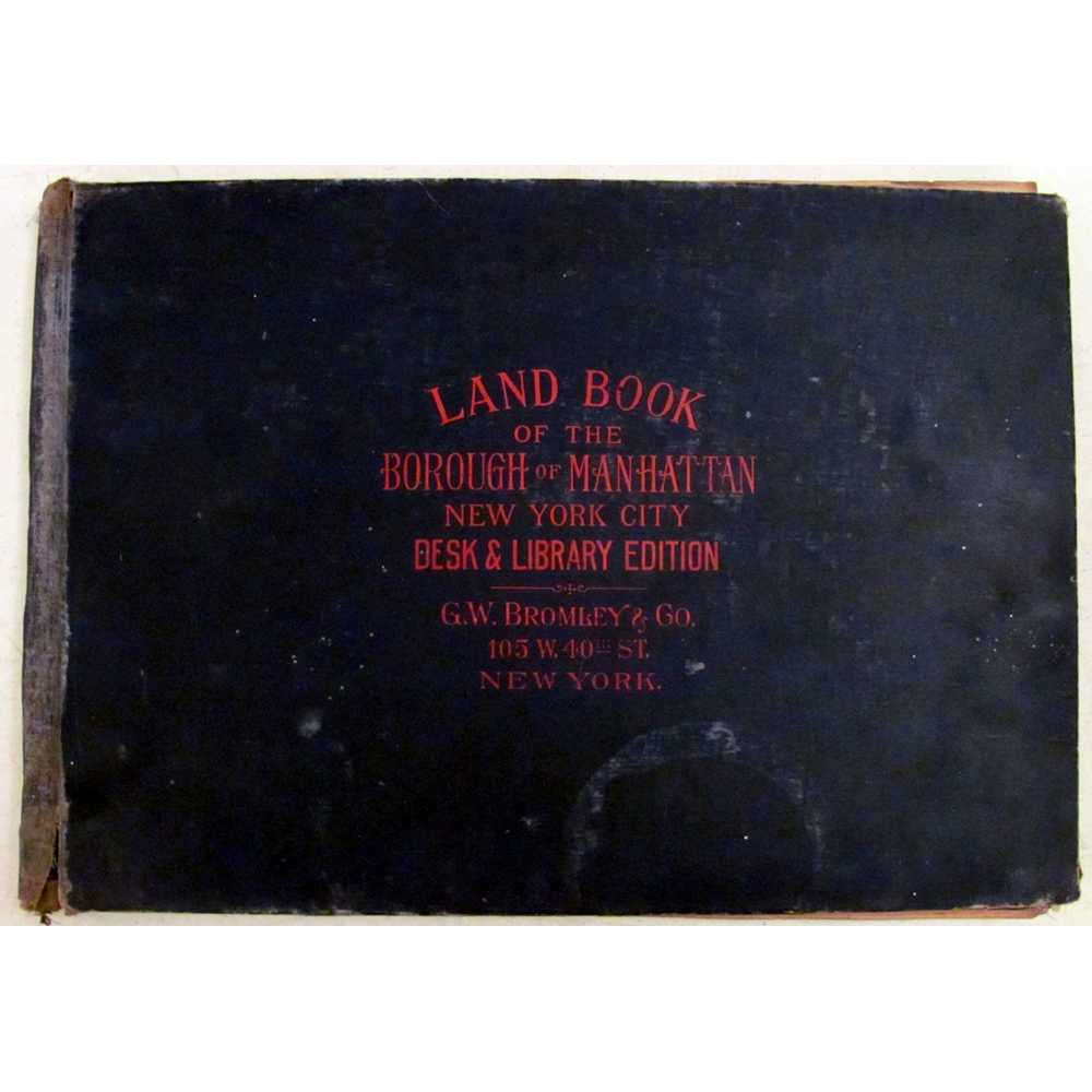
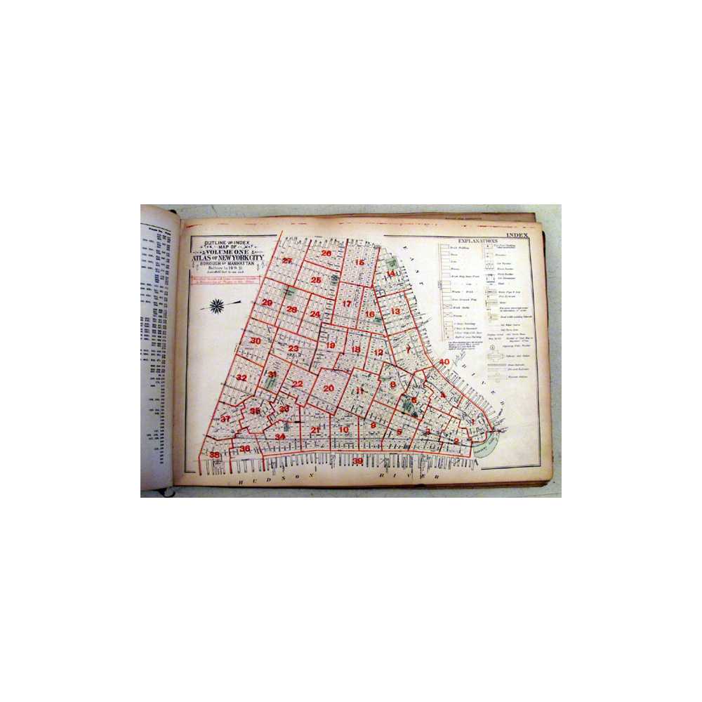
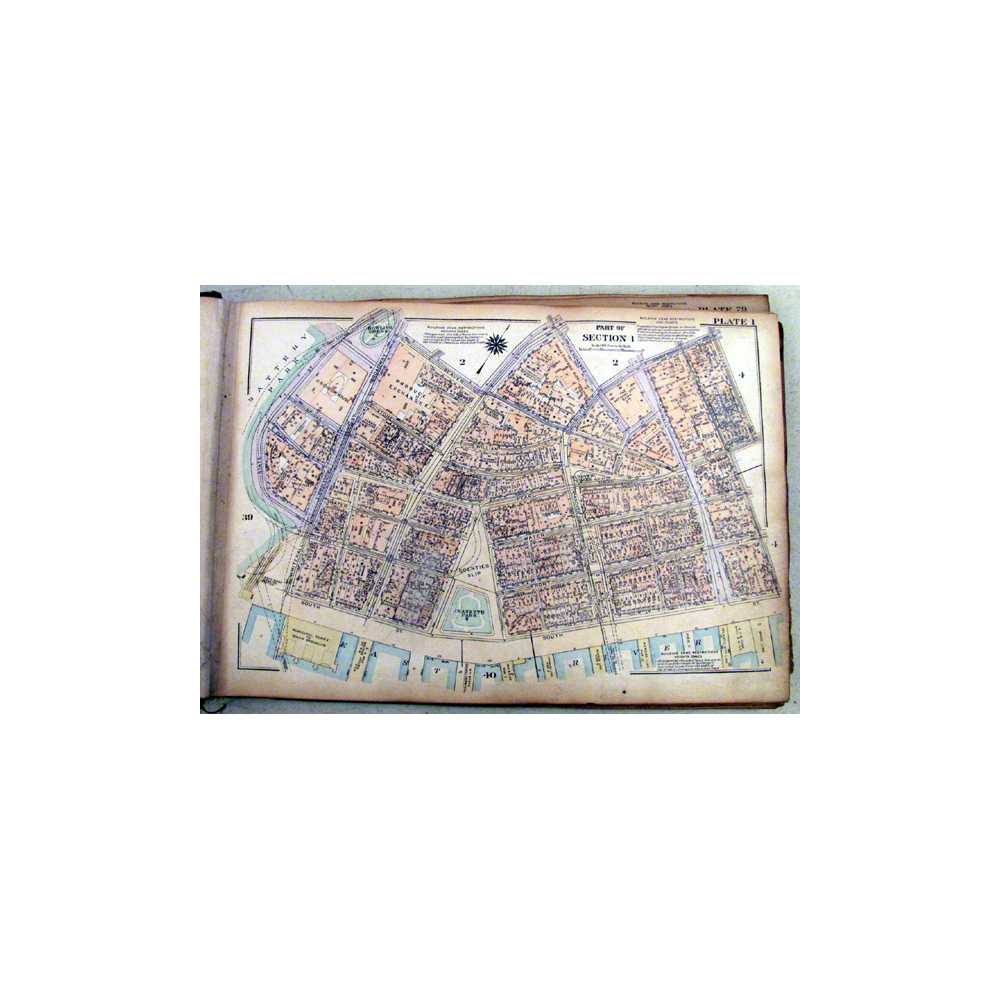
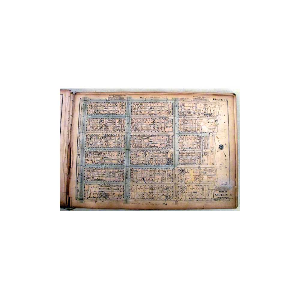

Title:Land Book of the Borough of Manhattan City of New York, Desk and Library Edition
Author:N/A
Price:USD$1,600.00
Shipping:Set Shipping State/Province
(To United States of America)
(To United States of America)
Item ID:DH00-012370
Quantity:1
Publisher:G. W. Bromley & Co, New York, 1925
Edition:First
Binding:Hardcover
Condition:Fair
Dust Jacket:No
G. W. Bromley & Co, 1925, Hardcover, Book Condition: Fair, Dust Jacket Condition: No, First
Size: 4to, oblong. Text contains minor marks/notes in pencil. Previous owner's name in pencil on front paste down. Black cloth over boards, includes 191 highly detailed maps of Manhattan broken down into sections, shows streets, railroads, parks, buildings in incredible detail. It even indicates whether the buildings are brick or iron etc. Useful indexes and keys help read maps. Binding loose, hinges and text block ... More Text...
Size: 4to, oblong. Text contains minor marks/notes in pencil. Previous owner's name in pencil on front paste down. Black cloth over boards, includes 191 highly detailed maps of Manhattan broken down into sections, shows streets, railroads, parks, buildings in incredible detail. It even indicates whether the buildings are brick or iron etc. Useful indexes and keys help read maps. Binding loose, hinges and text block ... More Text...


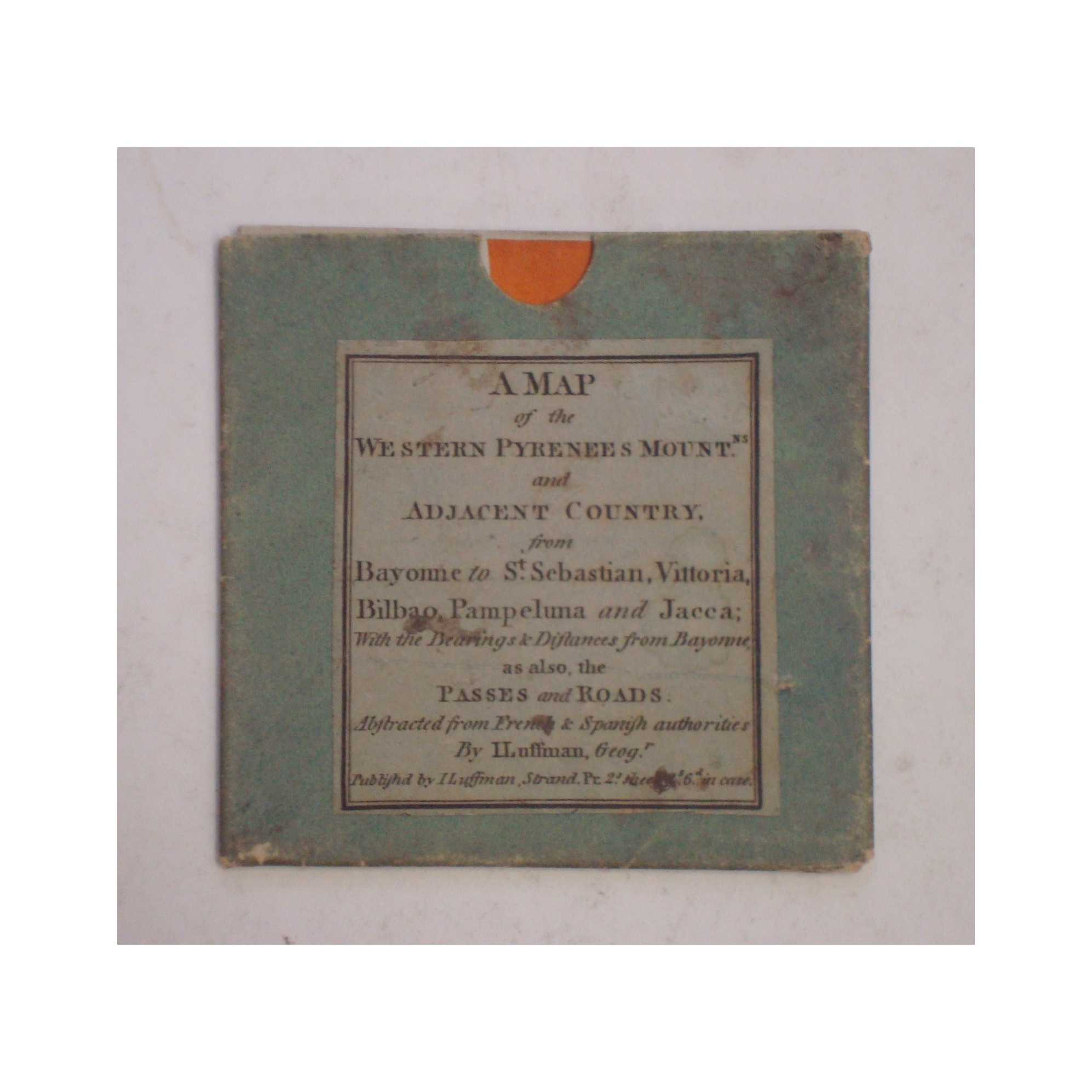
Title:A Map of the Western Pyrenees Mountains and Adjacent Country
Author:Luffman, John
Price:GBP£895.00 (about USD$1,115.00)
Shipping:GBP£7.50 (about USD$9.40)
(To United States of America)
(To United States of America)
Item ID:M002-01276
Quantity:1
Publisher:J. Luffman, Geographer, London, 1813
Edition:First
Binding:Softcover
Condition:Very Good
Dust Jacket:Good
J. Luffman, Geographer, 1813, Softcover, Book Condition: Very Good, Dust Jacket Condition: Good, First
Item constitutes a beautifully preserved original John Luffman map of the Western Pyrenees and the surrounding region, following the first phase of the Peninsular War. The image is largely free from notable damage or wear, but shows some very light discolouration commensurate with the item's age, along with some very small holes in the corners of the seams. Item includes the original slipcase, into which ... More Text...
Item constitutes a beautifully preserved original John Luffman map of the Western Pyrenees and the surrounding region, following the first phase of the Peninsular War. The image is largely free from notable damage or wear, but shows some very light discolouration commensurate with the item's age, along with some very small holes in the corners of the seams. Item includes the original slipcase, into which ... More Text...
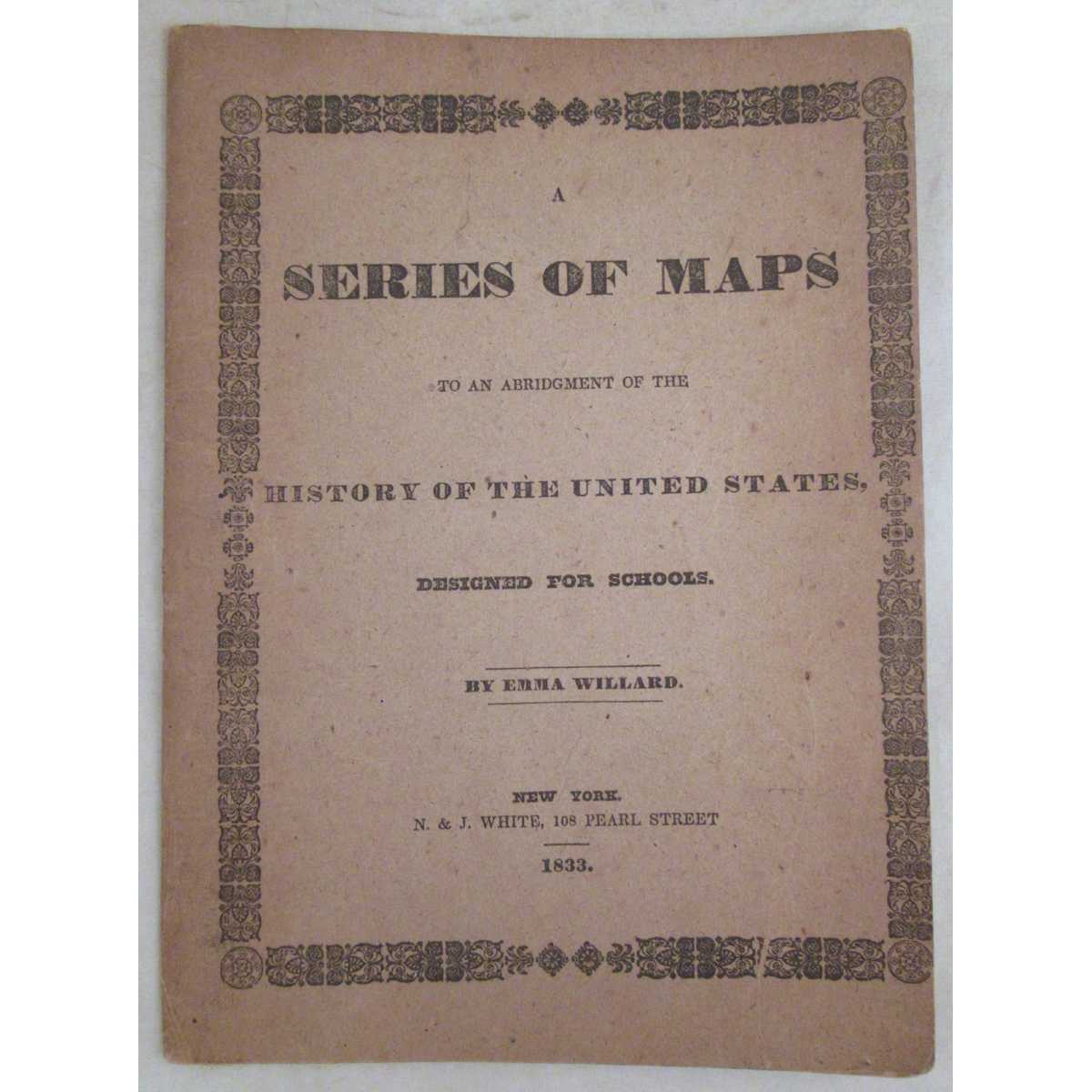

Title:A Series of Maps to an Abridgment of the History of the United States
Author:Willard, Emma
Price:USD$950.00
Shipping:Set Shipping State/Province
(To United States of America)
(To United States of America)
Item ID:DH00-015331
Quantity:1
Publisher:N. & J. White, New York, 1833
Edition:Unstated
Binding:Softcover
Condition:Very Good
Dust Jacket:No
N. & J. White, 1833, Softcover, Book Condition: Very Good, Dust Jacket Condition: No, Unstated
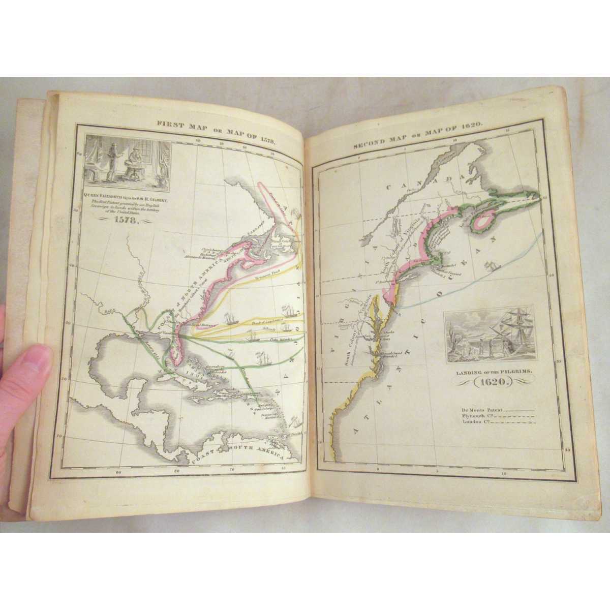
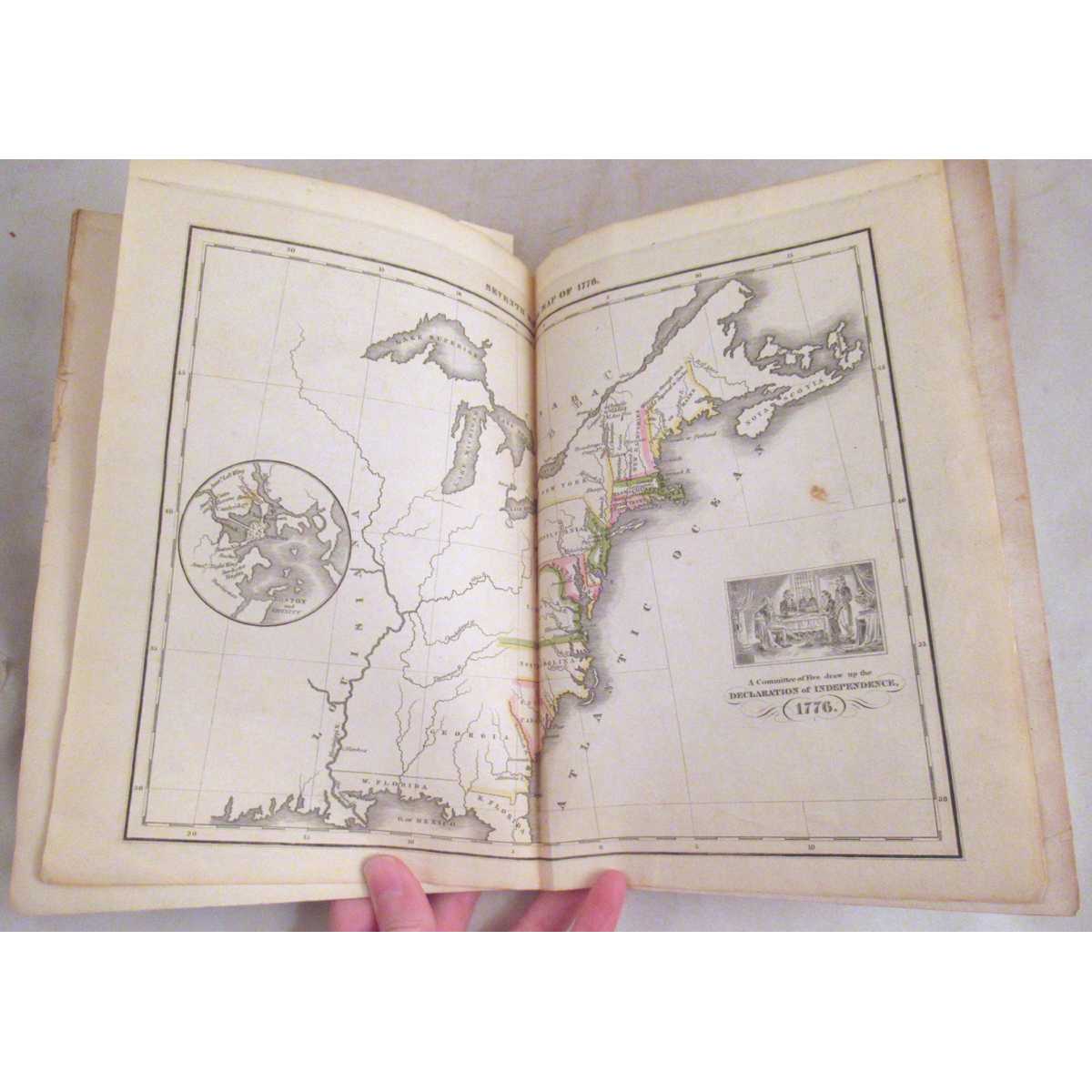
Size: 9 3/4" x 7". Text body is clean, and free from previous owner annotation, underlining and highlighting. Stiff, printed wraps, 8 hand-colored maps, 3 of which are double-page. This atlas originally accompanied Emma Willard's History of the United States. Maps include: "Introductory Map" which shows "Locations and Wanderings of the Aboriginal Tribes", "First Map or Map of 1578," "Second Map or Map of 1620," ... More Text...
Size: 9 3/4" x 7". Text body is clean, and free from previous owner annotation, underlining and highlighting. Stiff, printed wraps, 8 hand-colored maps, 3 of which are double-page. This atlas originally accompanied Emma Willard's History of the United States. Maps include: "Introductory Map" which shows "Locations and Wanderings of the Aboriginal Tribes", "First Map or Map of 1578," "Second Map or Map of 1620," ... More Text...

Title:Chorographia Britanniae, or a New Set of Maps of all the Counties in England and Wales
Author:Badeslade, Thomas & Toms, William
Price:GBP£750.00 (about USD$934.40)
Shipping:GBP£9.80 (about USD$12.30)
(To United States of America)
(To United States of America)
Item ID:SL00-28168
Quantity:1
Publisher:C. Hitch et al, 1742
Edition:Later
Binding:Hardcover
Condition:Good
Dust Jacket:not applicable
C. Hitch et al, 1742, Hardcover, Book Condition: Good, Dust Jacket Condition: not applicable, Later
Chubb CLXXII, I suspect, the maps dated Sept. 29th 1742. This example does not have the two tables ( found in some issues ) giving the rates for Hackney Coaches and Hackney Chairmen. Clean, tight and sound copy. All maps have good margins. Ink ownership stamp to front free endpaper. Inked county name handwritten on the verso of each map. The county town on each map is heightened with a red wash - contemporary ... More Text...
Chubb CLXXII, I suspect, the maps dated Sept. 29th 1742. This example does not have the two tables ( found in some issues ) giving the rates for Hackney Coaches and Hackney Chairmen. Clean, tight and sound copy. All maps have good margins. Ink ownership stamp to front free endpaper. Inked county name handwritten on the verso of each map. The county town on each map is heightened with a red wash - contemporary ... More Text...
Title:Living With Earth: An Introduction to Environmental Geology
Author:Hudson
Price:USD$895.00
Shipping:Set Shipping State/Province
(To United States of America)
(To United States of America)
ISBN:0321696360
Item ID:AZ00-1561058528
Quantity:1
Publisher:Taylor, 2010
Binding:Loose Leaf Version 3 ring binder ready
Condition:As New
Taylor, 2010, Loose Leaf Version 3 ring binder ready, Book Condition: As New
Sealed in Plastic wrapper, Text appears nice and clean, Loose Leaf Version. Has ISBN Identification / bookstore sticker on outside of plastic wrapper, Appears to be in near new condition, Is still sealed in plastic wrapper. Looks very nice. . 491 pages. Quantity Available: 1. Shipped Weight: Under 1 kilo. Category: Geography & Maps; Travel & Places. ISBN: 0321696360. ISBN/EAN: 9780321696366. Pictures of this item not already displayed here available upon request. Inventory No: 1561058528.
Sealed in Plastic wrapper, Text appears nice and clean, Loose Leaf Version. Has ISBN Identification / bookstore sticker on outside of plastic wrapper, Appears to be in near new condition, Is still sealed in plastic wrapper. Looks very nice. . 491 pages. Quantity Available: 1. Shipped Weight: Under 1 kilo. Category: Geography & Maps; Travel & Places. ISBN: 0321696360. ISBN/EAN: 9780321696366. Pictures of this item not already displayed here available upon request. Inventory No: 1561058528.

Title:The Geology of Scripture, Illustrating the Operation of the Deluge, and the Effects of Which It Was Productive
Author:Browne (H., of Amesbury)
Price:GBP£560.00 (about USD$697.70)
Shipping:GBP£25.00 (about USD$31.20)
(To United States of America)
(To United States of America)
Item ID:PB09-3519
Quantity:1
Publisher:W. Penny and sold by the Author, UK, 1892
Edition:First
Binding:Hardcover
Condition:Good
Dust Jacket:No
W. Penny and sold by the Author, 1892, Hardcover, Book Condition: Good, Dust Jacket Condition: No, First
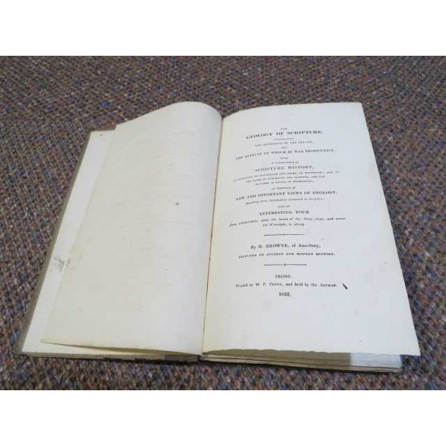
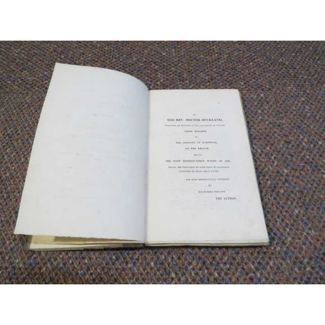
1st edition, vi, [2], 216pages. Complete with 9 lithographic plates (which include 2 hand-coloured) plus 1 hand-coloured map, totalling 10 in all. Hard grey-green paper boards, with cloth spine and printed paper spine-label. Covers very worn, spine label worn away, text block still solid, all 9 plates and map present, some spotting throughout. Previous owners signature on front end paper, contents clean. ... More Text...
1st edition, vi, [2], 216pages. Complete with 9 lithographic plates (which include 2 hand-coloured) plus 1 hand-coloured map, totalling 10 in all. Hard grey-green paper boards, with cloth spine and printed paper spine-label. Covers very worn, spine label worn away, text block still solid, all 9 plates and map present, some spotting throughout. Previous owners signature on front end paper, contents clean. ... More Text...
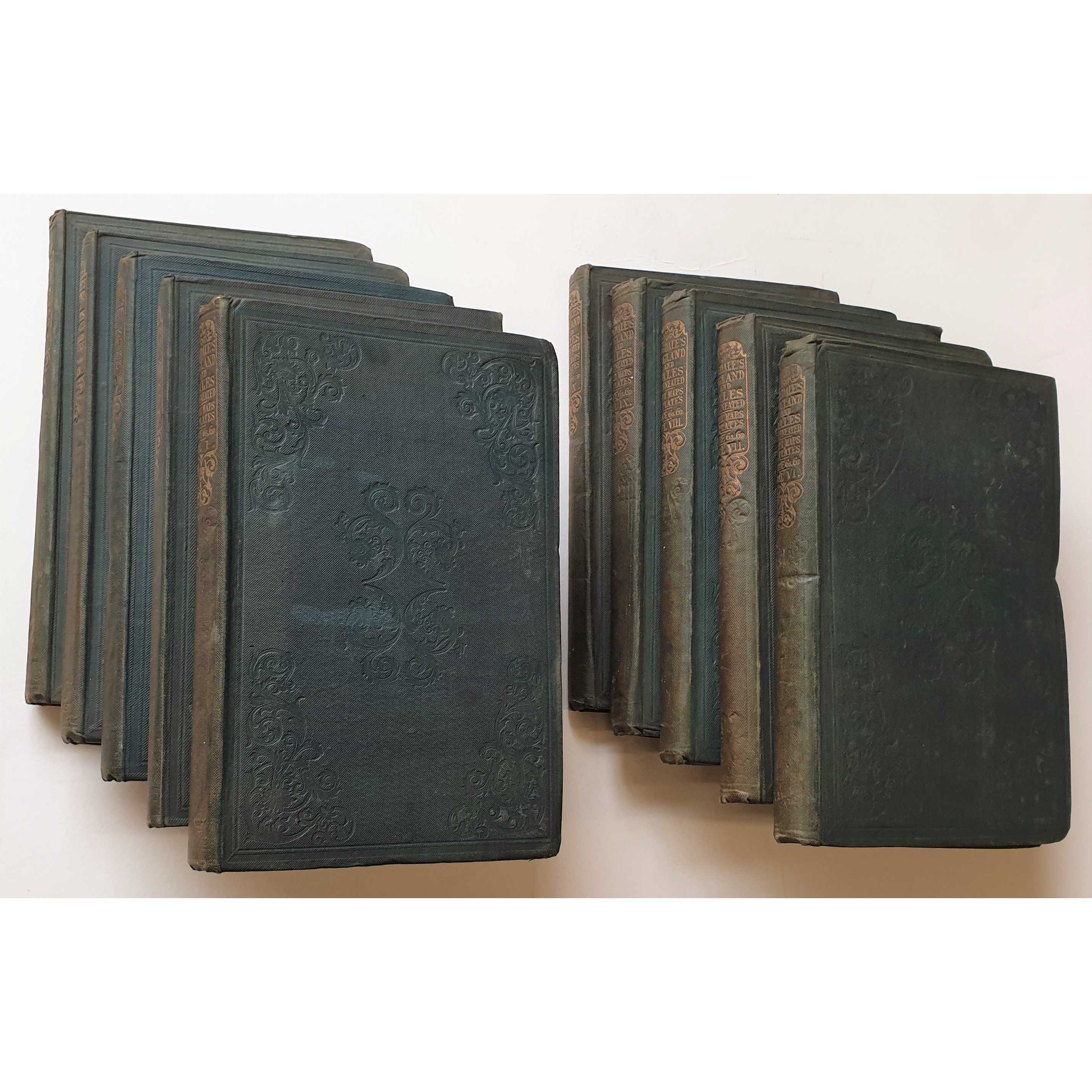
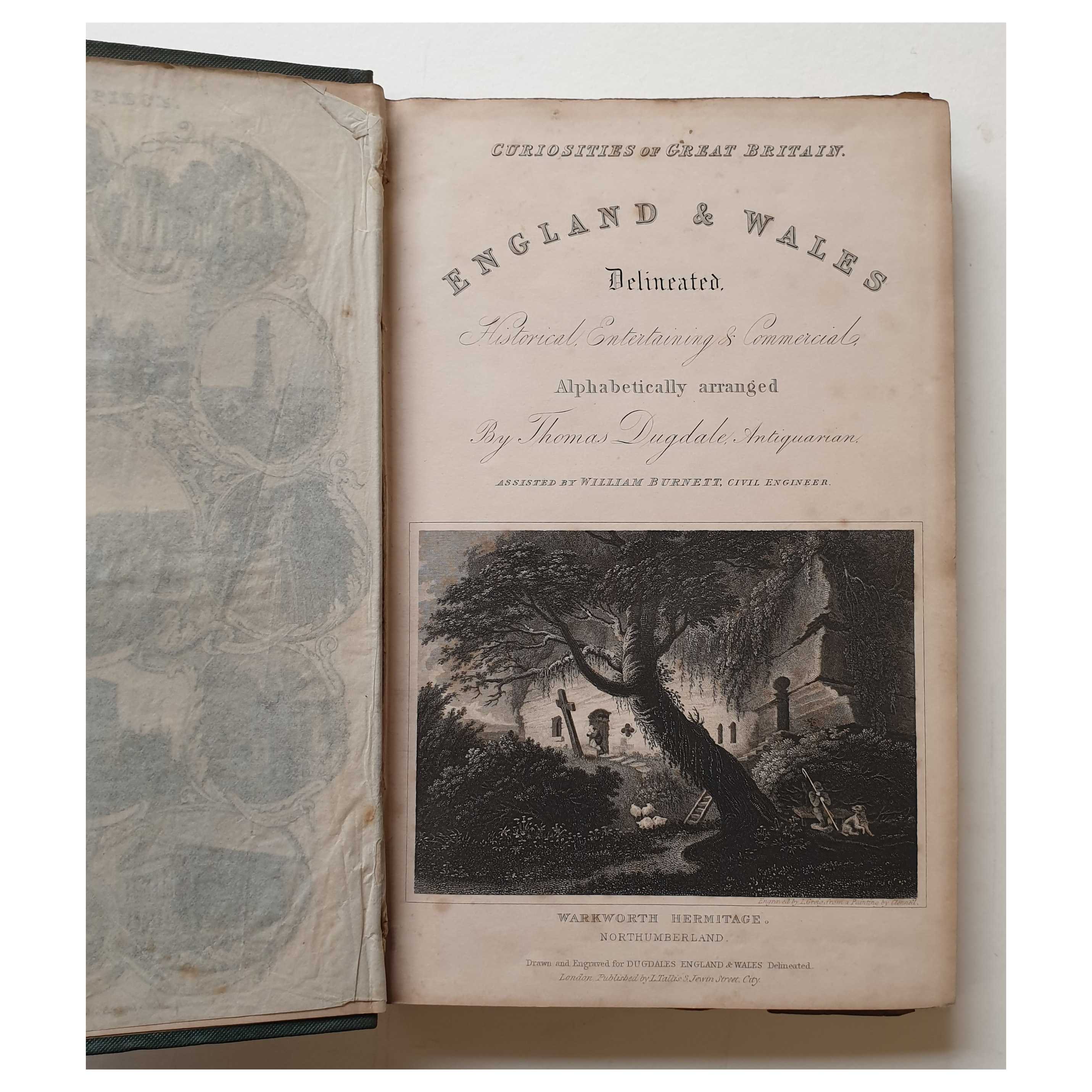
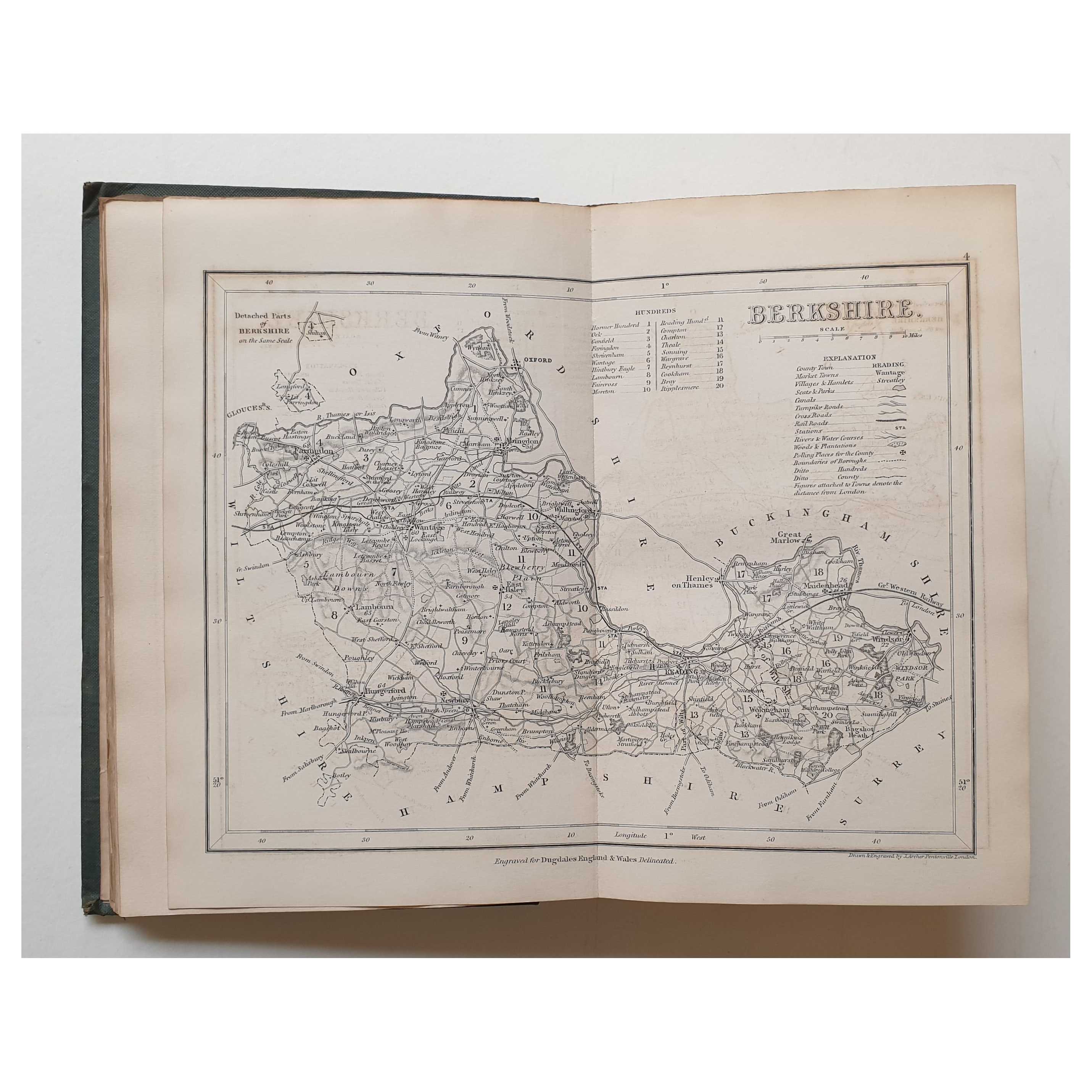
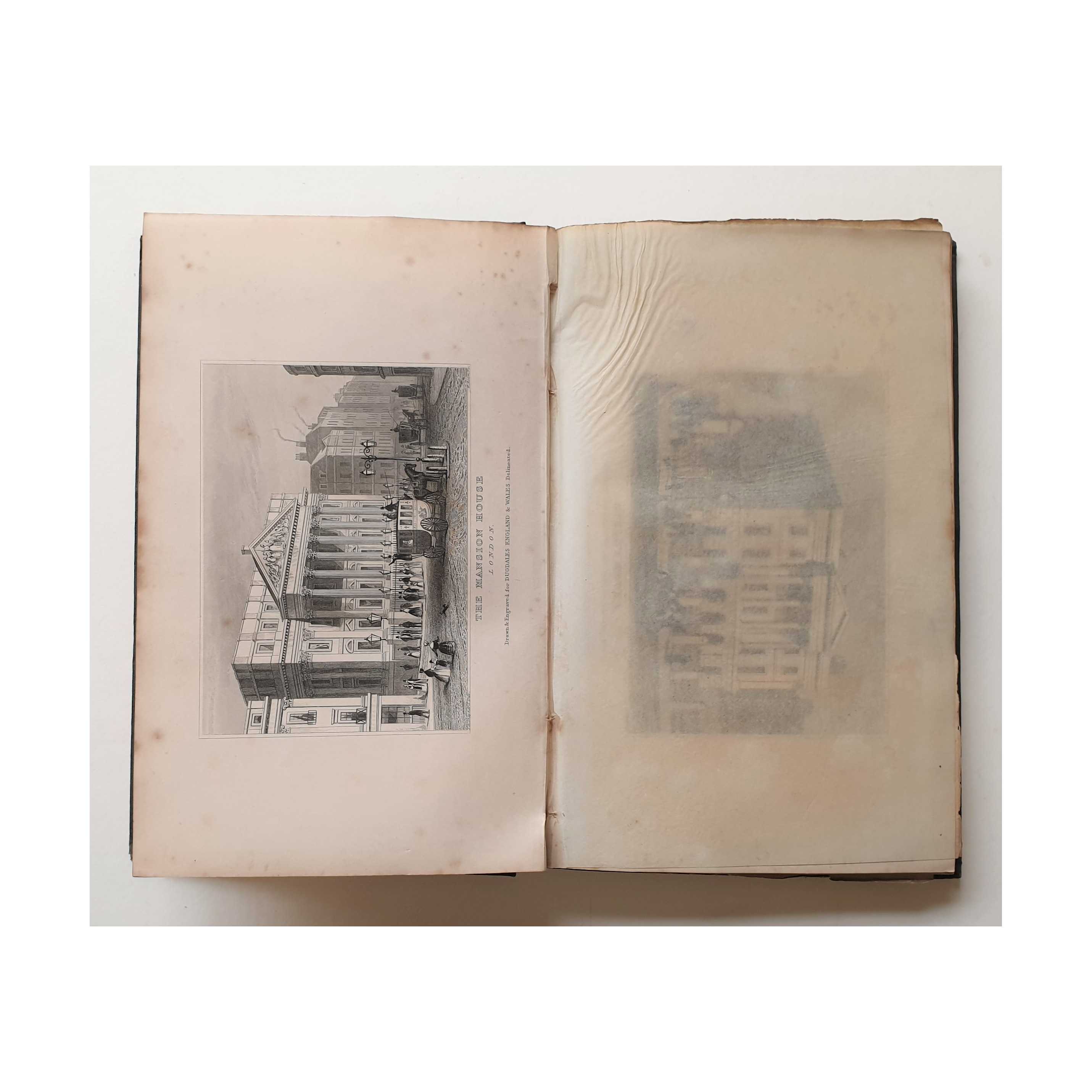
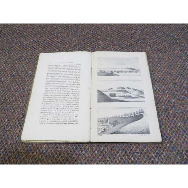
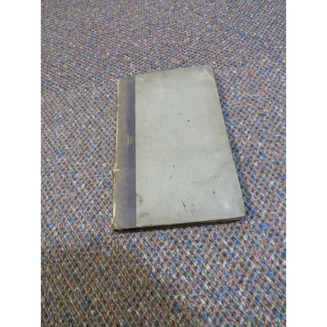
Title:England and Wales Delineated (Tallis, 1850 Vols. 1-10)
Author:Dugdale, Thomas
Price:GBP£495.00 (about USD$616.70)
Shipping:GBP£15.70 (about USD$19.50)
(To United States of America)
(To United States of America)
Item ID:M002-37389
Quantity:1
Publisher:Tallis, UK, 1850
Edition:1850
Binding:Hardcover
Condition:Good
Tallis, 1850, Hardcover, Book Condition: Good, 1850
A set of ten volumes; Vol. 11 is missing. Each has knocks and bumps at the outer corners and some mild rubbing at the edges and ends, from general handling and storage, but no major signs of damage wear, with all covers complete and intact, no tears or missing chips. Gilt titles across all volumes are a little dulled, but remain clearly legible. Binding is secure and intact throughout the set. Textual contents are largely clean and well-presented, and the ... More Text...
A set of ten volumes; Vol. 11 is missing. Each has knocks and bumps at the outer corners and some mild rubbing at the edges and ends, from general handling and storage, but no major signs of damage wear, with all covers complete and intact, no tears or missing chips. Gilt titles across all volumes are a little dulled, but remain clearly legible. Binding is secure and intact throughout the set. Textual contents are largely clean and well-presented, and the ... More Text...
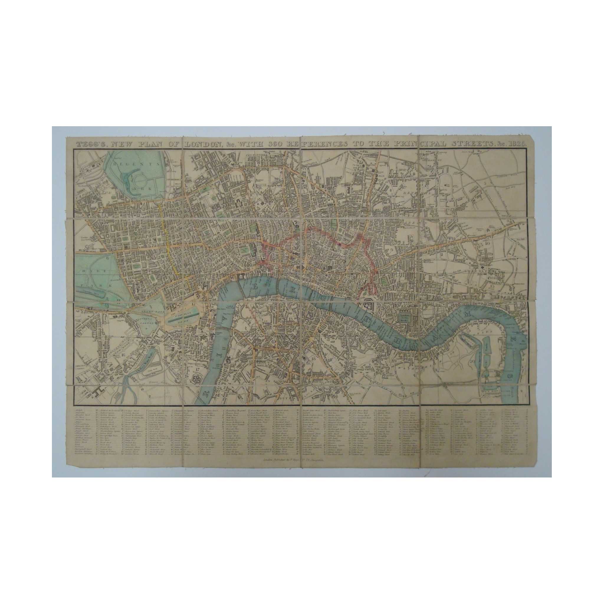
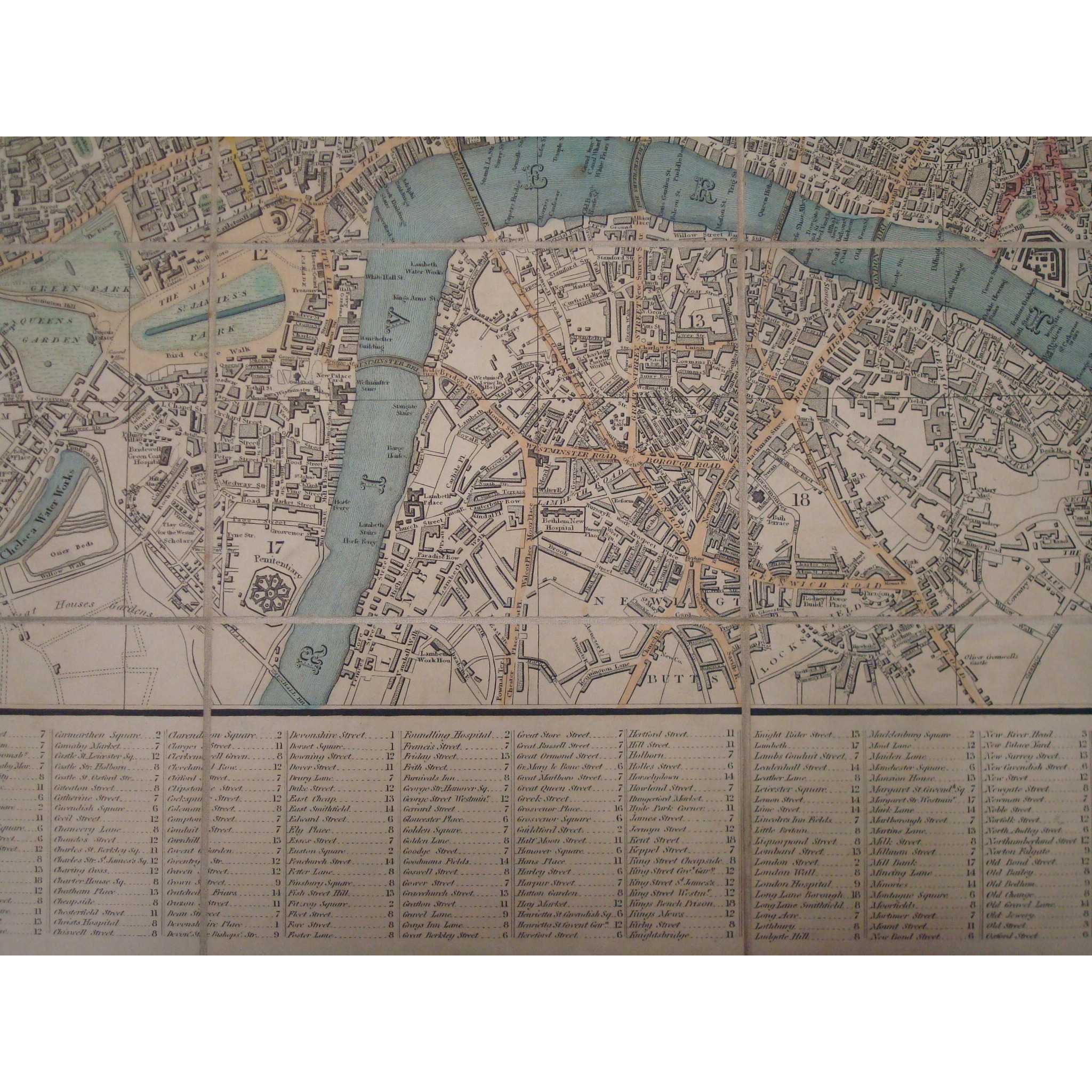
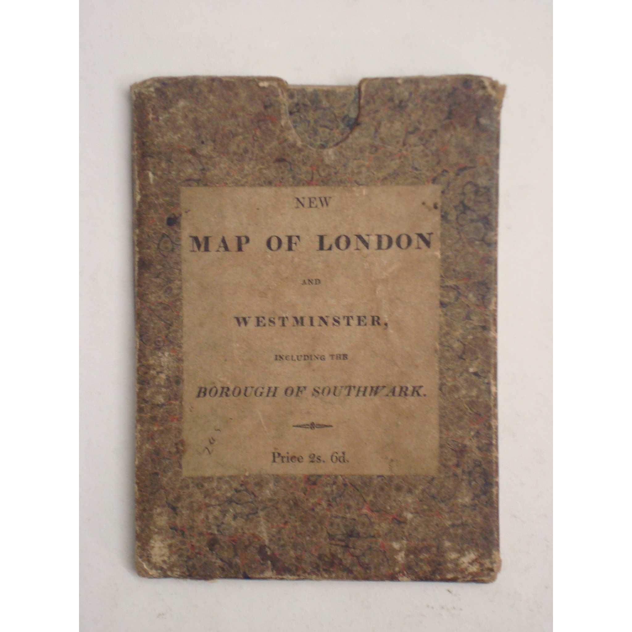
Title:Tegg's New Plan of London &c., 360 References to Principal Streets 1825
Author:Tegg, Thomas
Price:GBP£465.00 (about USD$579.30)
Shipping:GBP£7.50 (about USD$9.40)
(To United States of America)
(To United States of America)
Item ID:M002-01283
Quantity:1
Publisher:T.Tegg, UK, 1825
Edition:1825
Binding:Softcover
Condition:Very Good
Dust Jacket:Good
T.Tegg, 1825, Softcover, Book Condition: Very Good, Dust Jacket Condition: Good, 1825
Well-preserved and attractive copy of Tegg's 1825 version of the 'New Plan fo London'. Engraved map with original colour, Very Good condition, dissected and mounted on linen, including index of streets. Map bears some very light wear to edges of linen backing only, and very small chips to extreme corners only of the paper map. Item folds into green marbled paper slipcase including publisher's labels, which is generally ... More Text...
Well-preserved and attractive copy of Tegg's 1825 version of the 'New Plan fo London'. Engraved map with original colour, Very Good condition, dissected and mounted on linen, including index of streets. Map bears some very light wear to edges of linen backing only, and very small chips to extreme corners only of the paper map. Item folds into green marbled paper slipcase including publisher's labels, which is generally ... More Text...
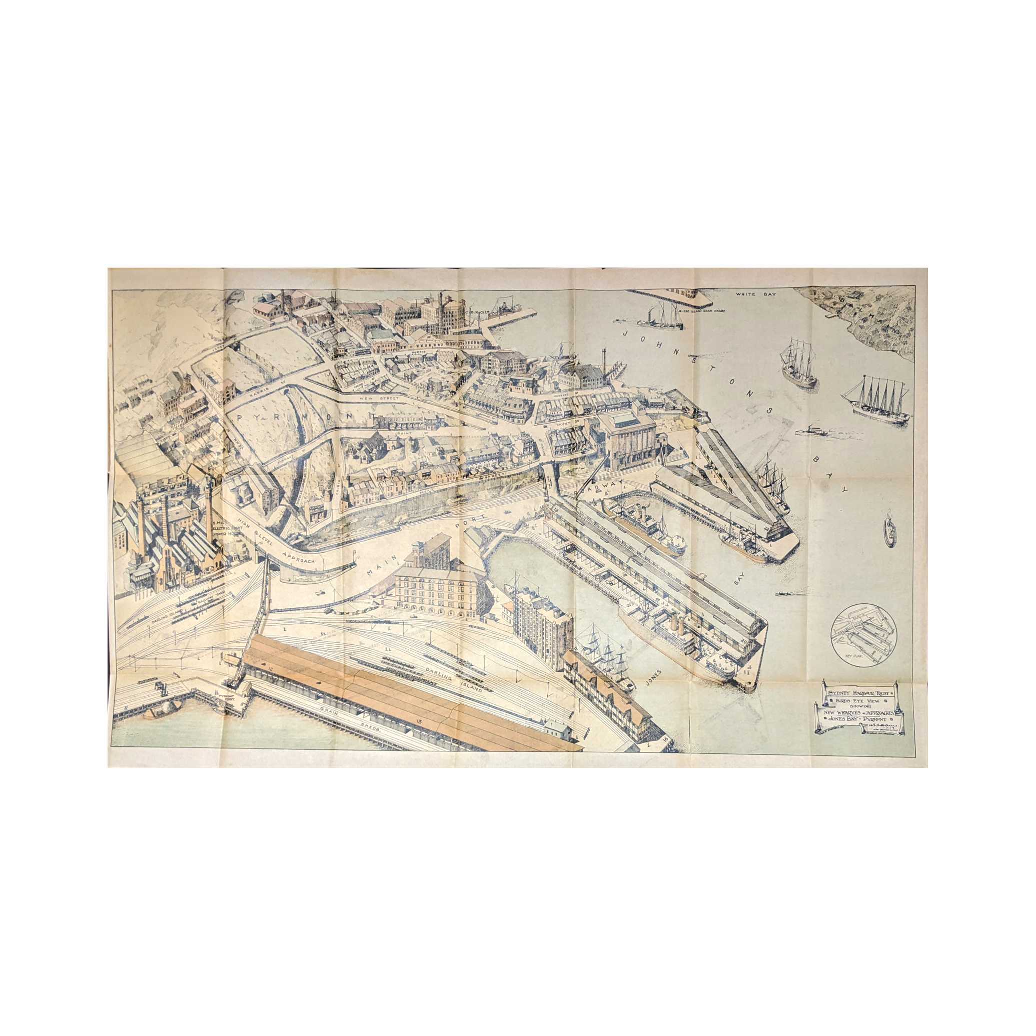
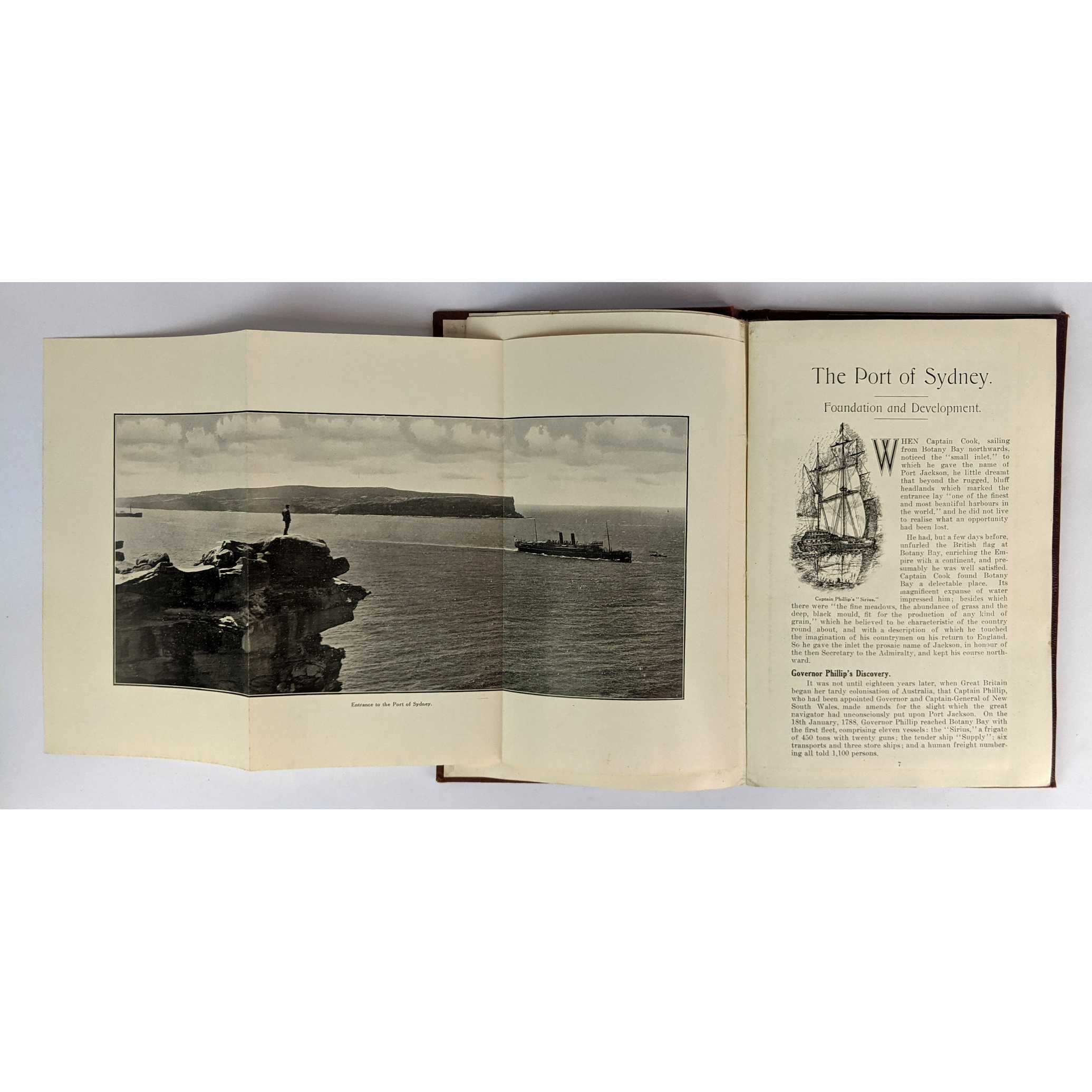

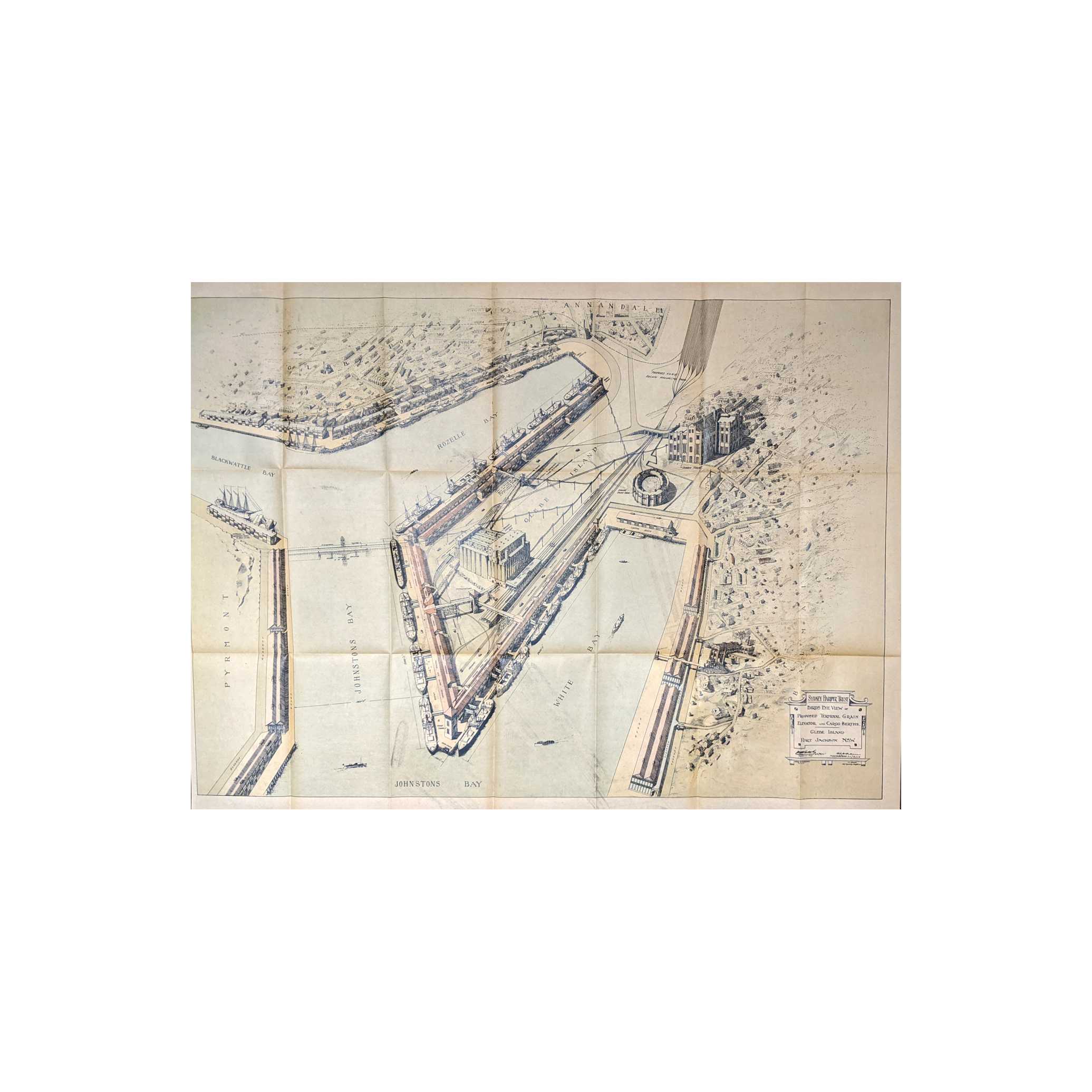
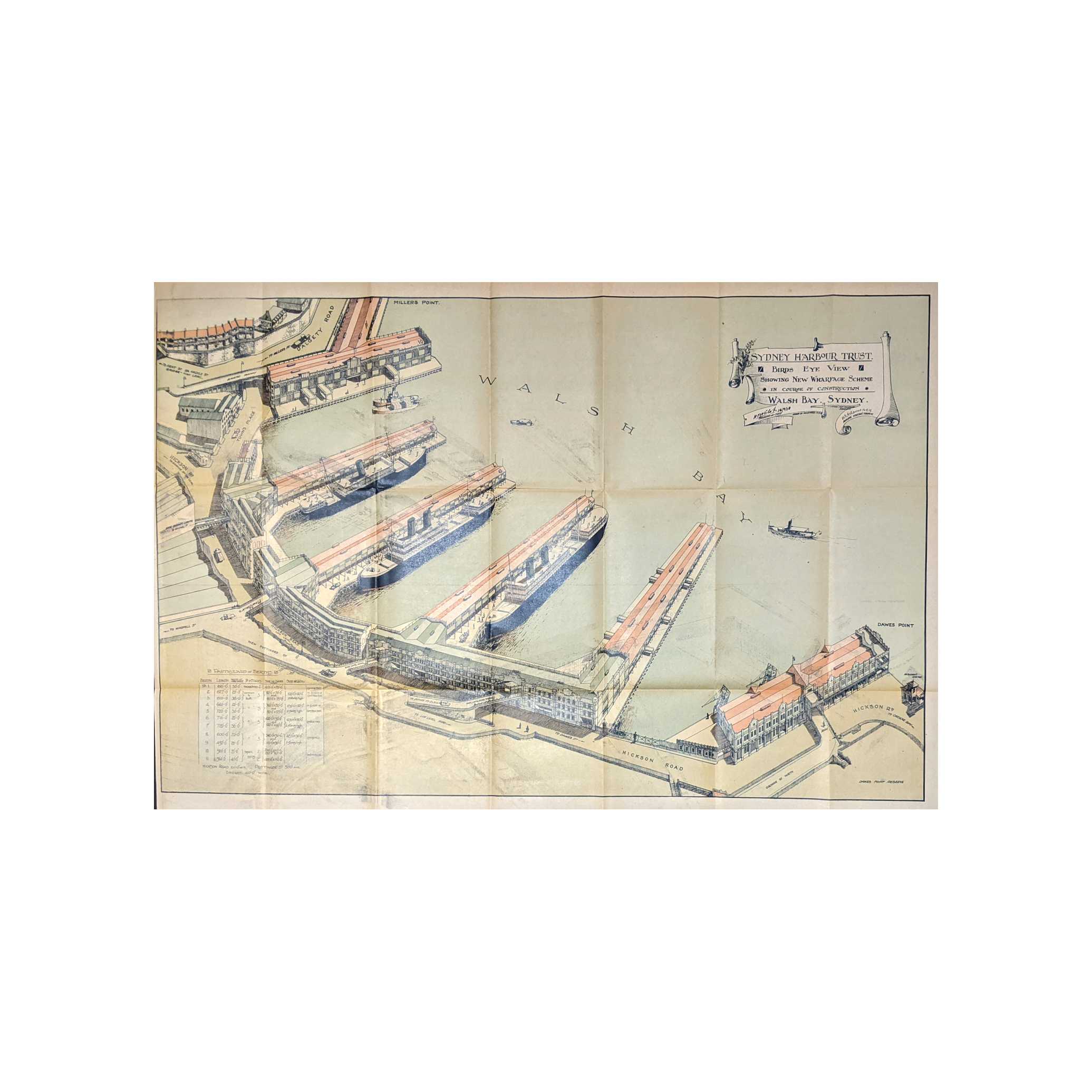
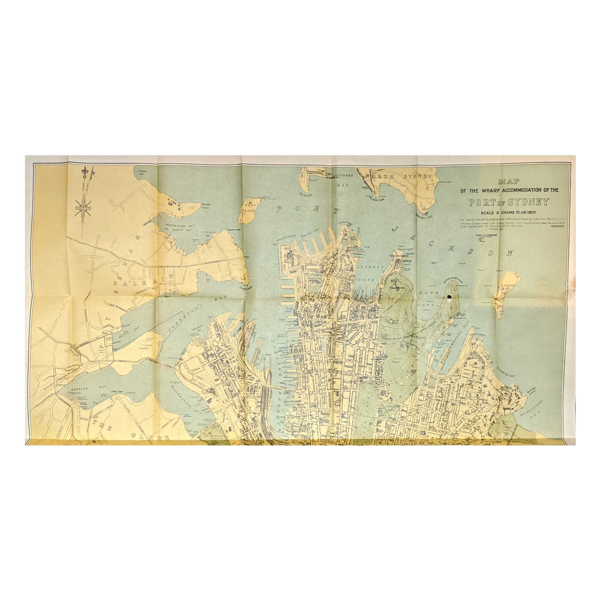
Title:Official Handbook: The Port of Sydney, N.S.W
Author:The Sydney Harbour Trust Commissioners
Price:AUD$850.00 (about USD$552.30)
Shipping:AUD$8.00 (about USD$5.20)
(To United States of America)
(To United States of America)
Item ID:LU00-0030991
Quantity:1
Publisher:The Sydney Harbour Trust Commissioners, Sydney, 1919
Edition:First
Binding:Hardcover
Condition:Very Good
The Sydney Harbour Trust Commissioners, 1919, Hardcover, Book Condition: Very Good, First
22.5cm x 14cm. 68 pages, 5 folding maps, 3 folding panorama photographic plates, black and white illustrations. Maroon cloth, gilt lettering. Recased. Minor foxing. Four of the folding maps have been placed into a pocket bound to the rear pastedown. Maps with some minor offsetting. Birds Eye View of the Port of Sydney map with an old amateur tape repair, now removed and professionally repaired, but leaving minor staining, the other maps with a few minor professional repairs. Map of the Wharf Accommodation of the Port of Sydney with a small hole at top horizontal fold toward right edge. Shipped Weight: .42 kilos.
22.5cm x 14cm. 68 pages, 5 folding maps, 3 folding panorama photographic plates, black and white illustrations. Maroon cloth, gilt lettering. Recased. Minor foxing. Four of the folding maps have been placed into a pocket bound to the rear pastedown. Maps with some minor offsetting. Birds Eye View of the Port of Sydney map with an old amateur tape repair, now removed and professionally repaired, but leaving minor staining, the other maps with a few minor professional repairs. Map of the Wharf Accommodation of the Port of Sydney with a small hole at top horizontal fold toward right edge. Shipped Weight: .42 kilos.
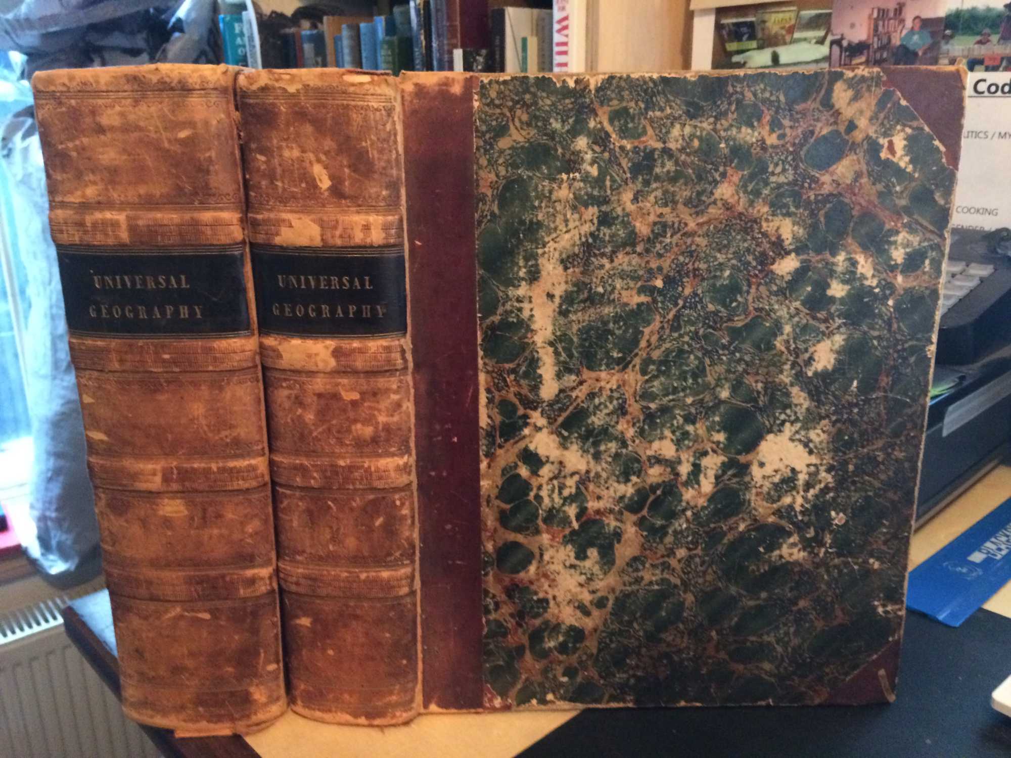
Title:An Authentic History and Entertaining Description of the World and its Inhabitants, forming a New and Complete Universal Geography. Vol I & II (Complete)
Author:Kelly, & Thomas Bartlett (ed.), Christopher
Price:GBP£425.00 (about USD$529.50)
Shipping:GBP£100.00 (about USD$124.60) [Min]
(To United States of America)
(To United States of America)
Item ID:DB03-45856
Quantity:1
Publisher:Thomas Kelly, London, 1840
Edition:New
Binding:Hardcover (Half Leather)
Condition:Good
Thomas Kelly, 1840, Hardcover (Half Leather), Book Condition: Good, New
Size: 4to <12". xxviii + 1122 / 848pp. 2-volume set (complete). Front hinges cracked, both vols. Minor wear to spines, with slight loss at ends. Title pieces present but volume number pieces absent. Scattered foxing, mostly to plates. Edges browned. Covers worn. Corners bumped. Numerous plates and maps present in both volumes. Quantity Available: 1. Shipped Weight: Over 5 kilos. Category: Geography & Maps; 19th century; History. Pictures of this item not already displayed here available upon request. Inventory No: 45856.
Size: 4to <12". xxviii + 1122 / 848pp. 2-volume set (complete). Front hinges cracked, both vols. Minor wear to spines, with slight loss at ends. Title pieces present but volume number pieces absent. Scattered foxing, mostly to plates. Edges browned. Covers worn. Corners bumped. Numerous plates and maps present in both volumes. Quantity Available: 1. Shipped Weight: Over 5 kilos. Category: Geography & Maps; 19th century; History. Pictures of this item not already displayed here available upon request. Inventory No: 45856.
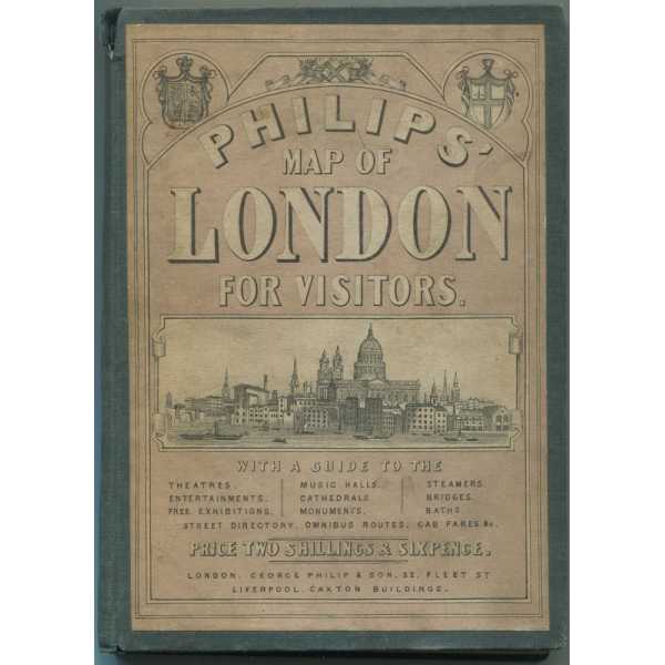


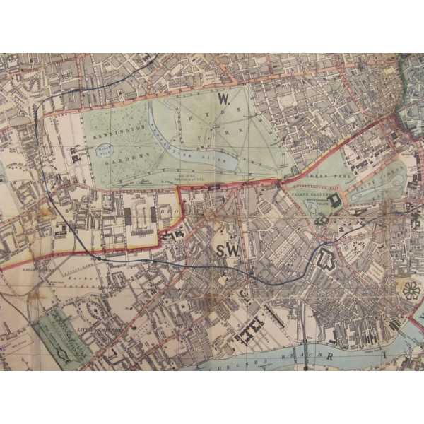
Title:Phillips' Map of London for Visitors and London Guide
Author:Various/Unknown
Price:USD$375.00
Shipping:Set Shipping State/Province
(To United States of America)
(To United States of America)
Item ID:DH00-011003
Quantity:1
Publisher:George Philip & Son, London and Liverpool, 1869
Edition:Unstated
Binding:Hardcover
Condition:Fair
Dust Jacket:No
George Philip & Son, 1869, Hardcover, Book Condition: Fair, Dust Jacket Condition: No, Unstated
Size: 16mo. Text body is clean, and free from previous owner annotation, underlining and highlighting. Green cloth over boards with illustrated paste down label on front cover, includes 16 page Phillips' London Guide, tan string bound wraps, with information on London, theaters, entertainment, music halls, exhibitions, cathedrals, monuments, parks, steamers, bridges, Street directory, bus routes, cab fares, and ... More Text...
Size: 16mo. Text body is clean, and free from previous owner annotation, underlining and highlighting. Green cloth over boards with illustrated paste down label on front cover, includes 16 page Phillips' London Guide, tan string bound wraps, with information on London, theaters, entertainment, music halls, exhibitions, cathedrals, monuments, parks, steamers, bridges, Street directory, bus routes, cab fares, and ... More Text...
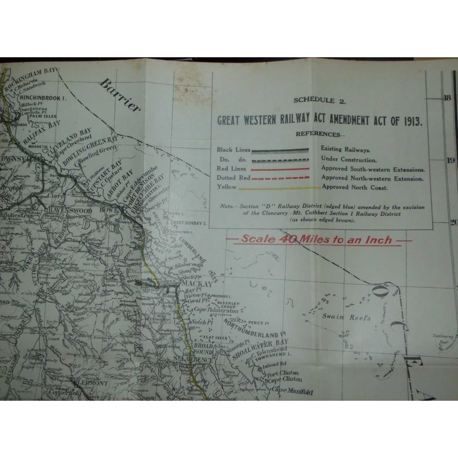

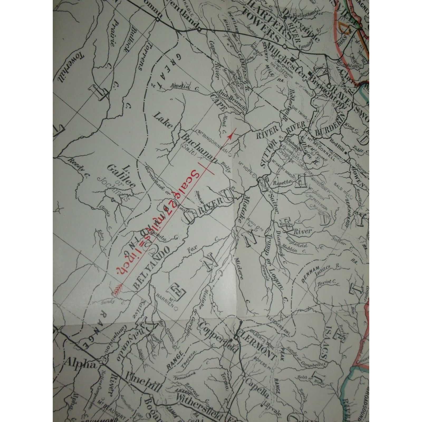
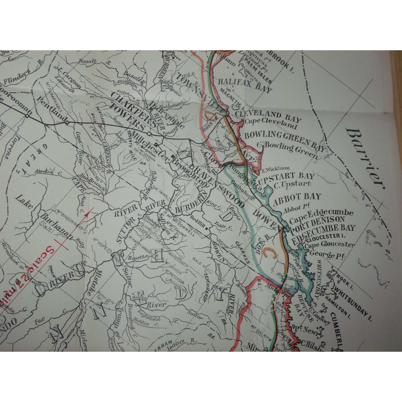
Title:Great Western Railway Act Amendment Act Of 1913
Author:Queensland Government
Price:AUD$560.00 (about USD$363.90)
Shipping:AUD$40.00 (about USD$26.00)
(To United States of America)
(To United States of America)
Item ID:SI00-005564
Quantity:1
Publisher:Queensland Government, Brisbane, 1916
Edition:First
Queensland Government, 1916, First
1 map. 500mm by 680mm. Map is in good condition with a couple of small tears. Map ex 1916 Queensland Government Statutes. Elephant Folio - over 15" - 23" tall. Quantity Available: 1. Category: Maps; Pictures of this item not already displayed here available upon request. Inventory No: 005564.
1 map. 500mm by 680mm. Map is in good condition with a couple of small tears. Map ex 1916 Queensland Government Statutes. Elephant Folio - over 15" - 23" tall. Quantity Available: 1. Category: Maps; Pictures of this item not already displayed here available upon request. Inventory No: 005564.

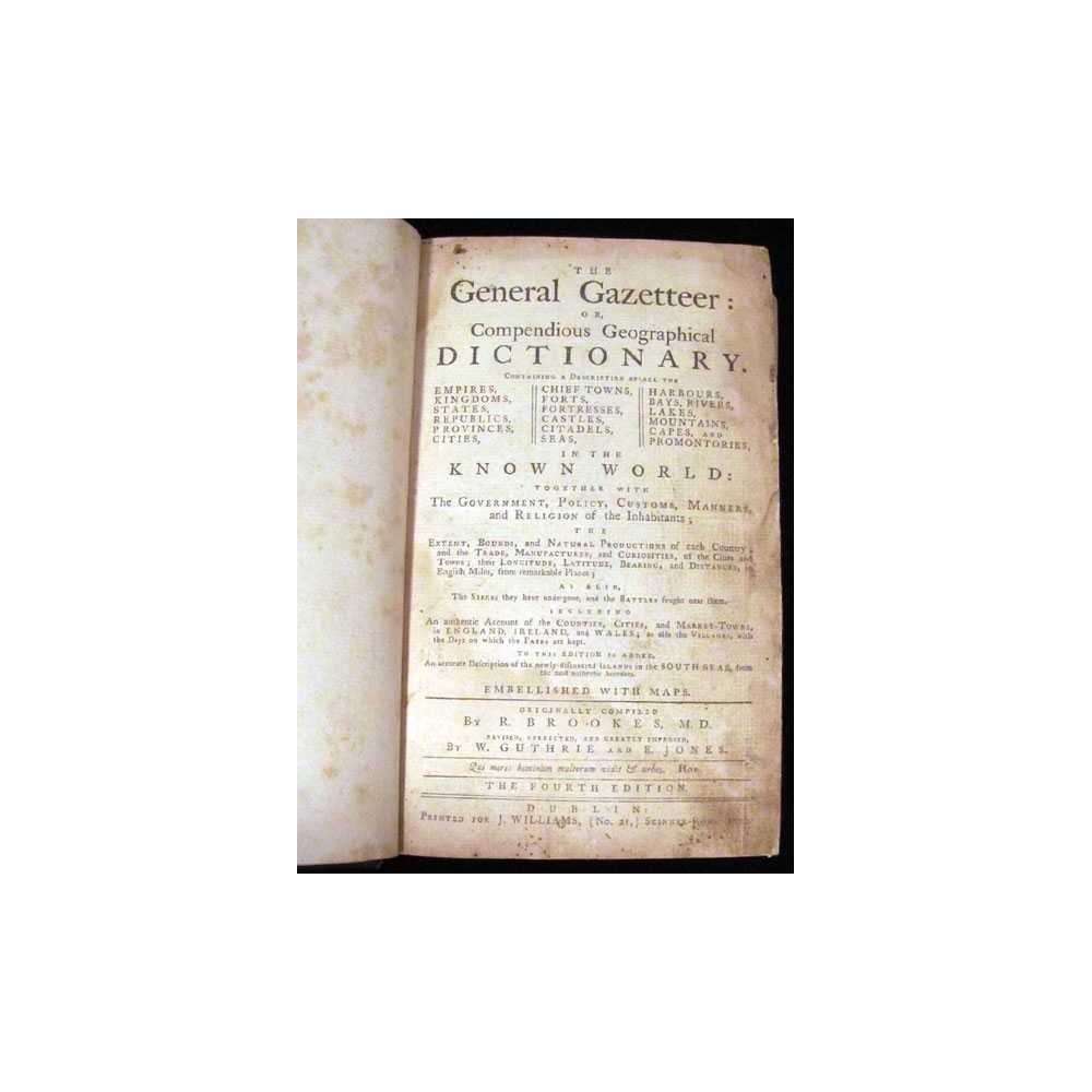


Title:The General Gazetteer: or, Compendious Geographical Dictionary
Author:Brookes, R.; Guthrie, W. and Jones, E.
Price:USD$350.00
Shipping:Set Shipping State/Province
(To United States of America)
(To United States of America)
Item ID:DH00-011951
Quantity:1
Publisher:Printed for J. Williams, Dublin, 1776
Edition:Fourth
Binding:Hardcover
Condition:Good
Dust Jacket:No
Printed for J. Williams, 1776, Hardcover, Book Condition: Good, Dust Jacket Condition: No, Fourth
Size: Octavo (standard book size). Text body is clean, and free from previous owner annotation, underlining and highlighting. Binding is sound. Previous owner's name and brief notes in ink on back of title page. Half brown gilt-stamped leather and marbled paper over boards, 5 raised bands, top edge gilt, marbled end papers, unpaginated, illustrated with 5 maps. Edges and corners bumped and worn, marbled paper ... More Text...
Size: Octavo (standard book size). Text body is clean, and free from previous owner annotation, underlining and highlighting. Binding is sound. Previous owner's name and brief notes in ink on back of title page. Half brown gilt-stamped leather and marbled paper over boards, 5 raised bands, top edge gilt, marbled end papers, unpaginated, illustrated with 5 maps. Edges and corners bumped and worn, marbled paper ... More Text...
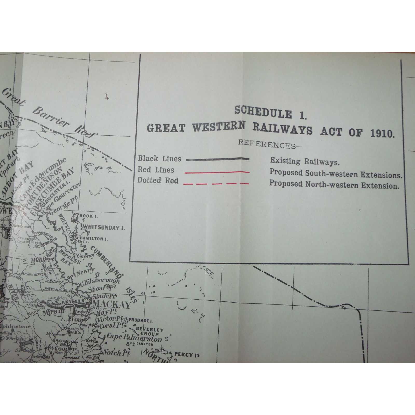
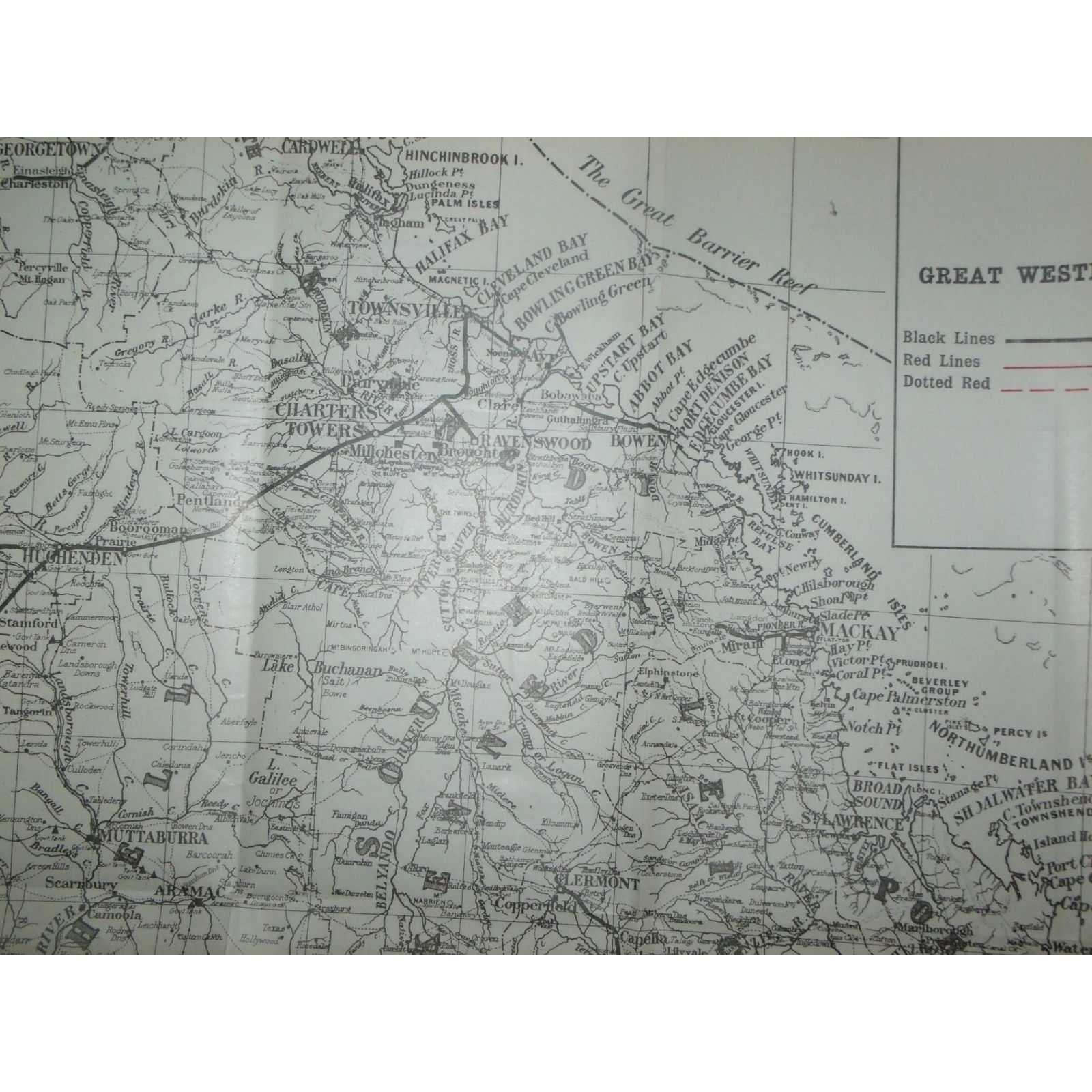
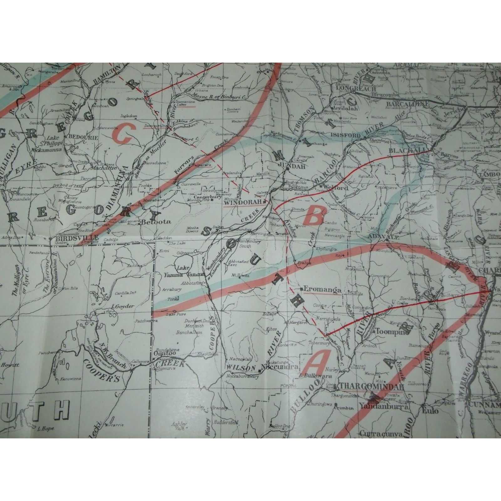
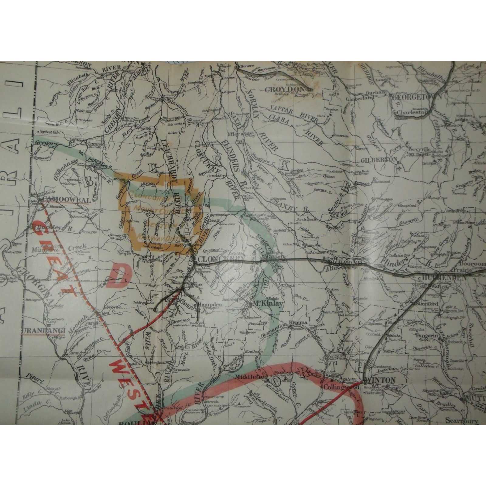
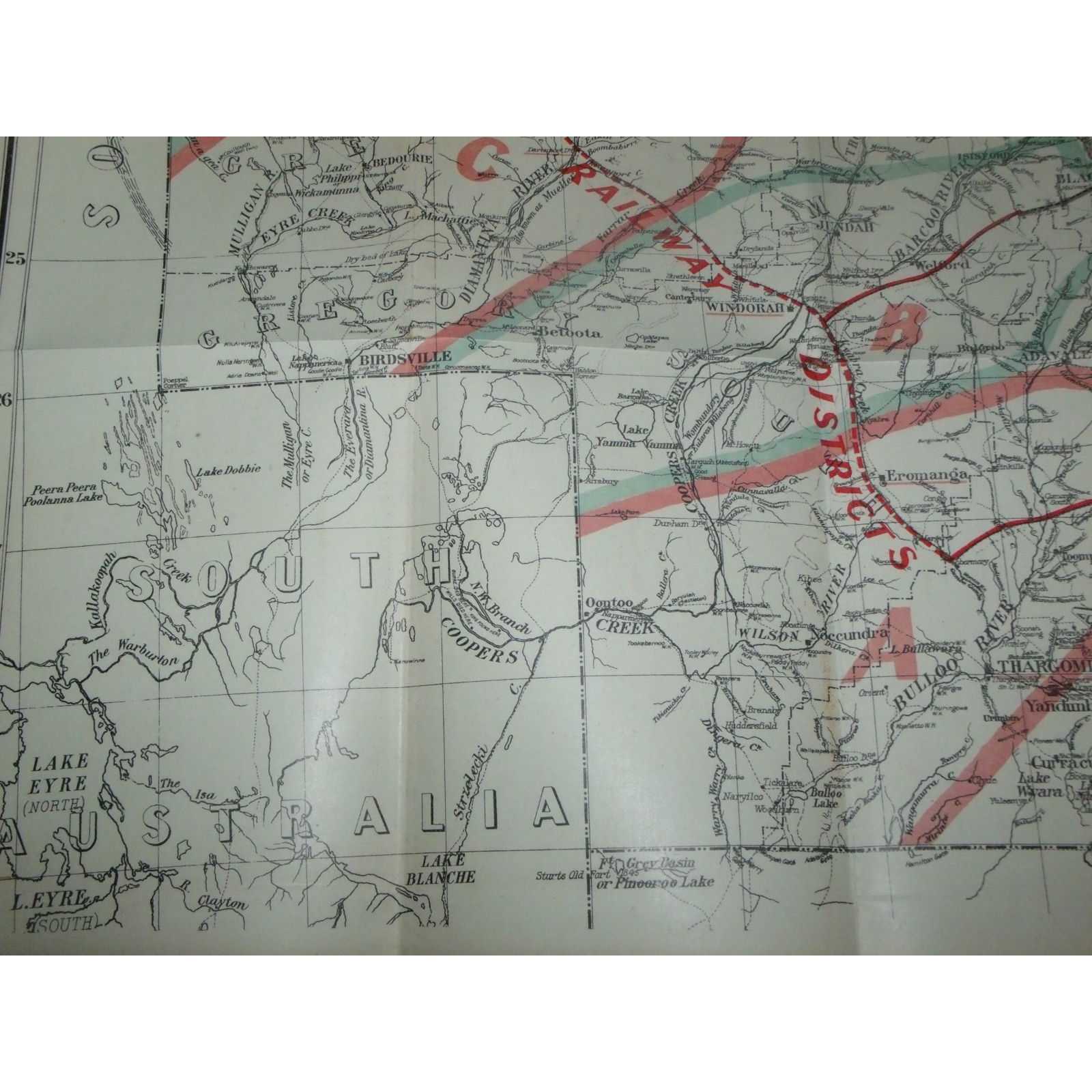
Title:Great Western Railways Act Of 1910: Eromanga, Windorah, Camooweal
Author:Queensland Government
Price:AUD$520.00 (about USD$337.90)
Shipping:AUD$40.00 (about USD$26.00)
(To United States of America)
(To United States of America)
Item ID:SI00-005561
Quantity:1
Publisher:Queensland Government, Brisbane, 1916
Edition:First
Queensland Government, 1916, First
1 map. 500 mm by 680 mm. Map is in good unmarked condition. Map ex 1916 Queensland Government Statutes. Elephant Folio - over 15" - 23" tall. Quantity Available: 1. Category: Maps; Pictures of this item not already displayed here available upon request. Inventory No: 005561.
1 map. 500 mm by 680 mm. Map is in good unmarked condition. Map ex 1916 Queensland Government Statutes. Elephant Folio - over 15" - 23" tall. Quantity Available: 1. Category: Maps; Pictures of this item not already displayed here available upon request. Inventory No: 005561.
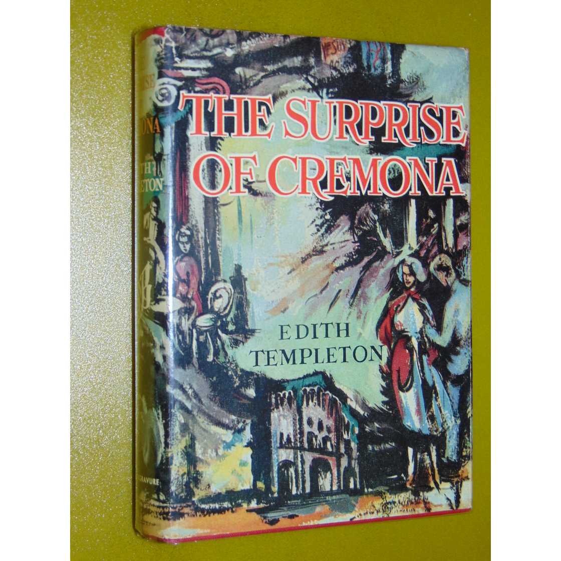
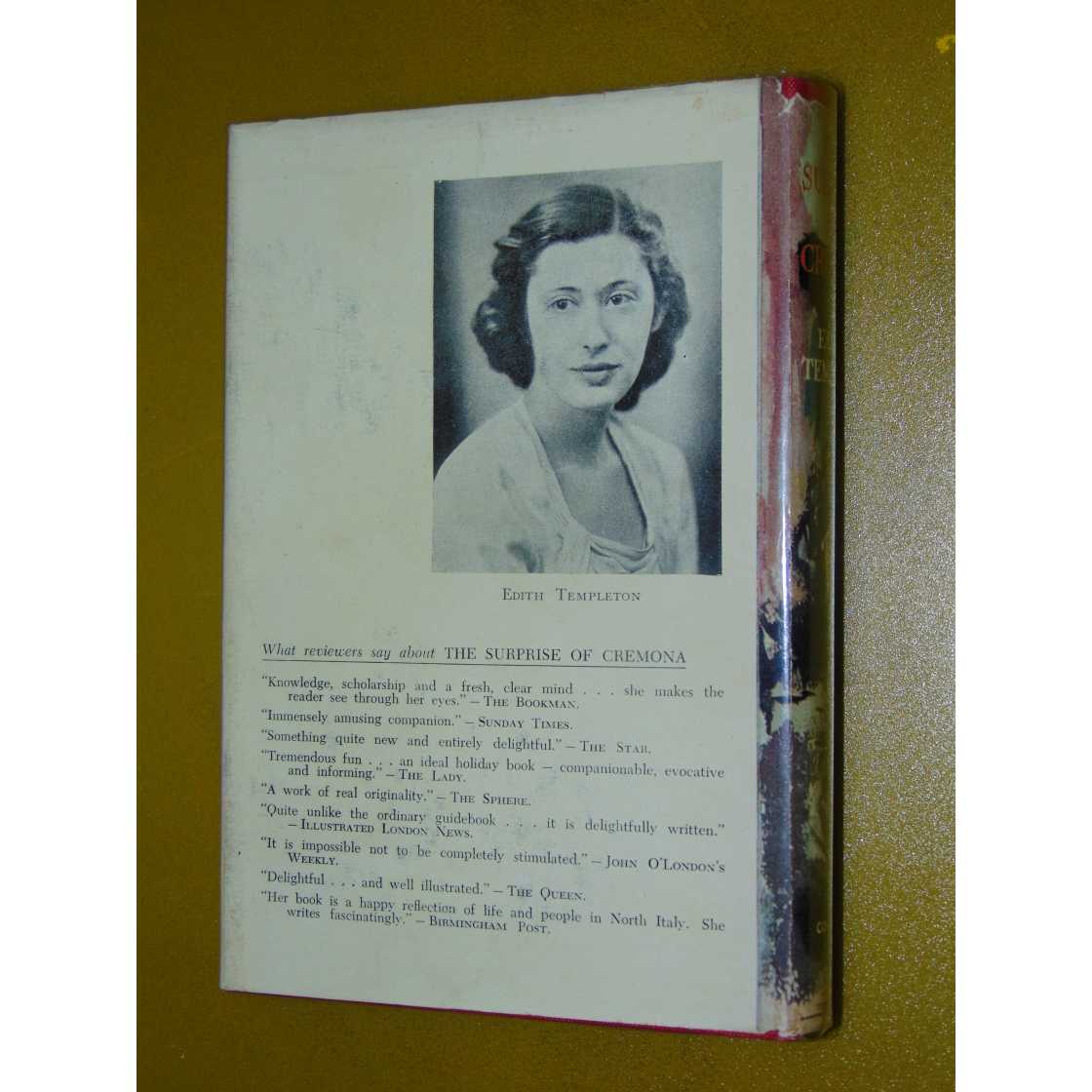
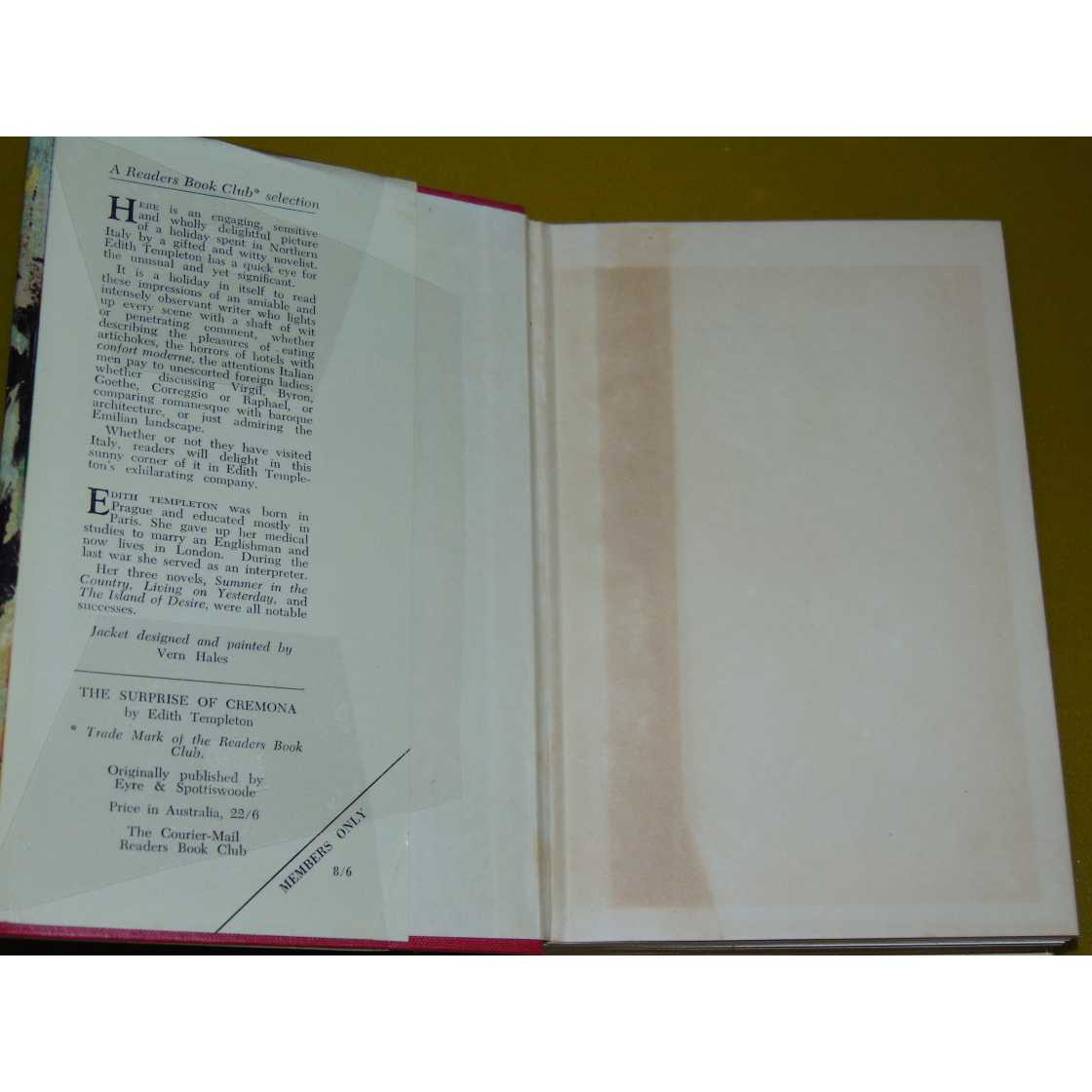
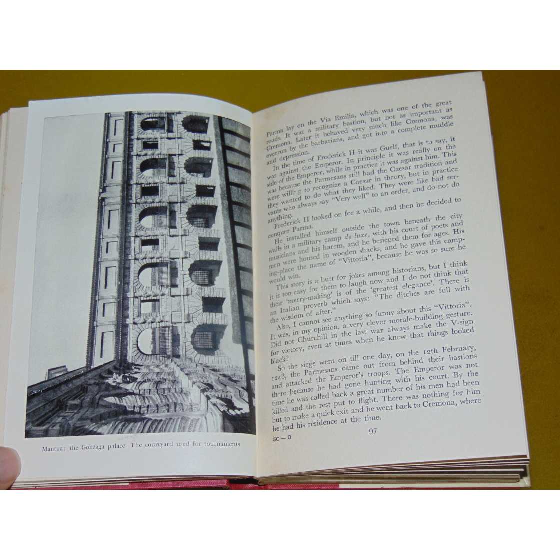
Title:The Surprise Of Cremona
Author:Templeton, Edith
Price:AUD$425.00 (about USD$276.20)
Shipping:AUD$40.00 (about USD$26.00)
(To United States of America)
(To United States of America)
Item ID:SI00-50611
Quantity:1
Publisher:Readers Book Club, Melbourne, 1955
Edition:Book Club
Illustrator:Vern Hales
Binding:Hardcover
Condition:Good
Dust Jacket:Good
Readers Book Club, 1955, Hardcover, Book Condition: Good, Dust Jacket Condition: Good, Book Club, Illustrated By: Vern Hales
Australian Book Club Edition. Dust jacket illustrated by Vern Hales/ Vern Hayles. Book is in good unmarked condition. Dust jacket is in good condition with some wear, tears & chipping, small area of loss to dust jacket at head of spine. Dust jacket condition preserved within new clear plastic non-adhesive removable protective covering. Size: Octavo (standard book size). 287 pages. Item Type: Book. Illustrator: Vern Hales. Quantity Available: 1. Category: Travel & Places; Italy; Geography & Maps. Pictures of this item not already displayed here available upon request. Inventory No: 50611.
Australian Book Club Edition. Dust jacket illustrated by Vern Hales/ Vern Hayles. Book is in good unmarked condition. Dust jacket is in good condition with some wear, tears & chipping, small area of loss to dust jacket at head of spine. Dust jacket condition preserved within new clear plastic non-adhesive removable protective covering. Size: Octavo (standard book size). 287 pages. Item Type: Book. Illustrator: Vern Hales. Quantity Available: 1. Category: Travel & Places; Italy; Geography & Maps. Pictures of this item not already displayed here available upon request. Inventory No: 50611.
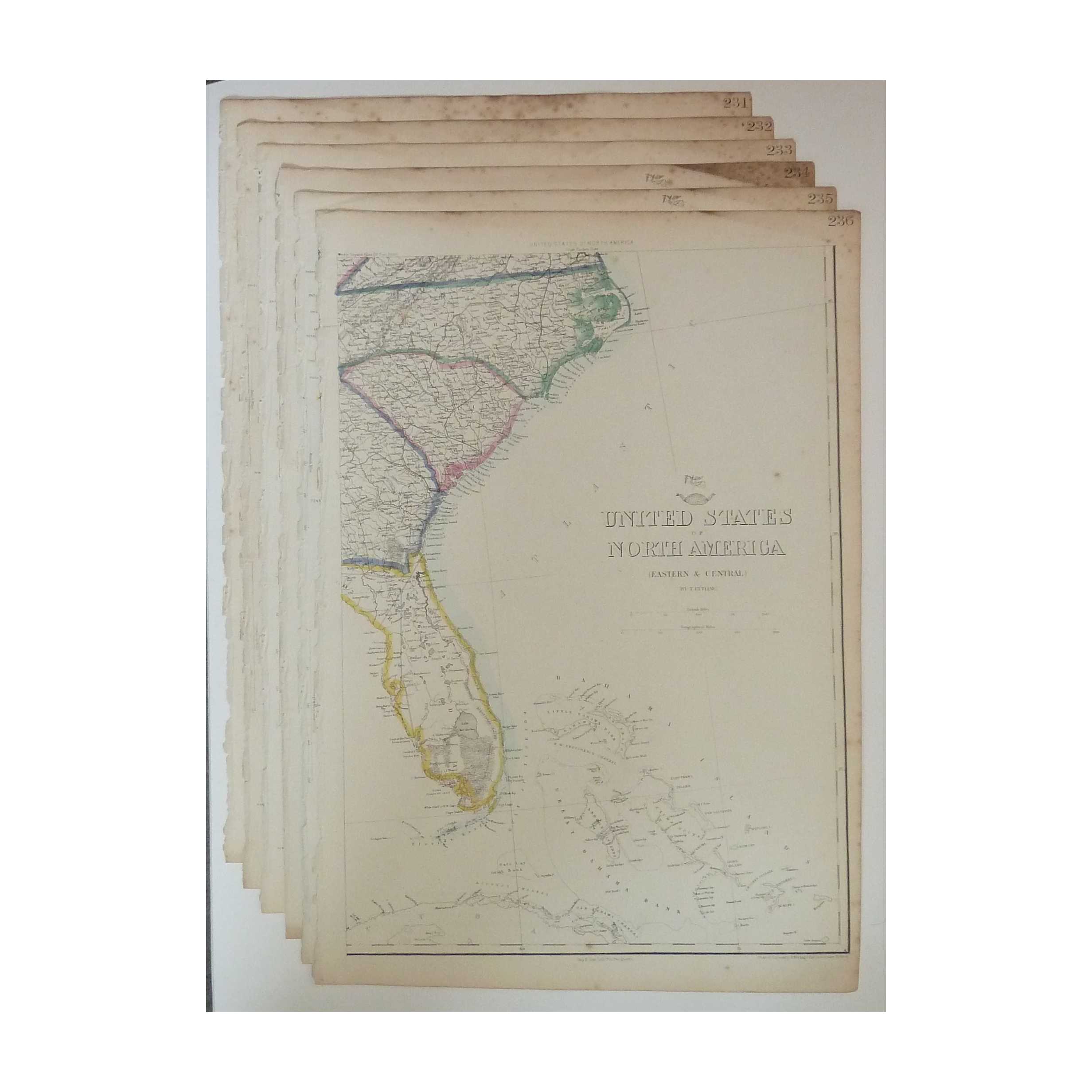
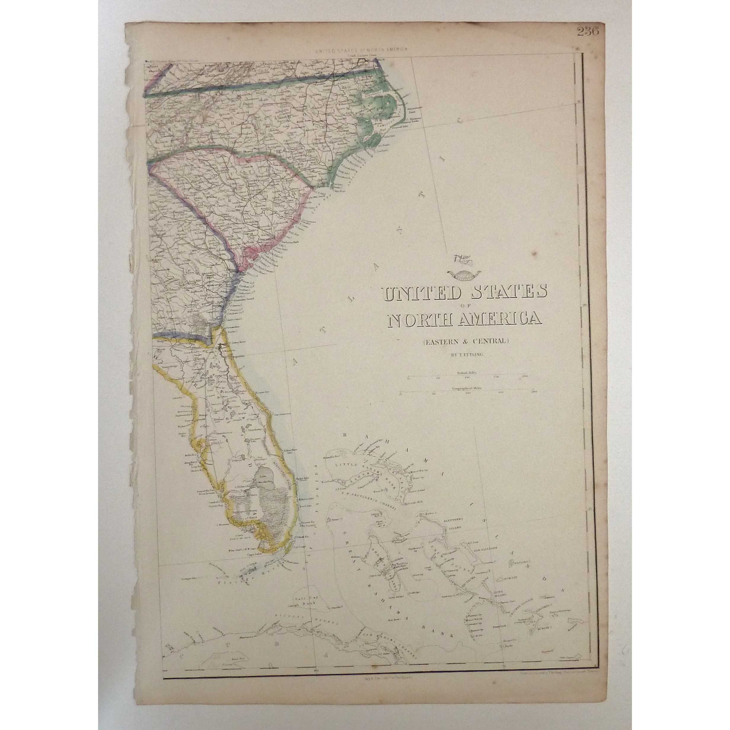
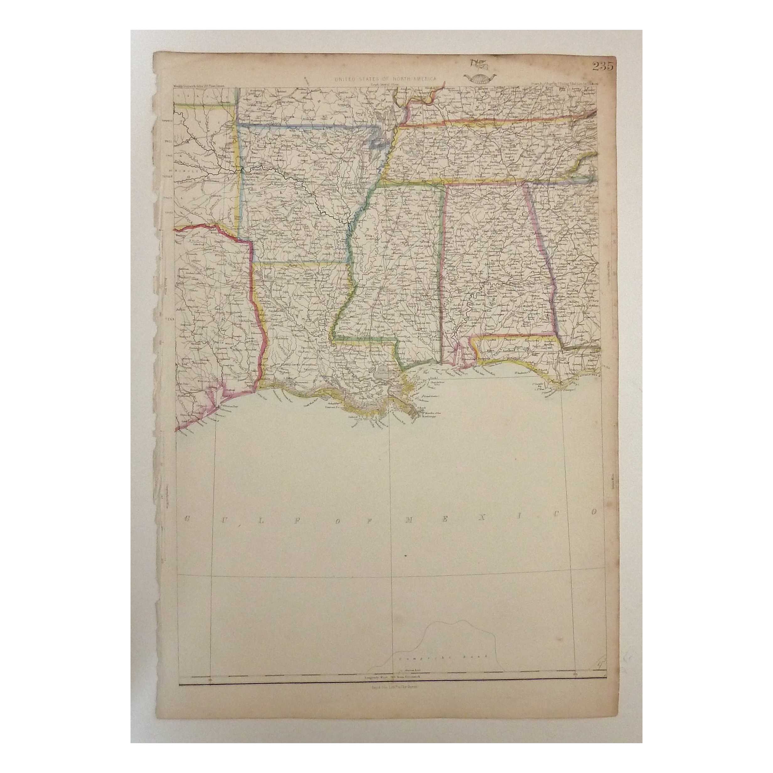

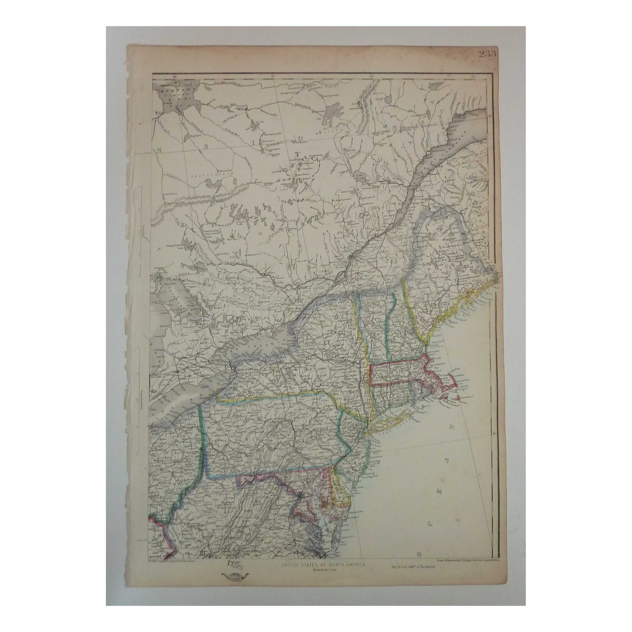
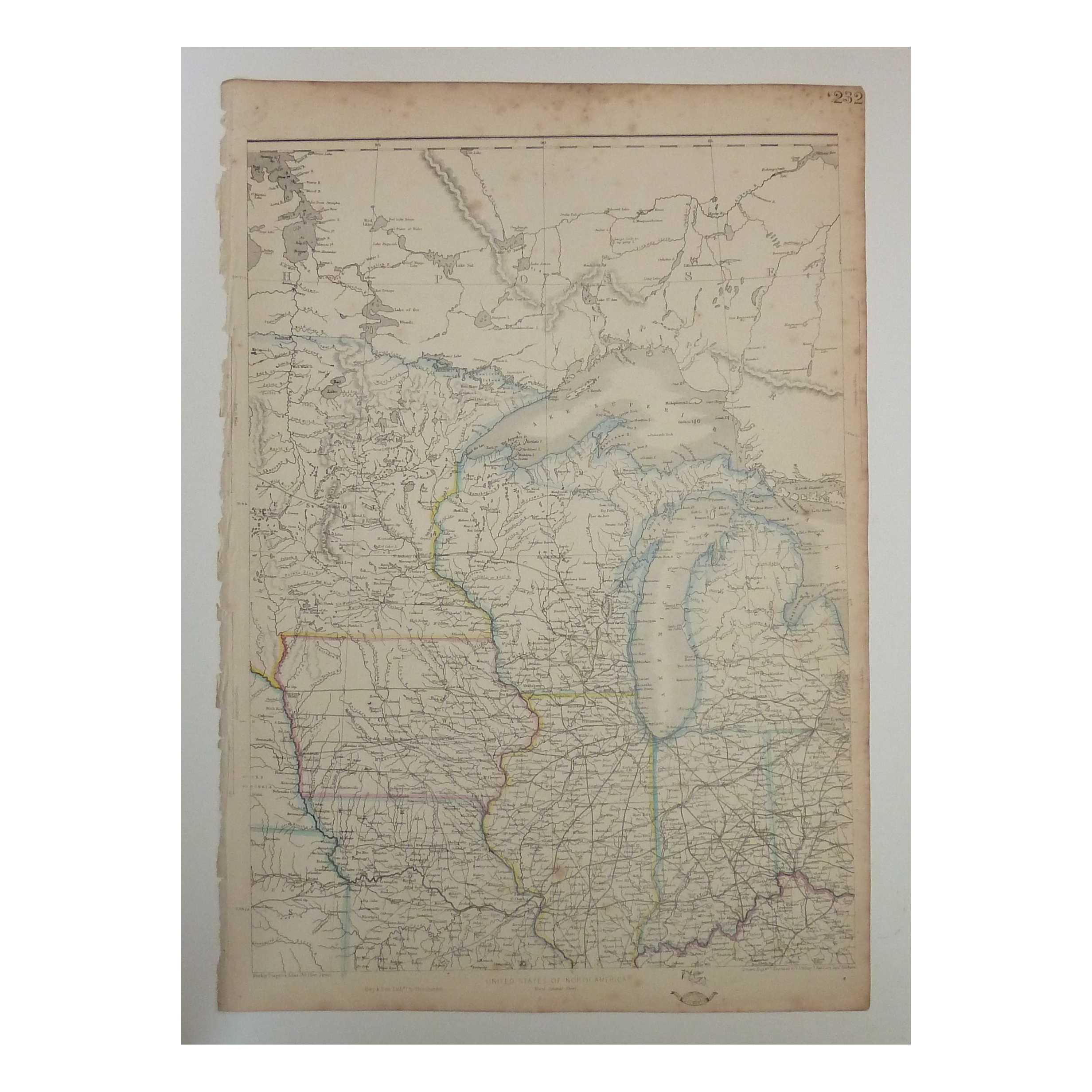

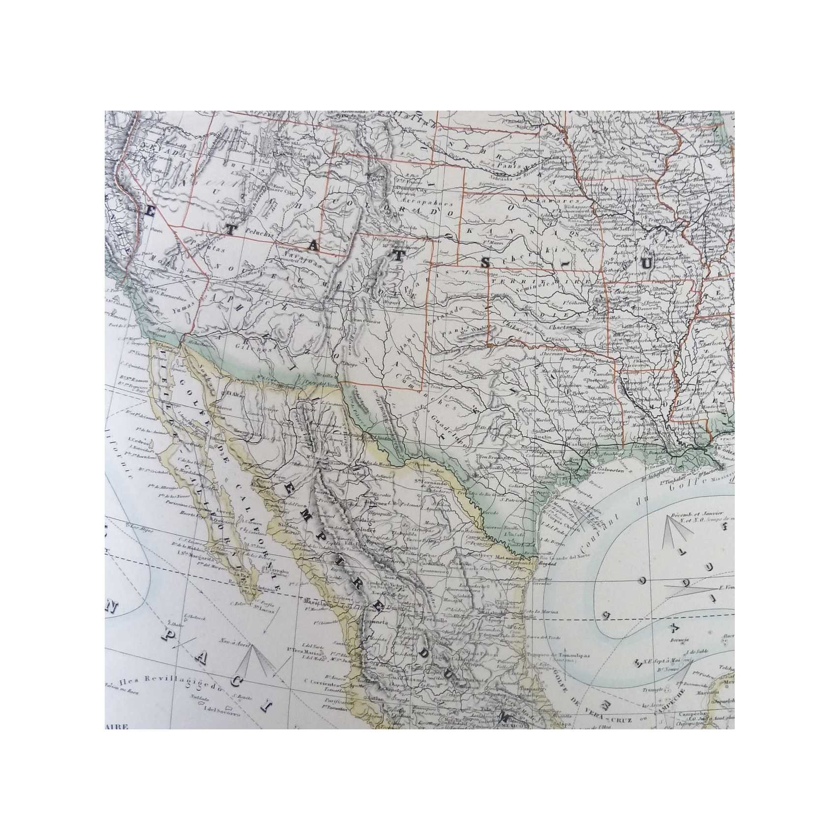
Title:United States of North America Complete Set of 6 (Dispatch Atlas 1863)
Author:Ettling, T.
Price:GBP£215.00 (about USD$267.90)
Shipping:GBP£9.80 (about USD$12.30)
(To United States of America)
(To United States of America)
Item ID:M002-10700
Quantity:1
Publisher:Cassell, UK, 1863
Edition:First
Binding:Softcover
Condition:Very Good
Cassell, 1863, Softcover, Book Condition: Very Good, First
A complete set of 6 original hand-coloured lithograph taken from Cassell's Weekly Dispatch Atlas, 1863 comprising the North East, South East, North Central, South Central, North West, and South West sheets of Ettling's United States of North America. All 6 sheets are overall presentable, with some browning and foxing to edges and corners, sometimes encroaching lightly to the printed image, but lines and colouring remain clear and bold across all ... More Text...
A complete set of 6 original hand-coloured lithograph taken from Cassell's Weekly Dispatch Atlas, 1863 comprising the North East, South East, North Central, South Central, North West, and South West sheets of Ettling's United States of North America. All 6 sheets are overall presentable, with some browning and foxing to edges and corners, sometimes encroaching lightly to the printed image, but lines and colouring remain clear and bold across all ... More Text...
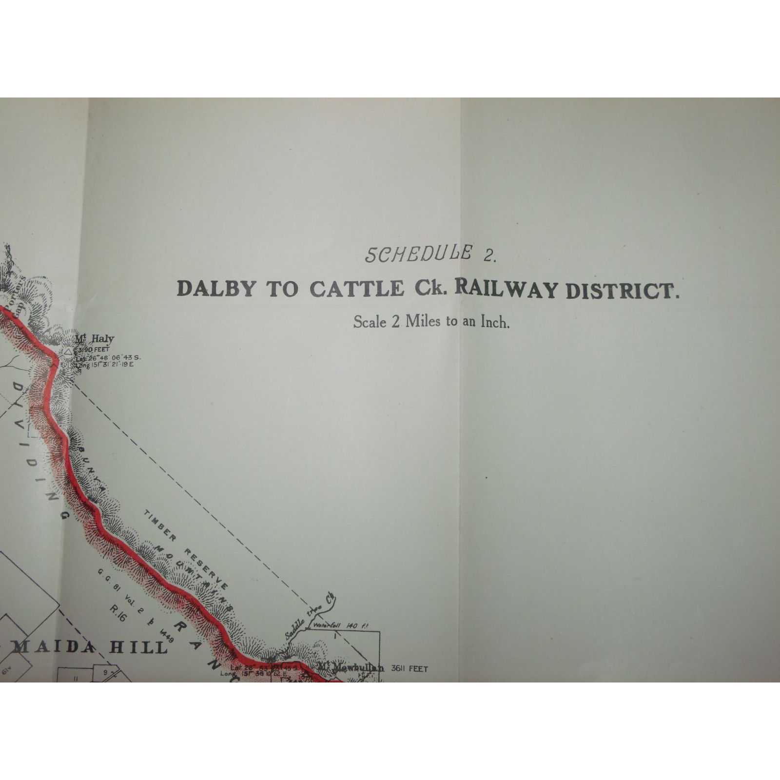
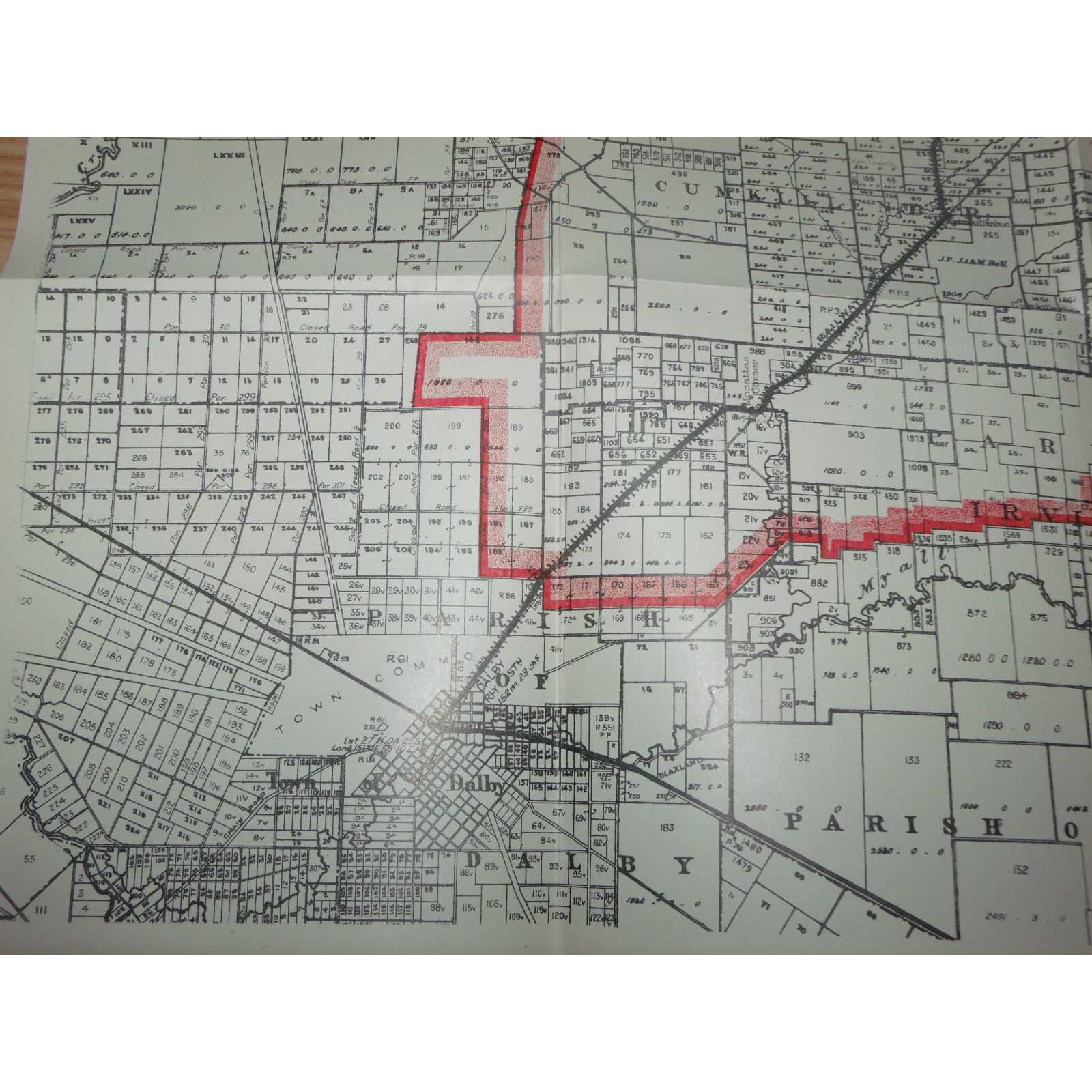
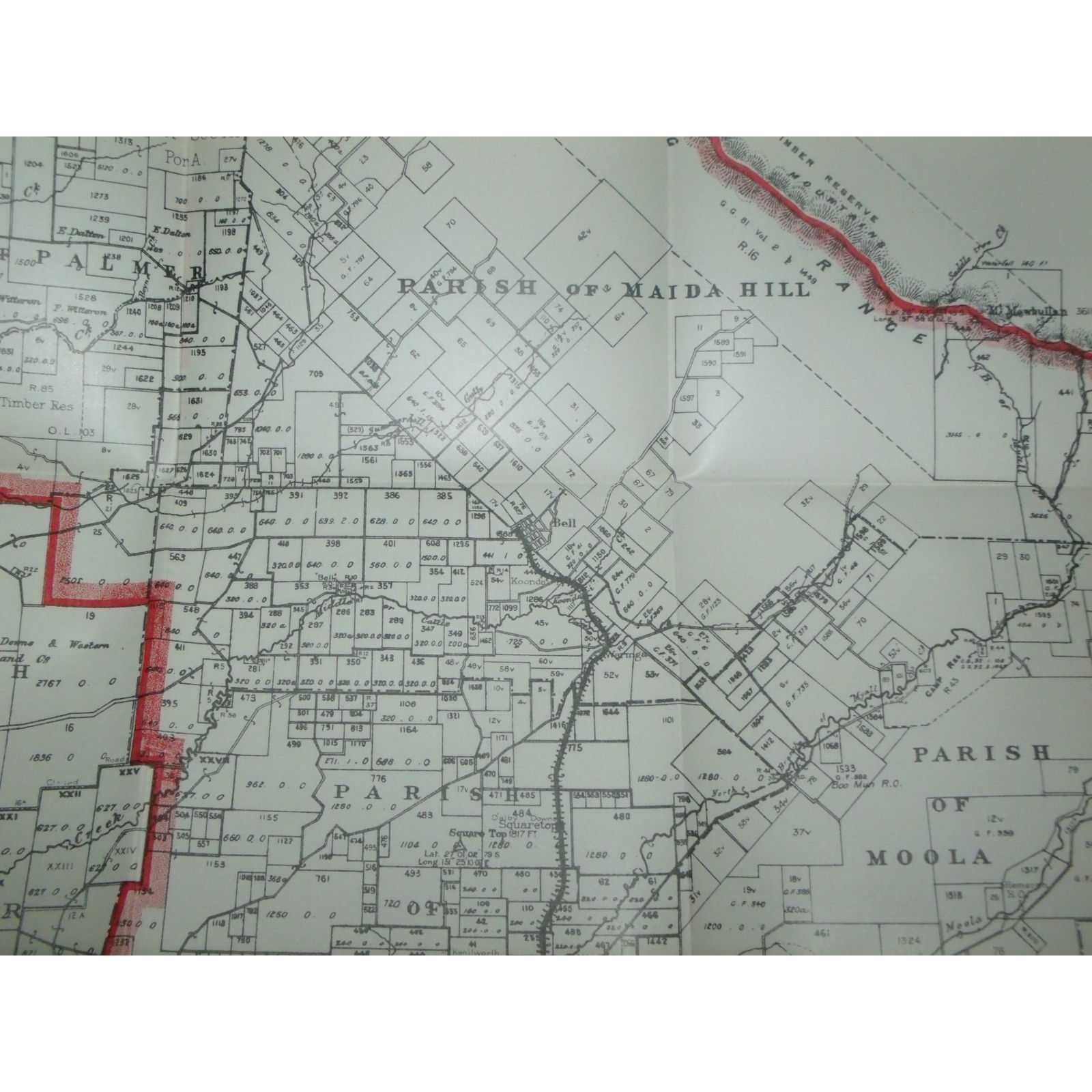
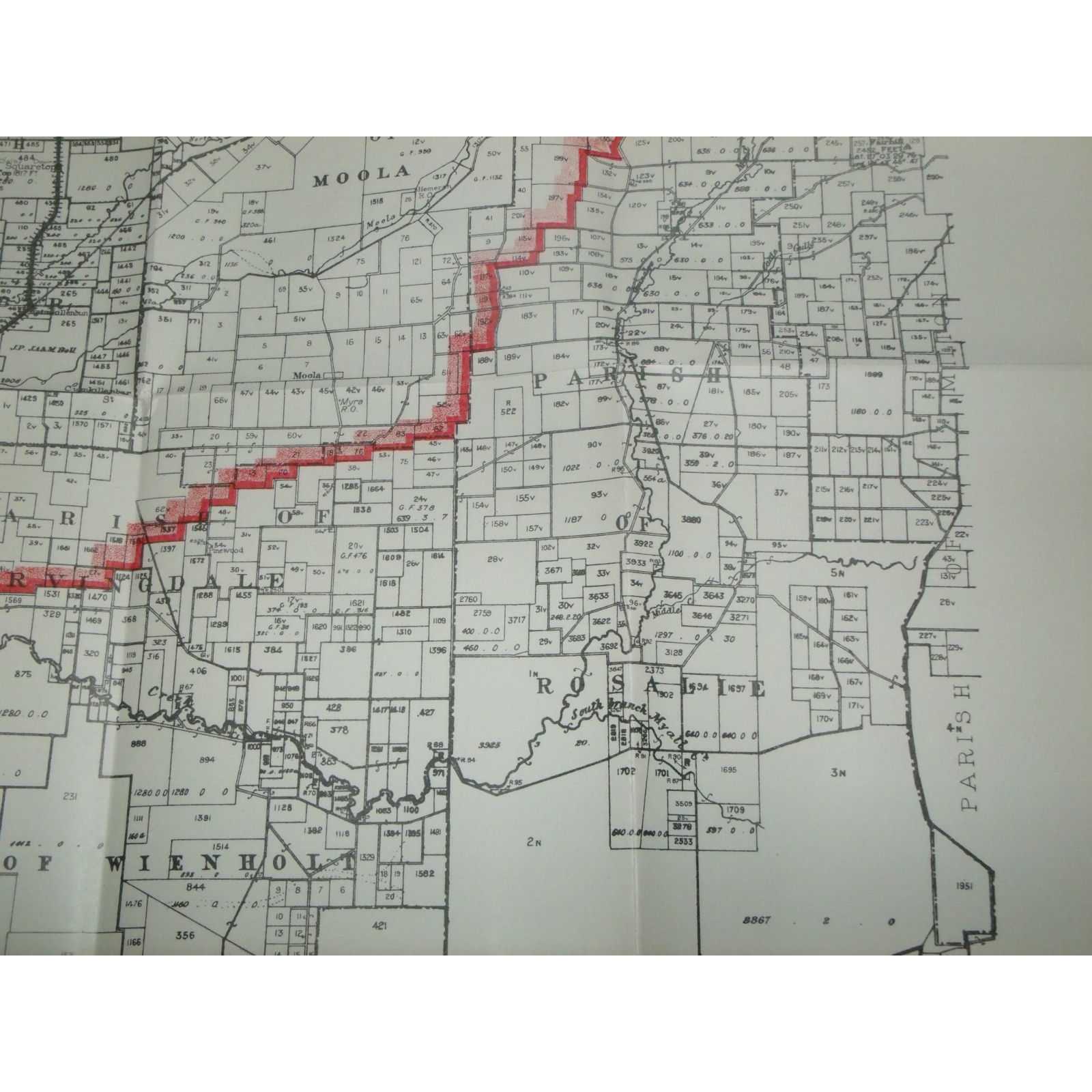
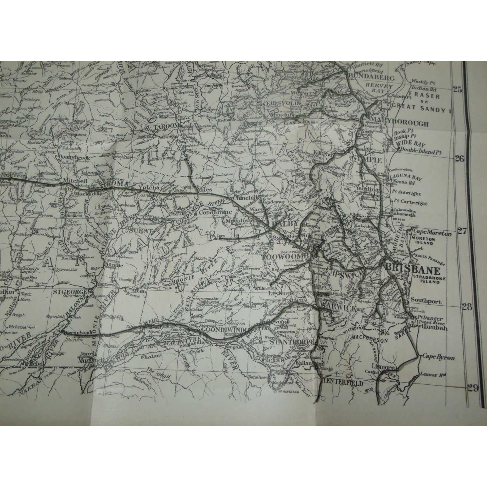
Title:Dalby To Cattle Ck. Railway District: Bell Branch
Author:Queensland Government
Price:AUD$410.00 (about USD$266.40)
Shipping:AUD$40.00 (about USD$26.00)
(To United States of America)
(To United States of America)
Item ID:SI00-005559
Quantity:1
Publisher:Queensland Government, Brisbane, 1916
Edition:First
Queensland Government, 1916, First
1 map. 470mm by 540mm. Map is in good unmarked condition.Map ex 1916 Queensland Government Statutes. Elephant Folio - over 15" - 23" tall. Quantity Available: 1. Category: Maps; Pictures of this item not already displayed here available upon request. Inventory No: 005559.
1 map. 470mm by 540mm. Map is in good unmarked condition.Map ex 1916 Queensland Government Statutes. Elephant Folio - over 15" - 23" tall. Quantity Available: 1. Category: Maps; Pictures of this item not already displayed here available upon request. Inventory No: 005559.
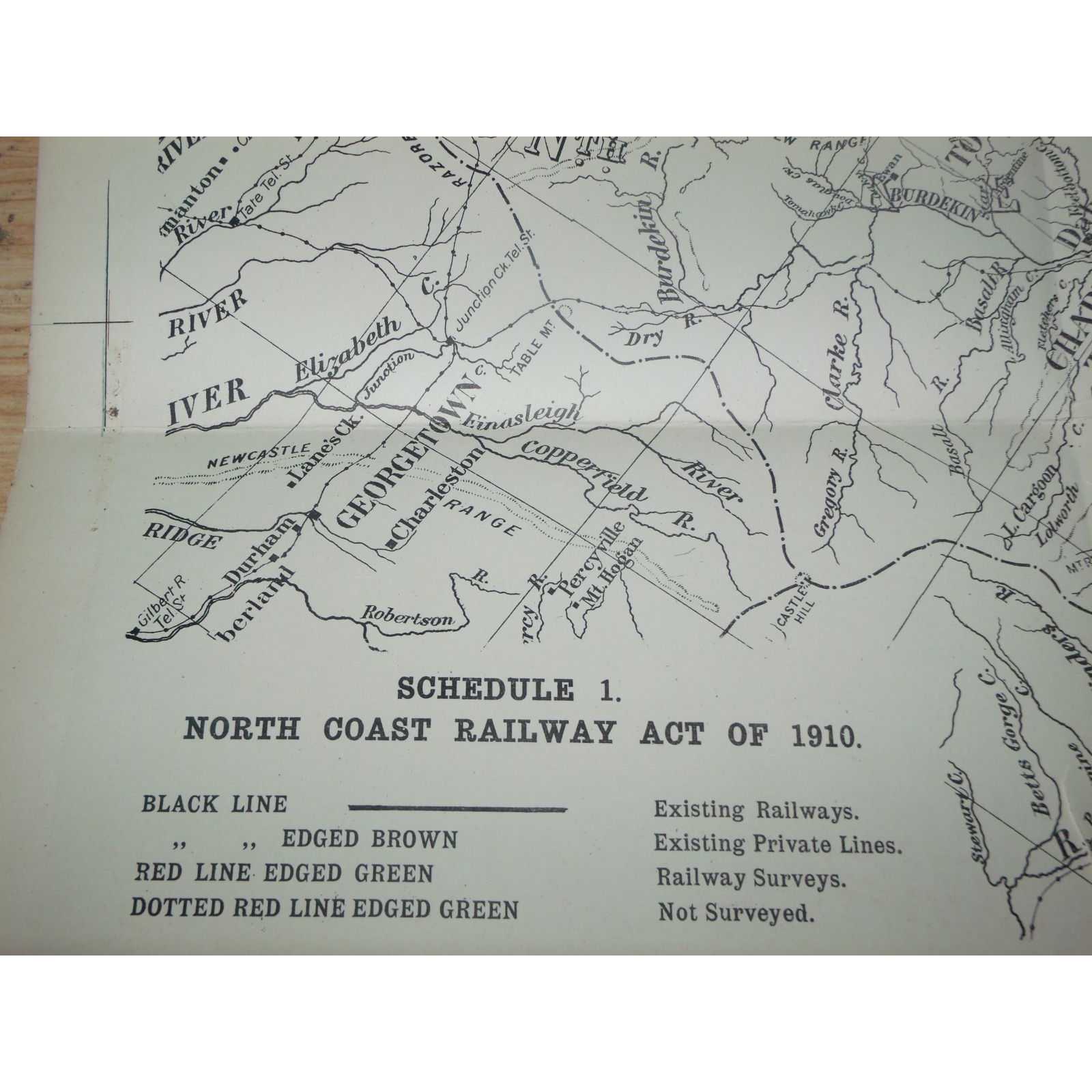


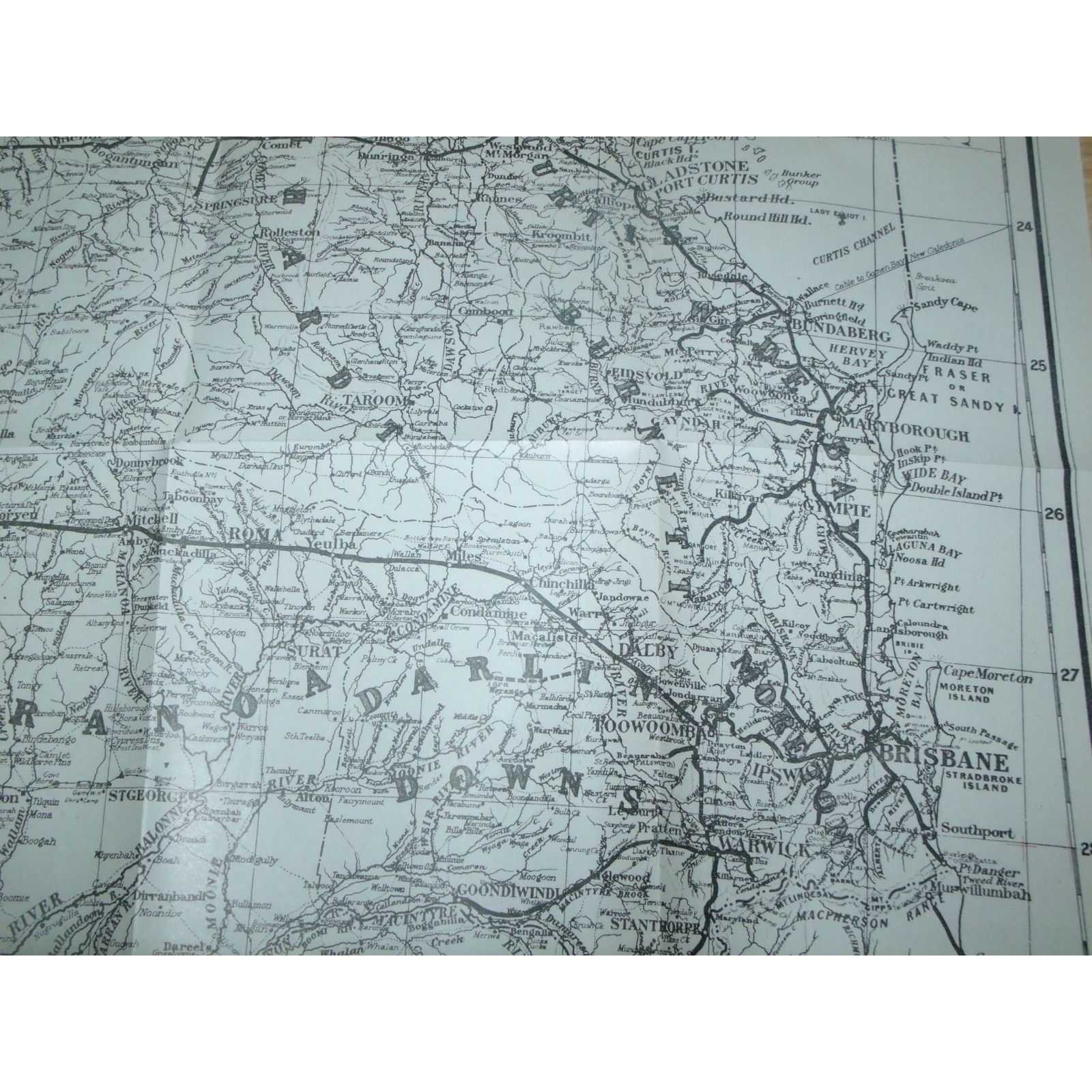
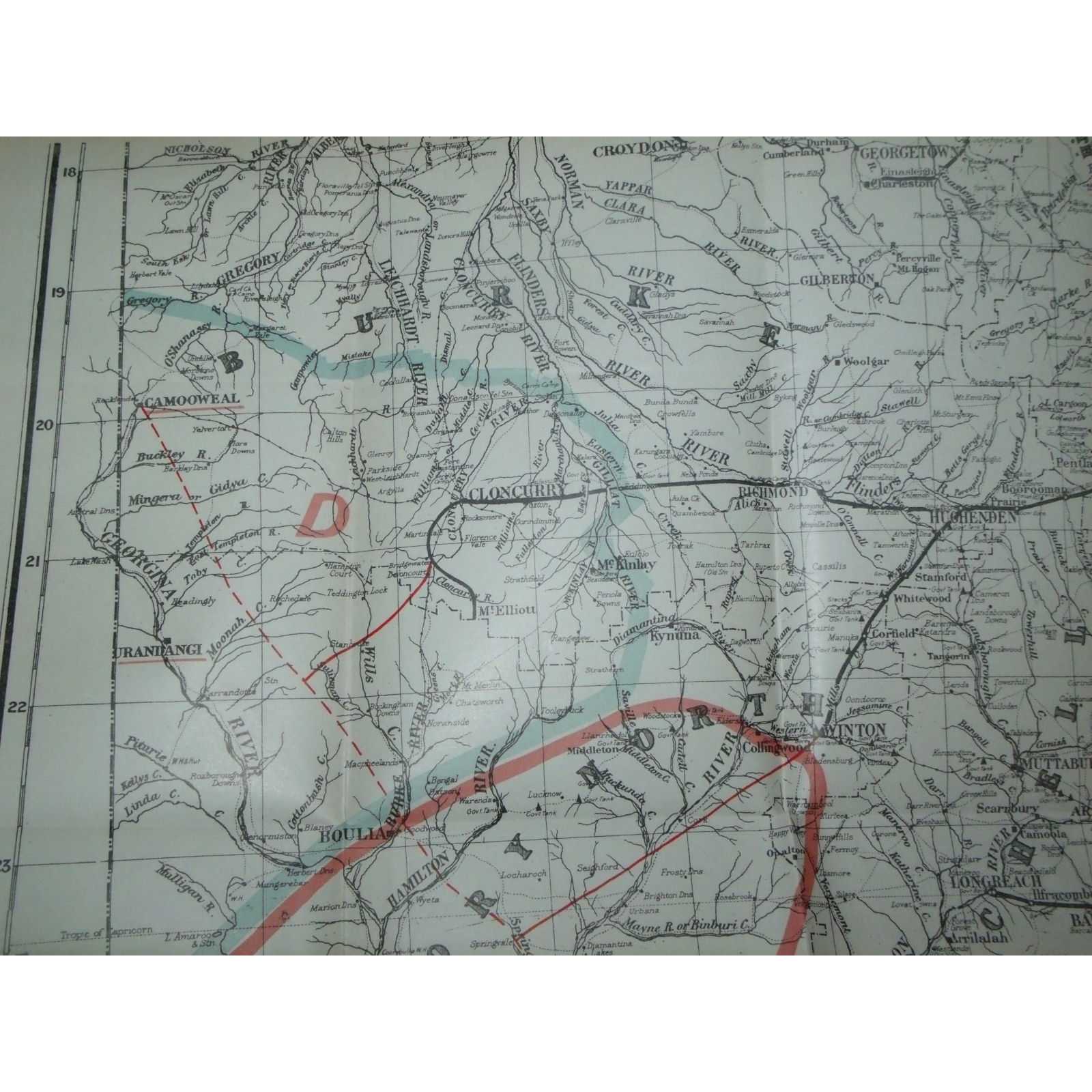
Title:North Coast Railway Act Of 1910: Rockhampton To Cairns, Hughenden, Emerald
Author:Queensland Government
Price:AUD$410.00 (about USD$266.40)
Shipping:AUD$40.00 (about USD$26.00)
(To United States of America)
(To United States of America)
Item ID:SI00-005560
Quantity:1
Publisher:Queensland Government, Brisbane, 1916
Edition:First
Queensland Government, 1916, First
1 map. 355mm by 620mm. Map is in good condition with a couple of small tears. Map ex 1916 Queensland Government Statutes. 4to - over 9¾" - 12" tall. Quantity Available: 1. Category: Maps; Pictures of this item not already displayed here available upon request. Inventory No: 005560.
1 map. 355mm by 620mm. Map is in good condition with a couple of small tears. Map ex 1916 Queensland Government Statutes. 4to - over 9¾" - 12" tall. Quantity Available: 1. Category: Maps; Pictures of this item not already displayed here available upon request. Inventory No: 005560.
Title:Relacion Historica Del Viaje A La America Meridional
Author:De Ulloa, (Jorge Juan-Antonio)
Price:GBP£200.00 (about USD$249.20)
Shipping:GBP£44.00 (about USD$54.90)
(To United States of America)
(To United States of America)
Item ID:TP01-73195
Quantity:1
Publisher:Fundacion Universitaria Espanola, Madrid, 1978
Edition:Facsimile
Binding:Hardcover
Condition:Good
Dust Jacket:Good
Fundacion Universitaria Espanola, 1978, Hardcover, Book Condition: Good, Dust Jacket Condition: Good, Facsimile
682pp+603pp+cxcv. Both jackets somewhat spotted and browned as are the page edges. Very heavy volumes may incur extra postage Size: Small Quarto. 2-volume set (complete). Category: Geography & Maps;
682pp+603pp+cxcv. Both jackets somewhat spotted and browned as are the page edges. Very heavy volumes may incur extra postage Size: Small Quarto. 2-volume set (complete). Category: Geography & Maps;
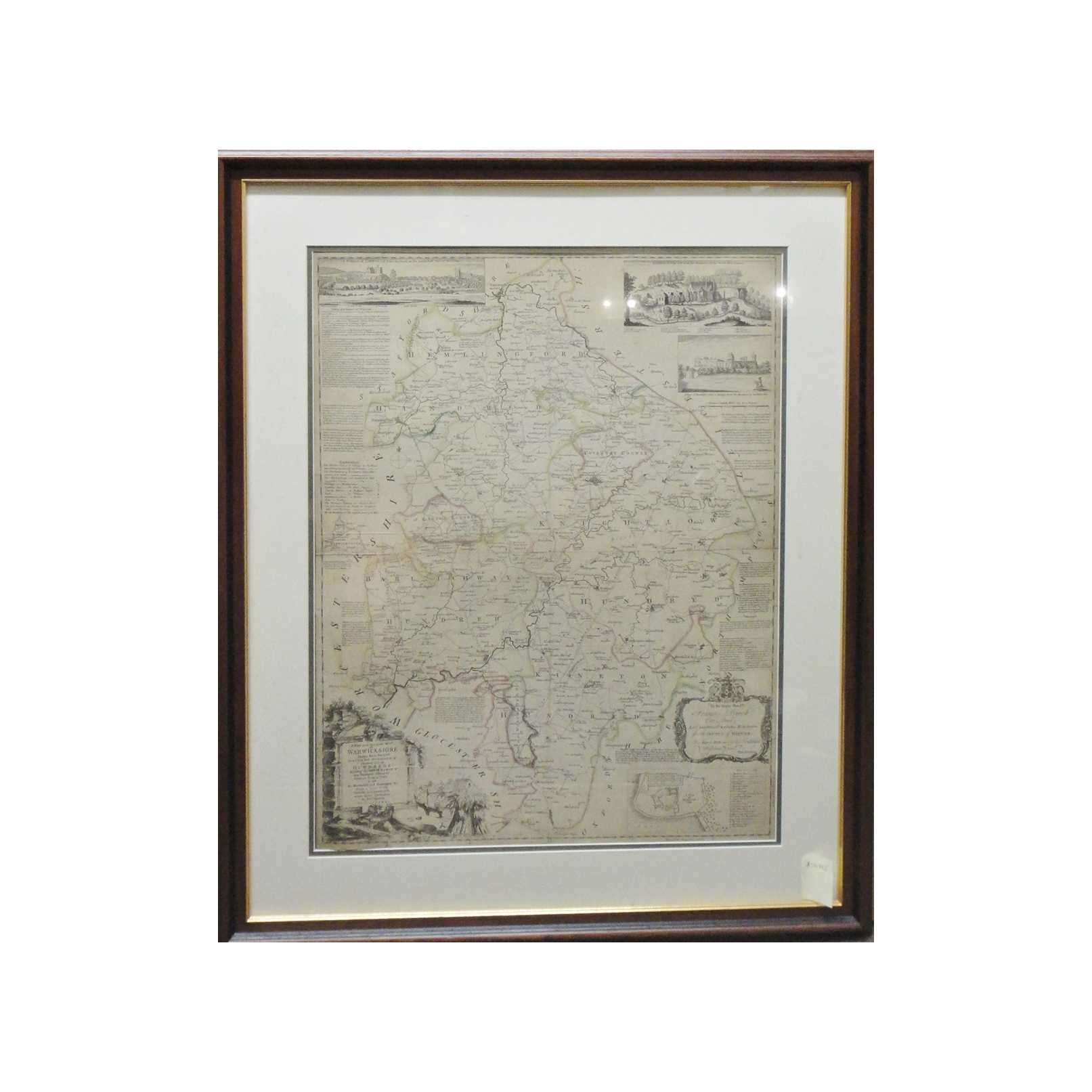

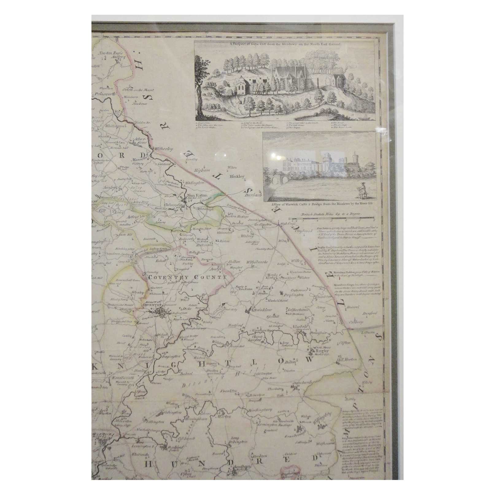
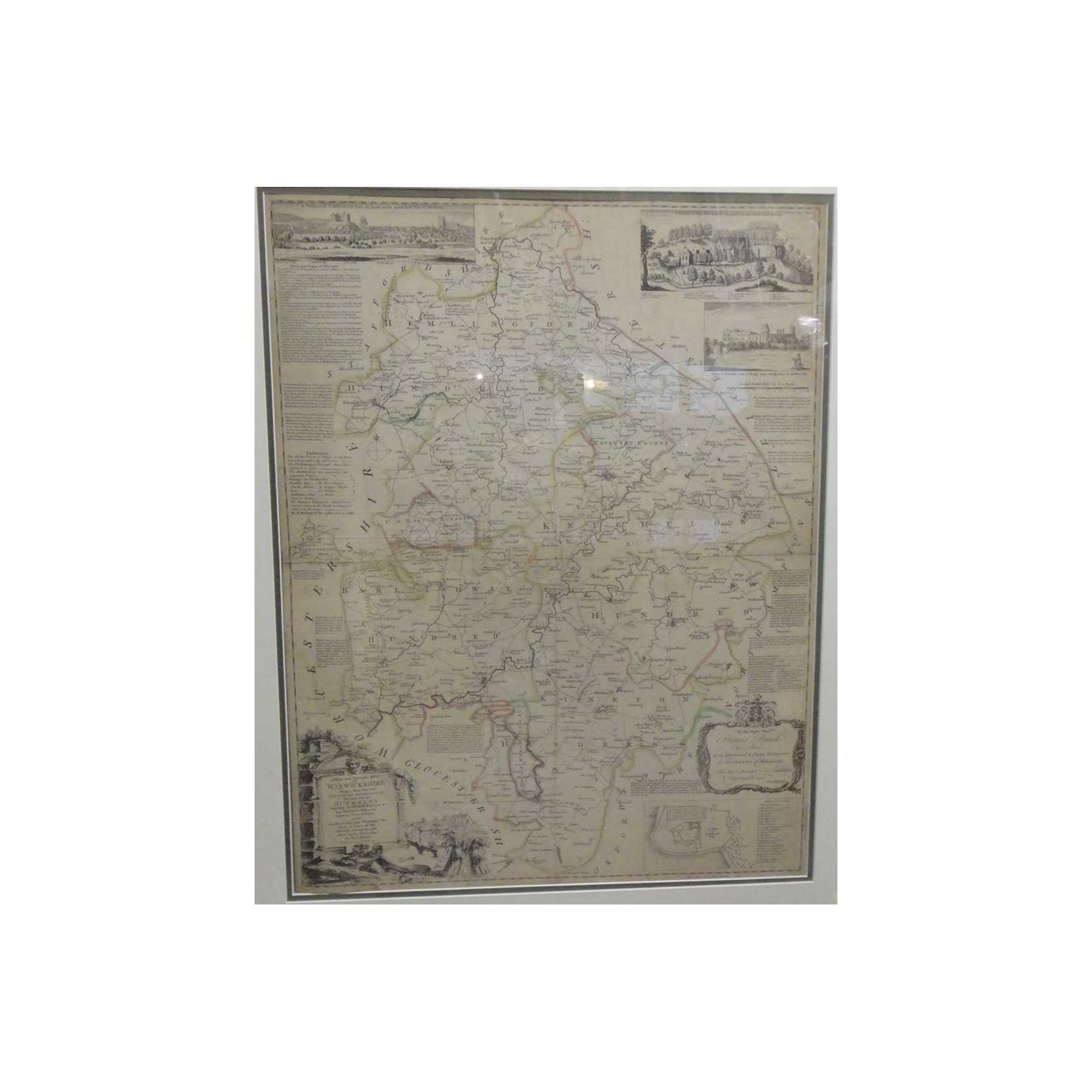
Title:New and Accurate Map of Warwickshire (Original, Hand-coloured)
Author:Kitchin, Thomas
Price:GBP£199.95 (about USD$249.10)
Shipping:GBP£15.70 (about USD$19.50)
(To United States of America)
(To United States of America)
Item ID:M002-04195
Quantity:1
Publisher:Thomas Kitchin, UK, 1760
Edition:1760
Binding:Softcover
Condition:Very Good
Thomas Kitchin, 1760, Softcover, Book Condition: Very Good, 1760
Date is approximate based on Kitchin's publication history. An original Thomas Kitchin map, hand-coloured and very well-preserved. Bears some browning along folded seams, and is overall a little toned and browned, commensurate with its age. The map is professionally mounted and framed. Glazing is available for collection only; item will otherwise be shipped unglazed. Not sold internationally unless additional carriage is paid. Full title: "A ... More Text...
Date is approximate based on Kitchin's publication history. An original Thomas Kitchin map, hand-coloured and very well-preserved. Bears some browning along folded seams, and is overall a little toned and browned, commensurate with its age. The map is professionally mounted and framed. Glazing is available for collection only; item will otherwise be shipped unglazed. Not sold internationally unless additional carriage is paid. Full title: "A ... More Text...
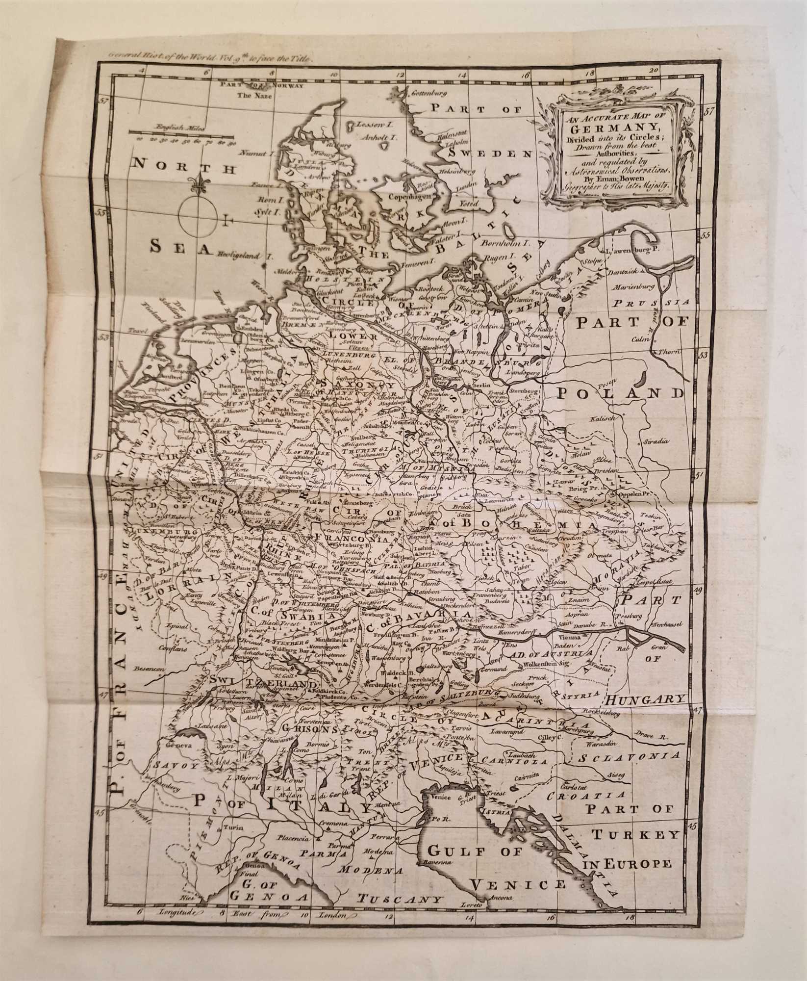
Title:New and Accurate Map of Germany (1764 Engraving)
Author:Gibson, Emanuel
Price:GBP£165.00 (about USD$205.60)
Shipping:GBP£7.50 (about USD$9.40)
(To United States of America)
(To United States of America)
Item ID:M002-39950
Quantity:1
Publisher:Newbery et. al, UK, 1764
Edition:1764
Binding:Softcover
Condition:Good
Newbery et. al, 1764, Softcover, Book Condition: Good, 1764
An original engraving produced in 1764, with some mild browning along the margins and outer edges, but generally clean and well-presented across the image surface with details clear and no major signs of wear. One vertical and four horizontal fold lines, as originally presented, reinforced on the rear side with acid-free conservation tape, some very mild signs of handling but no tears. Why on Amazon do most sellers not describe their actual book? ... More Text...
An original engraving produced in 1764, with some mild browning along the margins and outer edges, but generally clean and well-presented across the image surface with details clear and no major signs of wear. One vertical and four horizontal fold lines, as originally presented, reinforced on the rear side with acid-free conservation tape, some very mild signs of handling but no tears. Why on Amazon do most sellers not describe their actual book? ... More Text...

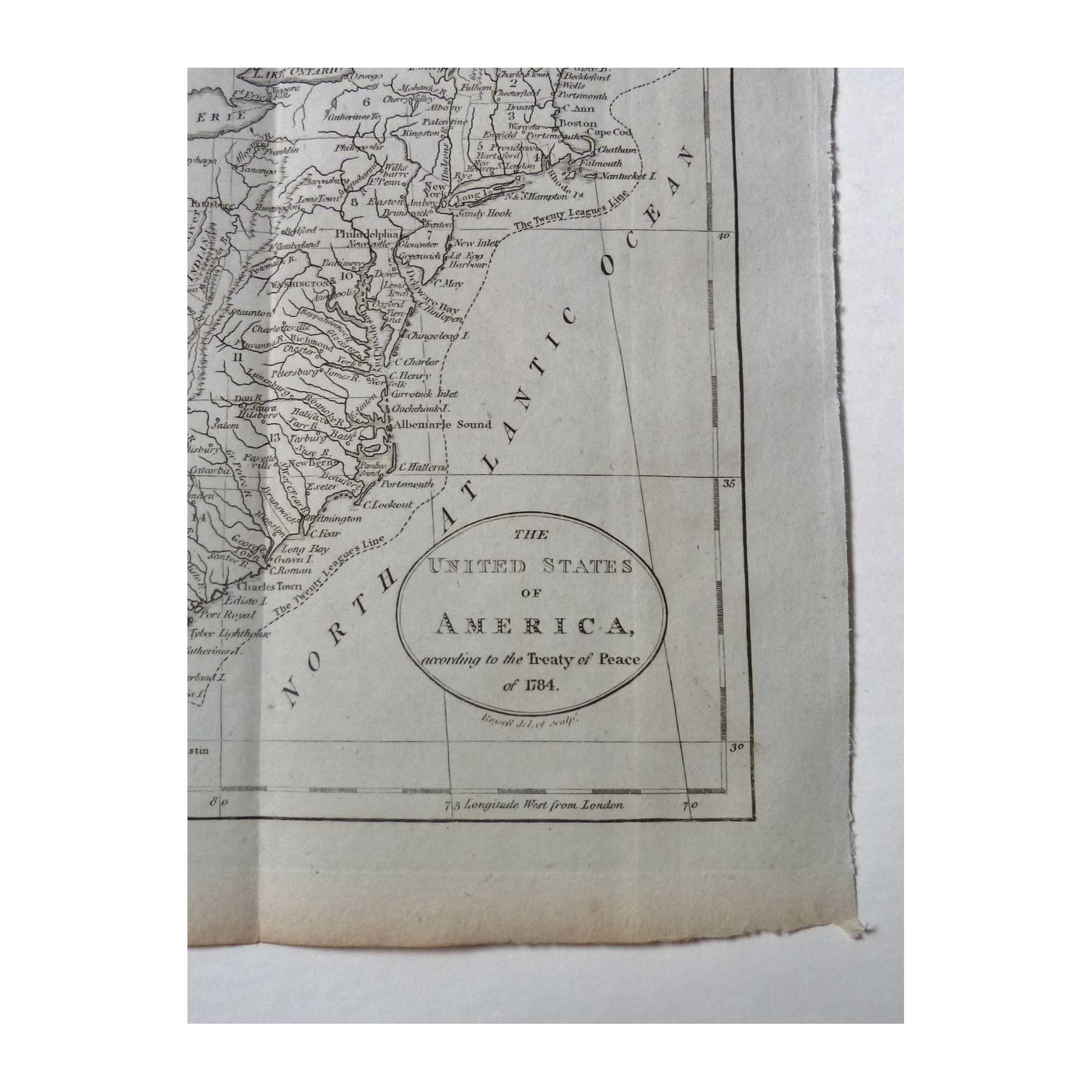
Title:United States of America after 1784 Peace Treaty (Geographical Grammar)
Author:Guthrie, William
Price:GBP£165.00 (about USD$205.60)
Shipping:GBP£7.50 (about USD$9.40)
(To United States of America)
(To United States of America)
Item ID:M002-11388
Quantity:1
Publisher:William Guthrie, UK, 1785
Edition:1785
Illustrator:Russell
Binding:Softcover
Condition:Good
William Guthrie, 1785, Softcover, Book Condition: Good, 1785, Illustrated By: Russell
A very well-preserved original engraving taken from Volume 2 of Guthrie's Geographical Grammar, 1785. Clean and unmarked across the majority of the image surface, apart from some faint damp marks at bottom edge, only encroaching slightly on the print. Two vertical fold lines as originally presented in the book, with some reinforcement along seams with conservation tape. Edges are a little toned and browned, commensurate ... More Text...
A very well-preserved original engraving taken from Volume 2 of Guthrie's Geographical Grammar, 1785. Clean and unmarked across the majority of the image surface, apart from some faint damp marks at bottom edge, only encroaching slightly on the print. Two vertical fold lines as originally presented in the book, with some reinforcement along seams with conservation tape. Edges are a little toned and browned, commensurate ... More Text...
Title:National Publishing Company's New Railroad, Post Office, Township and County Map of New York with Distances between Stations
Author:Various/Unknown
Price:USD$200.00
Shipping:Set Shipping State/Province
(To United States of America)
(To United States of America)
Item ID:DH00-008969
Quantity:1
Publisher:National Publishing Company, Boston, 1901
Edition:First
Binding:Hardcover
Condition:Very Good
Dust Jacket:No
National Publishing Company, 1901, Hardcover, Book Condition: Very Good, Dust Jacket Condition: No, First
Size: Octavo (standard book size). Text body is clean, and free from previous owner annotation, underlining and highlighting. Binding is tight, covers and spine fully intact. Dark green (or black?) pebbled cloth over boards with elaborate gilt stamped printing and decoration on front, opens up to reveal a linen backed paper color map that is 41 3/4 " x 46"; includes a List of All Steam Railroads in New ... More Text...
Size: Octavo (standard book size). Text body is clean, and free from previous owner annotation, underlining and highlighting. Binding is tight, covers and spine fully intact. Dark green (or black?) pebbled cloth over boards with elaborate gilt stamped printing and decoration on front, opens up to reveal a linen backed paper color map that is 41 3/4 " x 46"; includes a List of All Steam Railroads in New ... More Text...
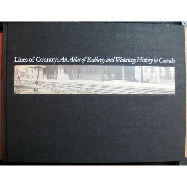


Title:Lines of Country: An Atlas of Railway and Waterway History in Canada
Author:Andreae, Christopher
Price:USD$200.00
Shipping:Set Shipping State/Province
(To United States of America)
(To United States of America)
ISBN:1550461338
Item ID:DH00-011002
Quantity:1
Publisher:The Boston Mills Press, Erin, Ontario, Canada, 1997
Edition:First
Illustrator:Matthews, Geoffrey [Cartography]
Binding:Hardcover
Condition:Very Good
Dust Jacket:No
The Boston Mills Press, 1997, Hardcover, Book Condition: Very Good, Dust Jacket Condition: No, First, Illustrated By: Matthews, Geoffrey [Cartography]
Size: Folio. Text body is clean, and free from previous owner annotation, underlining and highlighting. Binding is tight, covers and spine fully intact but boards sprung/bowed. Black cloth over boards with black-and-white photographic paste down on front cover, 12 1/2" x 16 1/2", 238 oversize pages (ix, [1], 228 pages), thirty-nine full-page color maps, 560 ... More Text...
Size: Folio. Text body is clean, and free from previous owner annotation, underlining and highlighting. Binding is tight, covers and spine fully intact but boards sprung/bowed. Black cloth over boards with black-and-white photographic paste down on front cover, 12 1/2" x 16 1/2", 238 oversize pages (ix, [1], 228 pages), thirty-nine full-page color maps, 560 ... More Text...
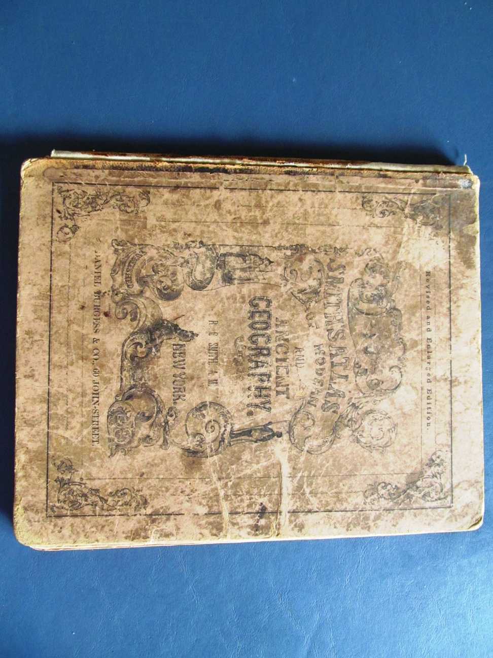
Title:Smith's Atlas of Modern and Ancient Geography, Corrected and Enlarged to Accompany Smith's Geography for Schools, Academies, and Families
Author:Smith, Roswell C.
Price:USD$200.00
Shipping:Set Shipping State/Province
(To United States of America)
(To United States of America)
Item ID:PL00-001605
Quantity:1
Publisher:Daniel Burgess & Co, New York, NY, 1855
Binding:Hardcover
Condition:Fair
Dust Jacket:No
Daniel Burgess & Co, 1855, Hardcover, Book Condition: Fair, Dust Jacket Condition: No
Size: 4mo - over 9 3/4" - 12" tall. 68 pp. Almost every page in the book has been manually numbered in pencil, but these do not affect the maps themselves. There are numerous other markings in the book as well, but they are pretty much on blank pages. The pages themselves are yellowed, but this is still a very informative book with great maps. Several chips out of the spine, and binding is loose but intact. Heavy shelfwear to the cover. Quantity Available: 1. Shipped Weight: 1 - 2 pounds. Category: Geography & Maps; Pictures of this item not already displayed here available upon request. Inventory No: 001605.
Size: 4mo - over 9 3/4" - 12" tall. 68 pp. Almost every page in the book has been manually numbered in pencil, but these do not affect the maps themselves. There are numerous other markings in the book as well, but they are pretty much on blank pages. The pages themselves are yellowed, but this is still a very informative book with great maps. Several chips out of the spine, and binding is loose but intact. Heavy shelfwear to the cover. Quantity Available: 1. Shipped Weight: 1 - 2 pounds. Category: Geography & Maps; Pictures of this item not already displayed here available upon request. Inventory No: 001605.
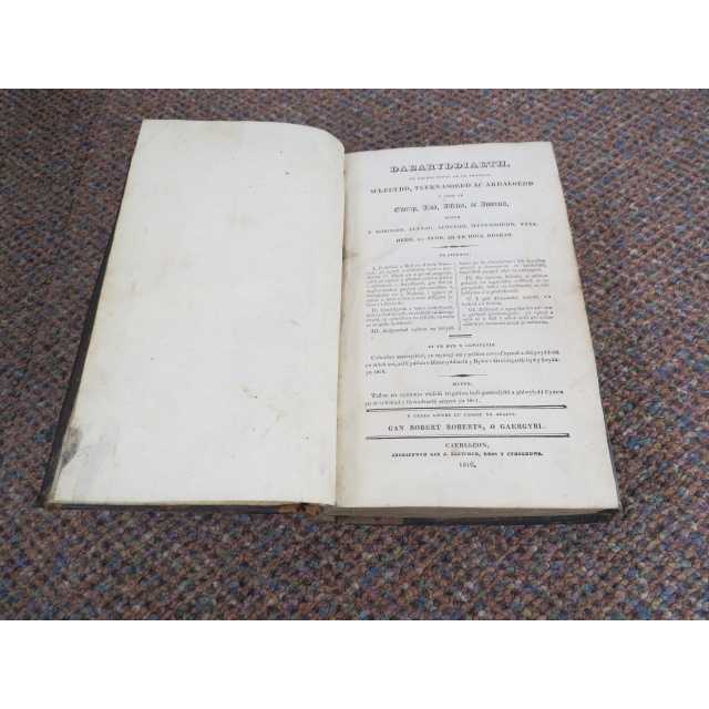
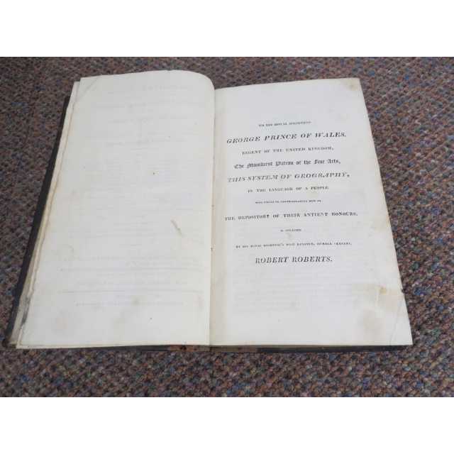
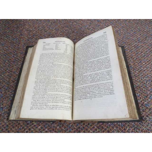
Title:Daearyddiaeth yn rhoddi hanes am yr amrywiol wledydd teyrnasoedd ac ardaloedd y sydd yn Ewrop Asia Affrica ac America (Geography gives a history of the various countries, kingdoms and areas that are in Europe, Asia, Africa and America)
Author:Robert Roberts
Price:GBP£150.00 (about USD$186.90)
Shipping:GBP£30.00 (about USD$37.40)
(To United States of America)
(To United States of America)
Item ID:PB09-3532
Quantity:1
Publisher:Gan G Fletcher, Wales UK, 1816
Edition:First
Binding:Hardcover (Full Leather)
Condition:Good
Dust Jacket:No
Gan G Fletcher, 1816, Hardcover (Full Leather), Book Condition: Good, Dust Jacket Condition: No, First
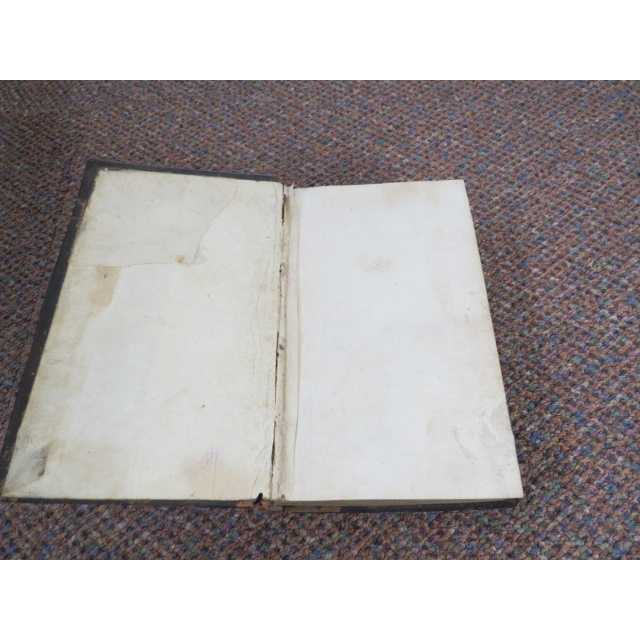
1st Edition, Original copy: Welsh language throughout, title translates (Geography gives a history of the various countries, kingdoms and areas that are in Europe, Asia, Africa and America) Half title page His Royal Highness Prince of Wales.....This system of Geography in the language of a People. xvi, 548 pages, missing front and rear end papers, shelf wear, leather covers, pages grubby but all readable ... More Text...
1st Edition, Original copy: Welsh language throughout, title translates (Geography gives a history of the various countries, kingdoms and areas that are in Europe, Asia, Africa and America) Half title page His Royal Highness Prince of Wales.....This system of Geography in the language of a People. xvi, 548 pages, missing front and rear end papers, shelf wear, leather covers, pages grubby but all readable ... More Text...

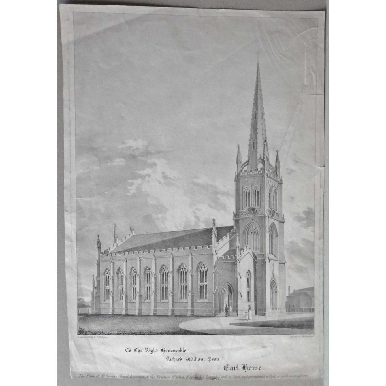
Title:St George's Church Chapel Leicester 1830 Antique Lithograph Print
Author:T M Baynes
Price:GBP£150.00 (about USD$186.90)
Shipping:GBP£9.80 (about USD$12.30)
(To United States of America)
(To United States of America)
Item ID:M002-20328
Quantity:1
Publisher:C. Hullmandel, unknown, 1830
Edition:1st
Illustrator:Hulmandel Printed
Binding:Softcover (Single Sheet of thick paper)
Condition:Very Good
C. Hullmandel, 1830, Softcover (Single Sheet of thick paper), Book Condition: Very Good, 1st, Illustrated By: Hulmandel Printed
This is an original antique engraving print of St. George's Chapel or St. George's Church, Leicestershire, in excellent condition. It is sized 285 x 410 mm, under a mount sized 440 x 565 mm. It is a little creased which could be removed relatively easily but I haven't bothered yet, it is also a little trimmed but the description is still at the bottom (under the mount). This is a ... More Text...
This is an original antique engraving print of St. George's Chapel or St. George's Church, Leicestershire, in excellent condition. It is sized 285 x 410 mm, under a mount sized 440 x 565 mm. It is a little creased which could be removed relatively easily but I haven't bothered yet, it is also a little trimmed but the description is still at the bottom (under the mount). This is a ... More Text...
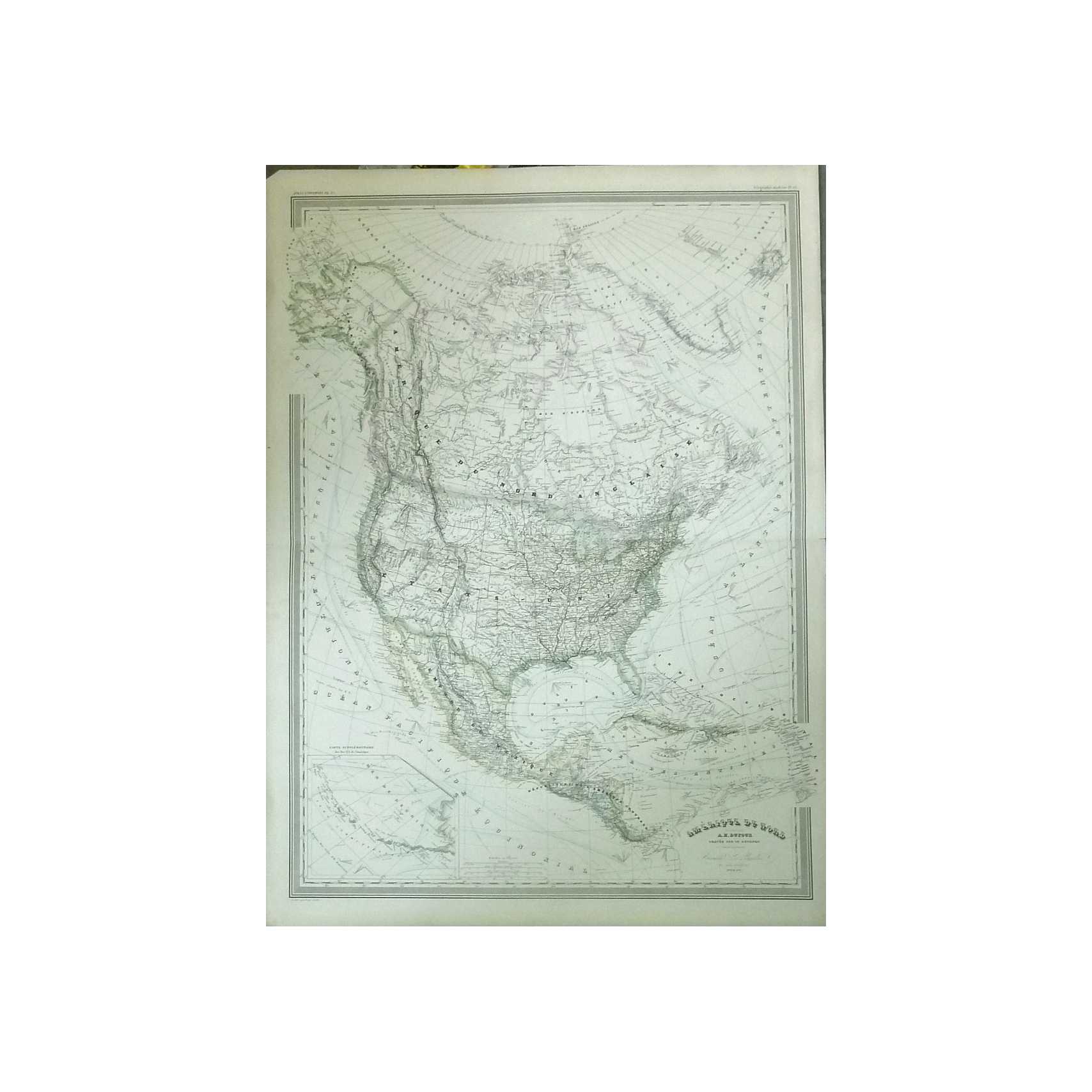
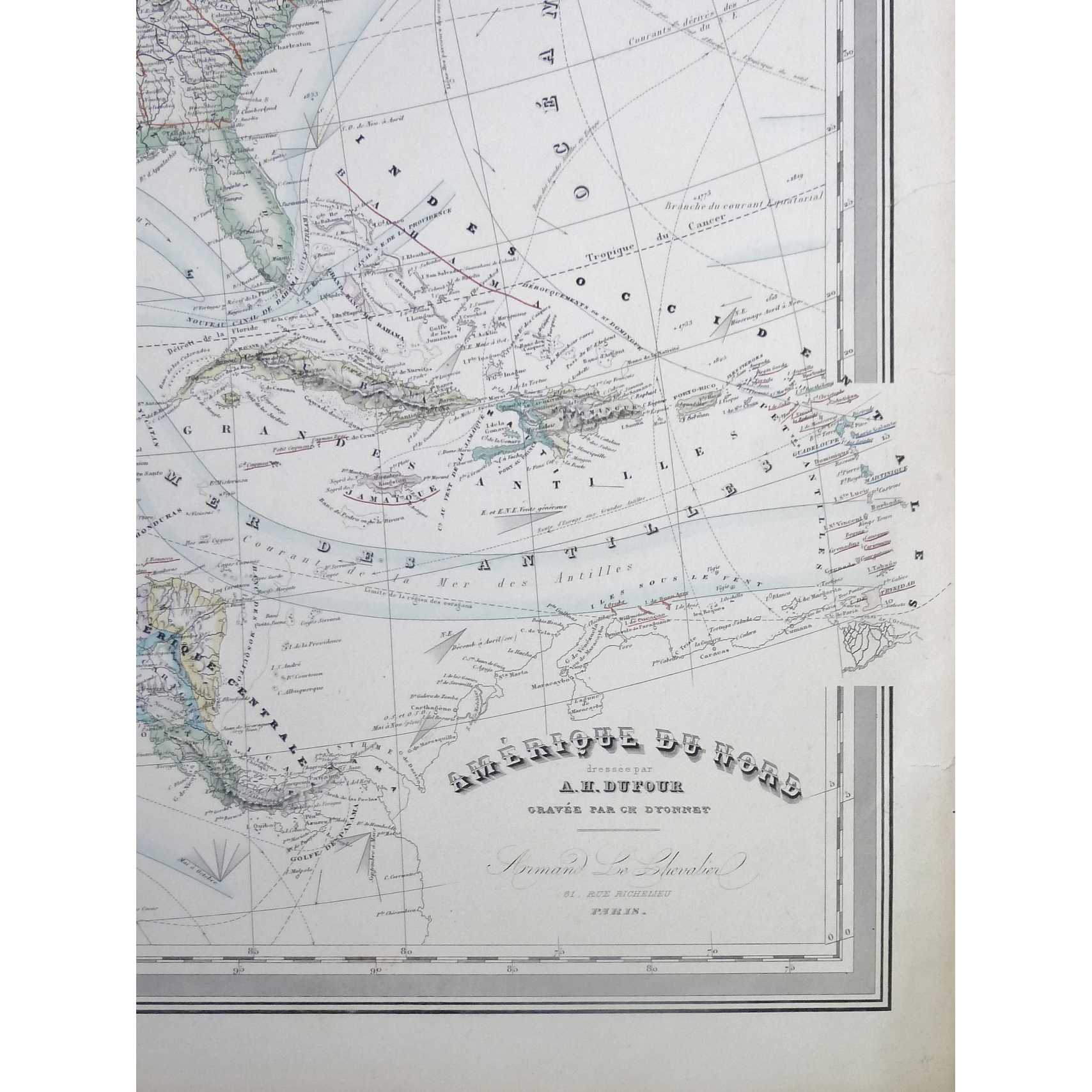
Title:North America (Amerique du Nord) Original Handcoloured Engraving
Author:Dufour, A.H.
Price:GBP£146.95 (about USD$183.10)
Shipping:GBP£15.70 (about USD$19.50)
(To United States of America)
(To United States of America)
Item ID:M002-09807
Quantity:1
Publisher:The Engineer, UK, 1857
Edition:1857 Original Engraving
Binding:Softcover
Condition:Very Good
The Engineer, 1857, Softcover, Book Condition: Very Good, 1857 Original Engraving
A very well-preserved copy, attractively hand-coloured and clean and unmarked, with a few small nicks and tears along right-hand side repaired and reinforced with preservation tape. Horizontal fold line through centre as originally presented. Some minor toning at page edges commensurate with age. Taken from 'Atlas Universel', published by Armand le Chevalier in 1857. Why on Amazon do most sellers not describe their actual ... More Text...
A very well-preserved copy, attractively hand-coloured and clean and unmarked, with a few small nicks and tears along right-hand side repaired and reinforced with preservation tape. Horizontal fold line through centre as originally presented. Some minor toning at page edges commensurate with age. Taken from 'Atlas Universel', published by Armand le Chevalier in 1857. Why on Amazon do most sellers not describe their actual ... More Text...
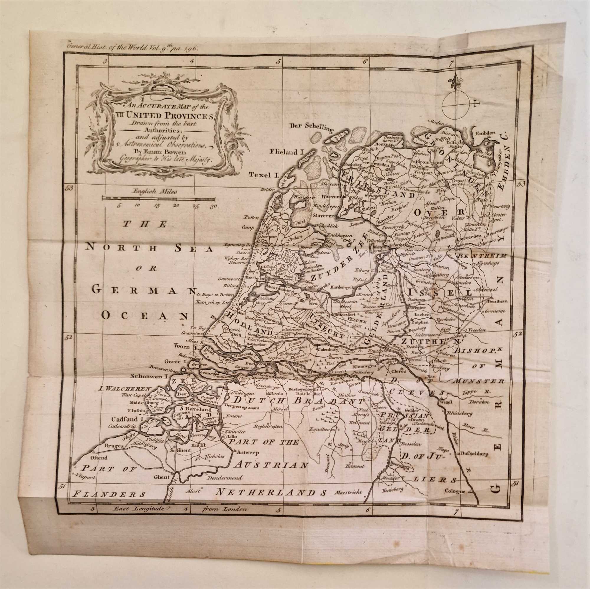
Title:Accurate Map of Seven United Provinces, Netherlands (1764 Engraving)
Author:Gibson, Emanuel
Price:GBP£145.00 (about USD$180.70)
Shipping:GBP£7.50 (about USD$9.40)
(To United States of America)
(To United States of America)
Item ID:M002-39951
Quantity:1
Publisher:Newbery et. al, UK, 1764
Edition:1764
Binding:Softcover
Condition:Good
Newbery et. al, 1764, Softcover, Book Condition: Good, 1764
An original engraving produced in 1764, with some mild browning along the margins and outer edges, but generally clean and well-presented across the image surface with details clear and no major signs of wear. One vertical and three horizontal fold lines, as originally presented, with some visible creasing reinforced on the rear side with acid-free conservation tape, some very mild signs of handling but no tears. Small patch at the upper corner to ... More Text...
An original engraving produced in 1764, with some mild browning along the margins and outer edges, but generally clean and well-presented across the image surface with details clear and no major signs of wear. One vertical and three horizontal fold lines, as originally presented, with some visible creasing reinforced on the rear side with acid-free conservation tape, some very mild signs of handling but no tears. Small patch at the upper corner to ... More Text...
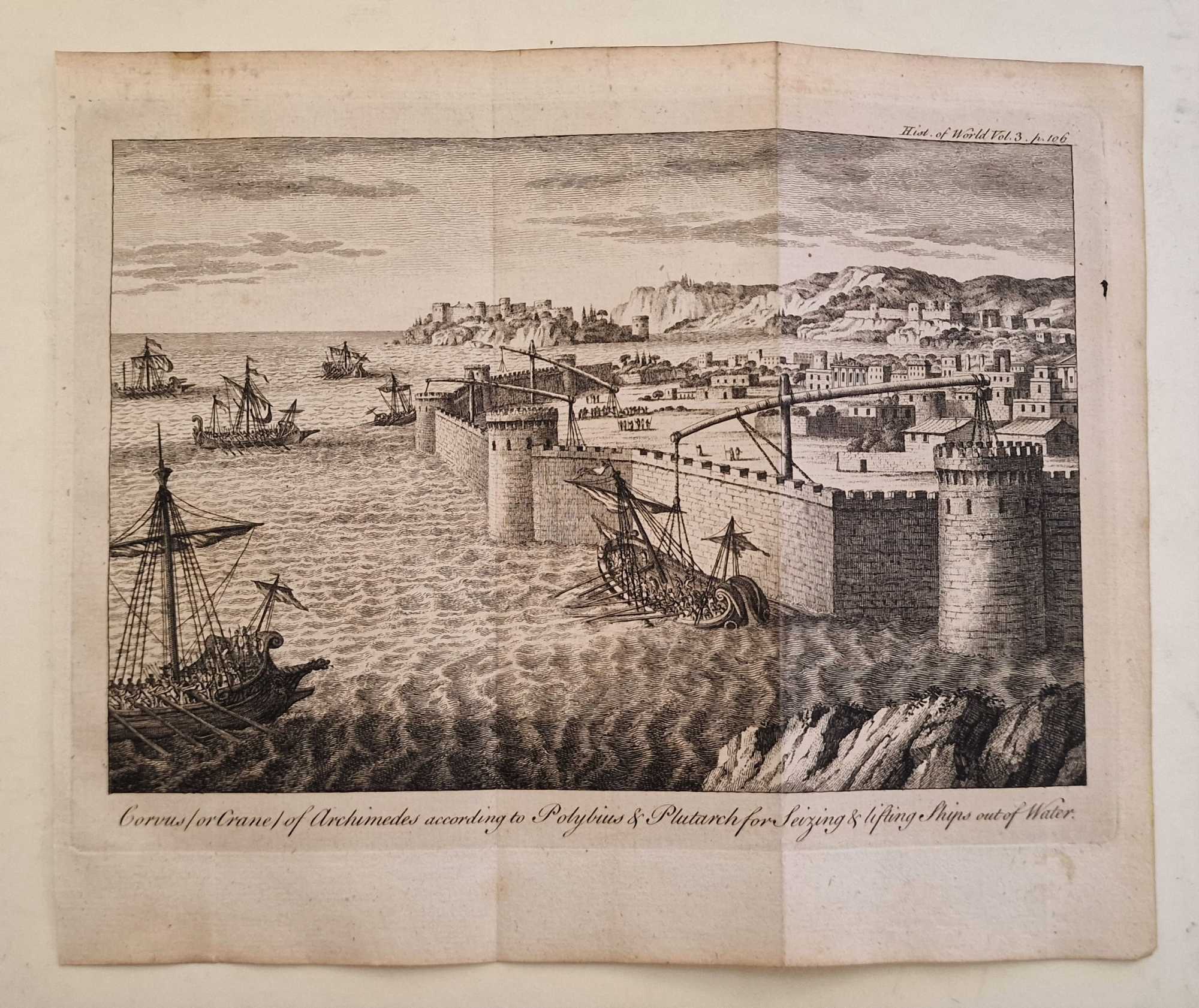
Title:The Claw / Crane of Archimedes According to Polybius (1764 Engraving)
Author:Gibson, J.
Price:GBP£145.00 (about USD$180.70)
Shipping:GBP£7.50 (about USD$9.40)
(To United States of America)
(To United States of America)
Item ID:M002-39948
Quantity:1
Publisher:Newbery et. al, UK, 1764
Edition:1764
Binding:Softcover
Condition:Good
Newbery et. al, 1764, Softcover, Book Condition: Good, 1764
An original engraving produced in 1764, with some mild browning along the margins and outer edges, but generally clean and well-presented across the image surface with details clear and no major signs of wear. Two vertical fold lines, as originally presented, reinforced on the rear side with acid-free conservation tape, some very mild signs of handling but no tears. Why on Amazon do most sellers not describe their actual book? Buy with confidence ... More Text...
An original engraving produced in 1764, with some mild browning along the margins and outer edges, but generally clean and well-presented across the image surface with details clear and no major signs of wear. Two vertical fold lines, as originally presented, reinforced on the rear side with acid-free conservation tape, some very mild signs of handling but no tears. Why on Amazon do most sellers not describe their actual book? Buy with confidence ... More Text...
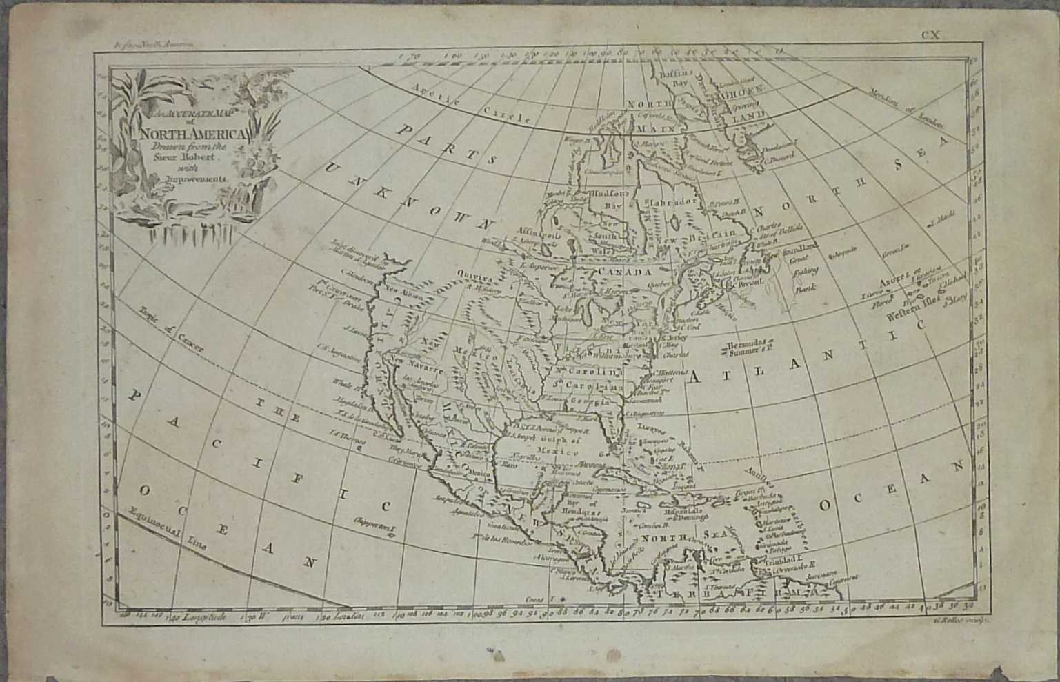
Title:Accurate Map of North America Drawn from the Sieur Robert (1762)
Author:Rollos, G.
Price:GBP£145.00 (about USD$180.70)
Shipping:GBP£9.80 (about USD$12.30)
(To United States of America)
(To United States of America)
Item ID:M002-10661
Quantity:1
Publisher:Fullarton, UK, 1762
Edition:First
Binding:Softcover
Condition:Very Good
Fullarton, 1762, Softcover, Book Condition: Very Good, First
An original 1762 engraving. Overall a very presentable copy, with some overall browning and thumb-marks to edges, largely commensurate with age, and not encroaching greatly on the printed image, with lines and text otherwise remaining clear and bold across the entire print. Some small nicks and brown marks to bottom edge, largely caused by removal from binding, otherwise only a few small nicks and edge creases, again not encroaching on the image. ... More Text...
An original 1762 engraving. Overall a very presentable copy, with some overall browning and thumb-marks to edges, largely commensurate with age, and not encroaching greatly on the printed image, with lines and text otherwise remaining clear and bold across the entire print. Some small nicks and brown marks to bottom edge, largely caused by removal from binding, otherwise only a few small nicks and edge creases, again not encroaching on the image. ... More Text...
Title:Original 1794 Map of England and Wales
Author:Kitchin, Thomas
Price:GBP£145.00 (about USD$180.70)
Shipping:GBP£9.80 (about USD$12.30)
(To United States of America)
(To United States of America)
Item ID:M002-10902
Quantity:1
Publisher:Kitchin, UK, 1794
Edition:First
Binding:Softcover
Condition:Very Good
Kitchin, 1794, Softcover, Book Condition: Very Good, First
An original 1794 engraving taken from the Complete History of England by Thomas Kitchin. Some minor edge repairs with conservation tape, otherwise a very well-preserved copy, largely clean and unmarked across the entire image surface, and flattened to a very presentable standard, with fold lines remaining visible but mostly unobtrusive. Why on Amazon do most sellers not describe their actual book? Buy with confidence and support a genuine ... More Text...
An original 1794 engraving taken from the Complete History of England by Thomas Kitchin. Some minor edge repairs with conservation tape, otherwise a very well-preserved copy, largely clean and unmarked across the entire image surface, and flattened to a very presentable standard, with fold lines remaining visible but mostly unobtrusive. Why on Amazon do most sellers not describe their actual book? Buy with confidence and support a genuine ... More Text...

Title:Map of The World as Known to the Ancients (1764 Engraving)
Author:Seale, R.W.
Price:GBP£145.00 (about USD$180.70)
Shipping:GBP£7.50 (about USD$9.40)
(To United States of America)
(To United States of America)
Item ID:M002-39952
Quantity:1
Publisher:Newbery et. al, UK, 1764
Edition:1764
Binding:Softcover
Condition:Good
Newbery et. al, 1764, Softcover, Book Condition: Good, 1764
An original engraving produced in 1764, with some mild browning along the margins and outer edges, but generally clean and well-presented across the image surface with details clear. Small perforation towards the bottom edges, not affecting any sifnificant detail of the print, patched and repaired. One horizontal and three vertical fold lines, as originally presented, with some visible creasing reinforced on the rear side with acid-free ... More Text...
An original engraving produced in 1764, with some mild browning along the margins and outer edges, but generally clean and well-presented across the image surface with details clear. Small perforation towards the bottom edges, not affecting any sifnificant detail of the print, patched and repaired. One horizontal and three vertical fold lines, as originally presented, with some visible creasing reinforced on the rear side with acid-free ... More Text...

Title:Map of Palestine, Division Among the Tribes (1764 Engraving)
Author:Seale, R.W.
Price:GBP£145.00 (about USD$180.70)
Shipping:GBP£7.50 (about USD$9.40)
(To United States of America)
(To United States of America)
Item ID:M002-39957
Quantity:1
Publisher:Newbery et. al, UK, 1764
Edition:1764
Binding:Softcover
Condition:Good
Newbery et. al, 1764, Softcover, Book Condition: Good, 1764
An original engraving produced in 1764, with some mild browning along the margins and outer edges, but generally clean and well-presented across the image surface with details clear. One horizontal and two vertical fold lines, as originally presented, with some visible creasing reinforced on the rear side with acid-free conservation tape, some very mild signs of handling but no tears. Small patch at the upper corner to preserve integrity of margin, ... More Text...
An original engraving produced in 1764, with some mild browning along the margins and outer edges, but generally clean and well-presented across the image surface with details clear. One horizontal and two vertical fold lines, as originally presented, with some visible creasing reinforced on the rear side with acid-free conservation tape, some very mild signs of handling but no tears. Small patch at the upper corner to preserve integrity of margin, ... More Text...

Title:Sydney Map 1842 ex The New Universal Gazetteer and Geographical Dictionary
Author:Thomson, John
Price:GBP£145.00 (about USD$180.70)
Shipping:GBP£7.50 (about USD$9.40)
(To United States of America)
(To United States of America)
Item ID:M002-11670
Quantity:1
Publisher:Ballantyne & Hughes, UK, 1842
Edition:First
Binding:Softcover
Condition:Very Good
Ballantyne & Hughes, 1842, Softcover, Book Condition: Very Good, First
Image size: 120 x 180 mm and text pages are 225 x 140 mm. A very presentable copy with slight even toning commensurate with age. Ex The New Universal and Geographical Dictionary by John Thomson published 1842. Some wear and thumbing to the page's edges and a mark that has stained through the page in the blank area of the map (shown in photo), but otherwise text and image are clear. Why on Amazon do most sellers not describe their actual ... More Text...
Image size: 120 x 180 mm and text pages are 225 x 140 mm. A very presentable copy with slight even toning commensurate with age. Ex The New Universal and Geographical Dictionary by John Thomson published 1842. Some wear and thumbing to the page's edges and a mark that has stained through the page in the blank area of the map (shown in photo), but otherwise text and image are clear. Why on Amazon do most sellers not describe their actual ... More Text...
Title:Intro to Geography, Intro to Geography Mapping workbook, Atlas of the World Geography
Author:Bergman, Edward F.
Price:USD$179.00
Shipping:Set Shipping State/Province
(To United States of America)
(To United States of America)
ISBN:0131692208
Item ID:AZ00-1561014897
Quantity:1
Publisher:Pearson, Upper Saddle River, NJ, 2004
Edition:Third
Binding:Softcover
Condition:As New
Pearson, 2004, Softcover, Book Condition: As New, Third
As New!!!In Shrink Wrap! Quantity Available: 1. Shipped Weight: Under 1 kilo. Category: Geography & Maps; ISBN: 0131692208. ISBN/EAN: 9780131692206. Pictures of this item not already displayed here available upon request. Inventory No: 1561014897.
As New!!!In Shrink Wrap! Quantity Available: 1. Shipped Weight: Under 1 kilo. Category: Geography & Maps; ISBN: 0131692208. ISBN/EAN: 9780131692206. Pictures of this item not already displayed here available upon request. Inventory No: 1561014897.

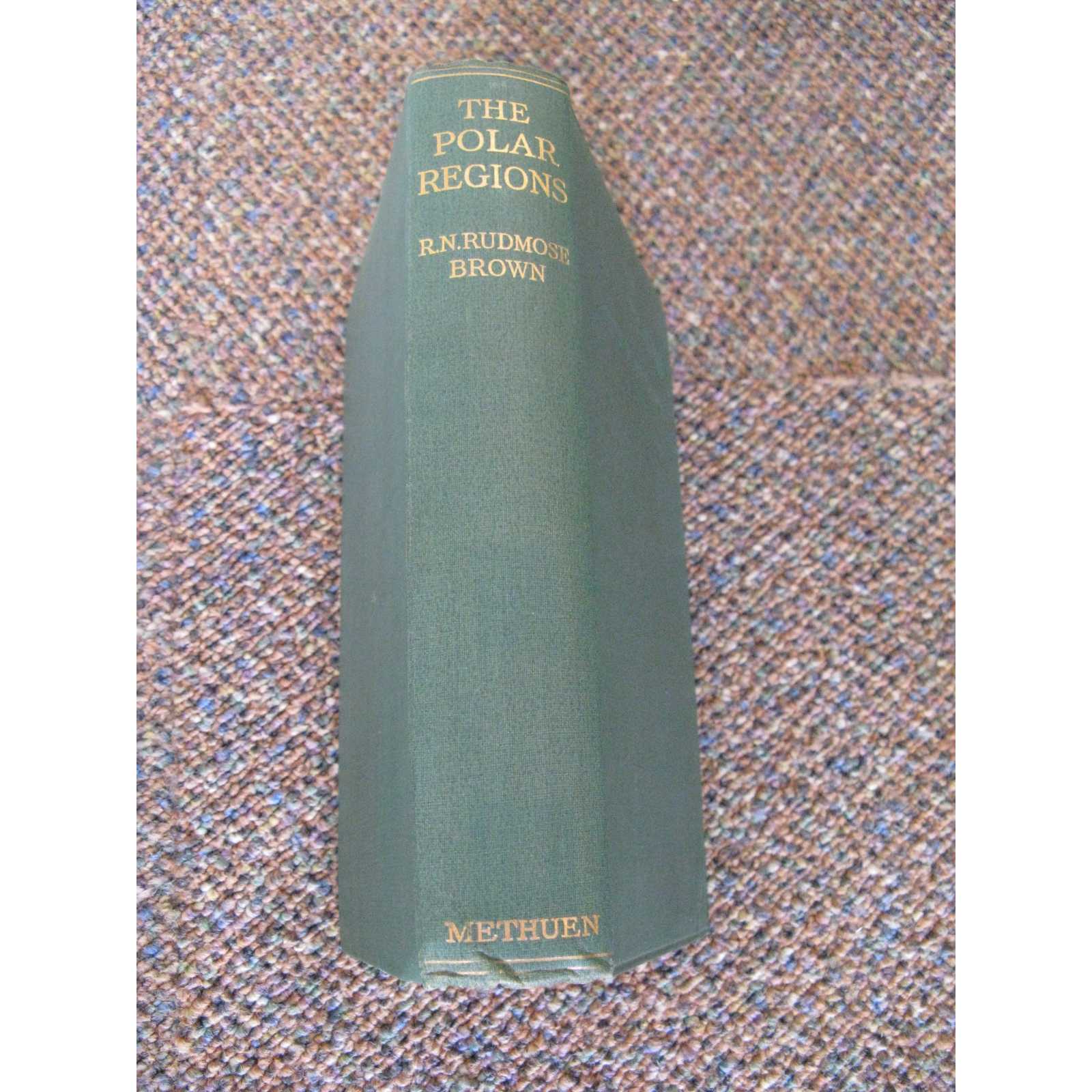

Title:THE POLAR REGIONS: A PHYSICAL AND ECONOMIC GEOGRAPHY OF THE ARCTIC AND ANTARCTIC
Author:Rudmose Brown R.N
Price:GBP£140.00 (about USD$174.50)
Shipping:GBP£25.00 (about USD$31.20)
(To United States of America)
(To United States of America)
Item ID:PB09-3177
Quantity:1
Publisher:Meuthuen & Co, 1927
Binding:Cloth
Condition:Very Good
Meuthuen & Co, 1927, Cloth, Book Condition: Very Good
1st Edition; ix,245pp, with 23 illustrations (maps) in text and 2 folding colour maps, 1 slightly torn, bibliography. Original green cloth blindstamped on front and with gilt titles on spine. Collected account of the actual state of knowledge of north and south polar regions, including geography, biology, commercial and political penetration. A survey of Arctic and Antarctic topics, especially scientific. "Brief account of knowledge on polar research and ... More Text...
1st Edition; ix,245pp, with 23 illustrations (maps) in text and 2 folding colour maps, 1 slightly torn, bibliography. Original green cloth blindstamped on front and with gilt titles on spine. Collected account of the actual state of knowledge of north and south polar regions, including geography, biology, commercial and political penetration. A survey of Arctic and Antarctic topics, especially scientific. "Brief account of knowledge on polar research and ... More Text...


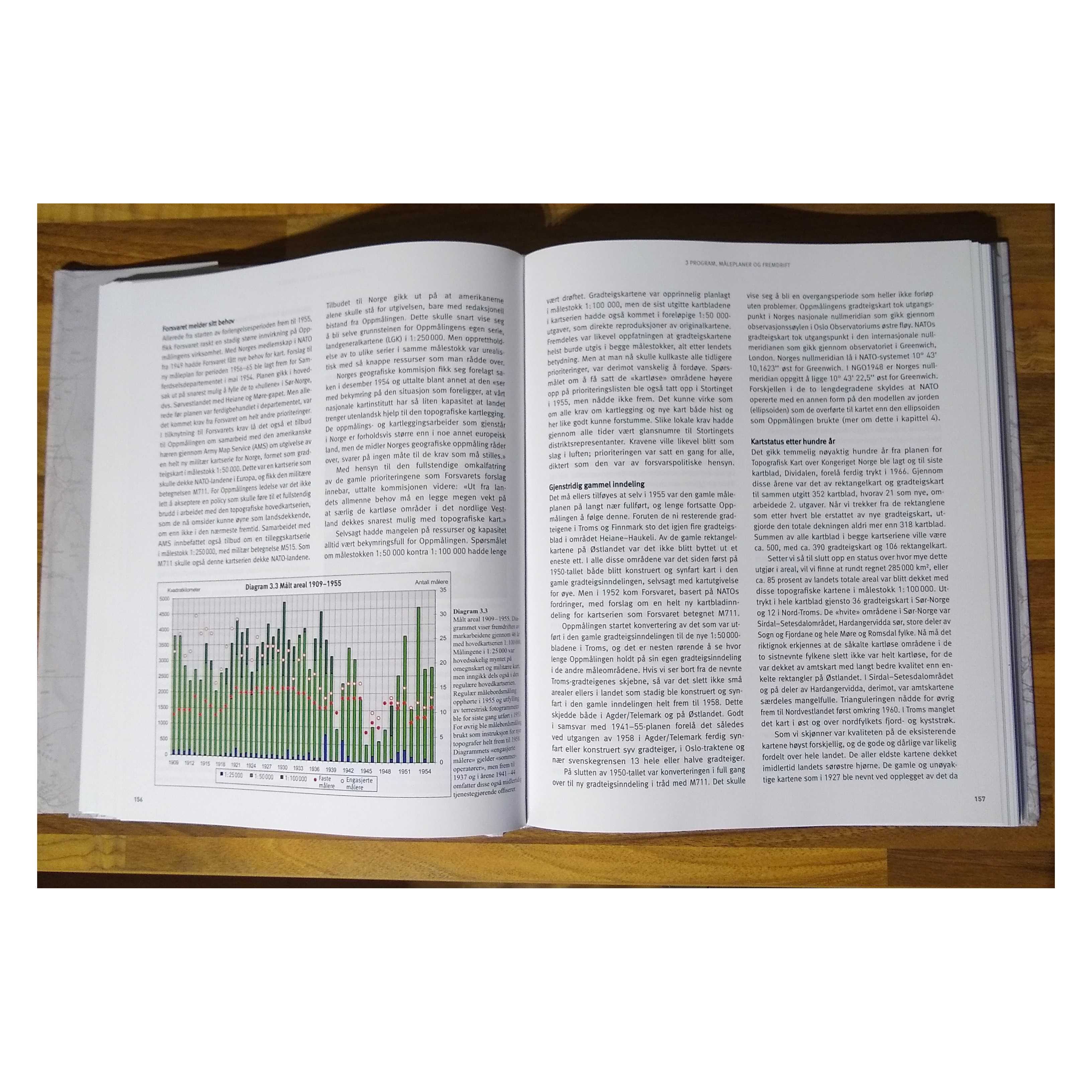
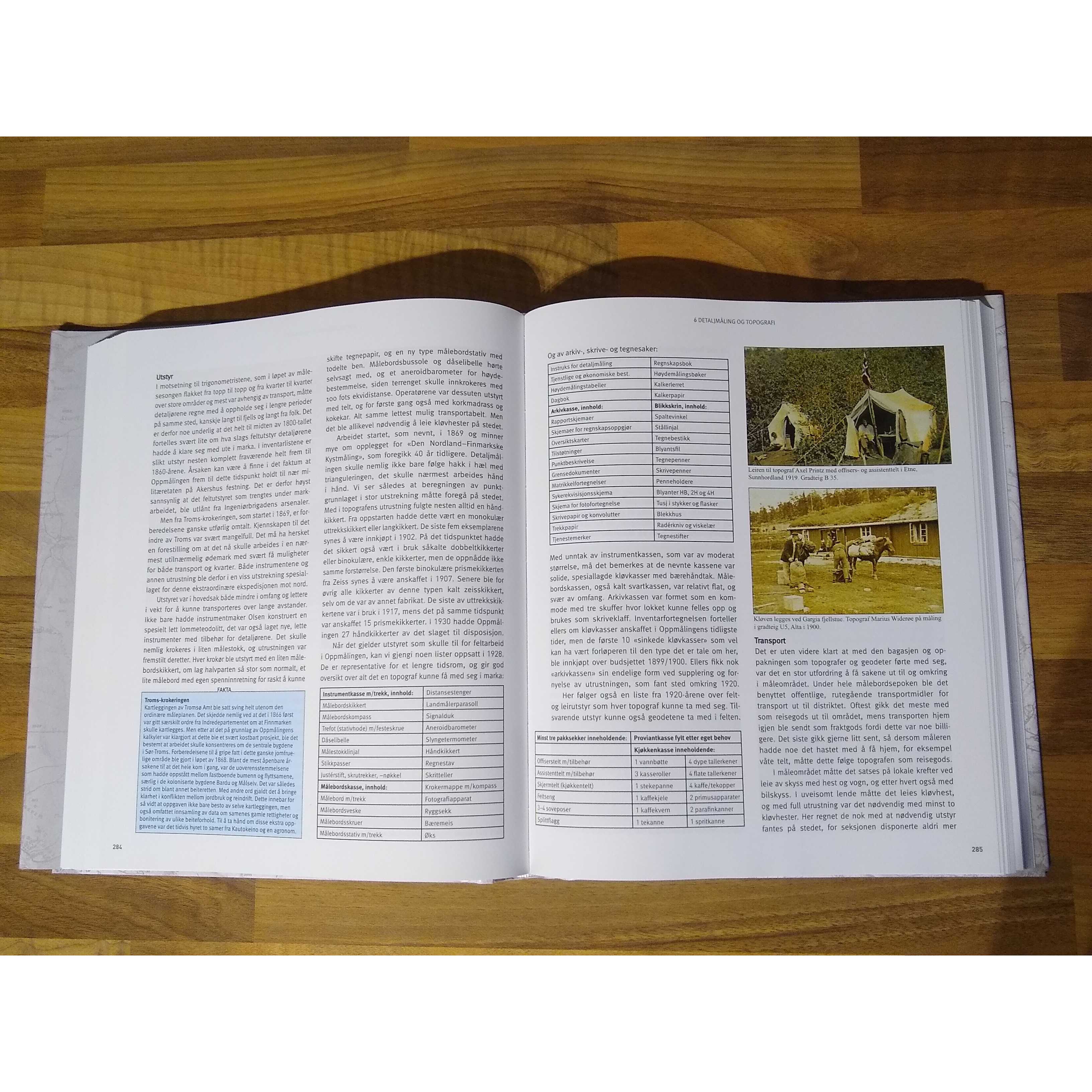
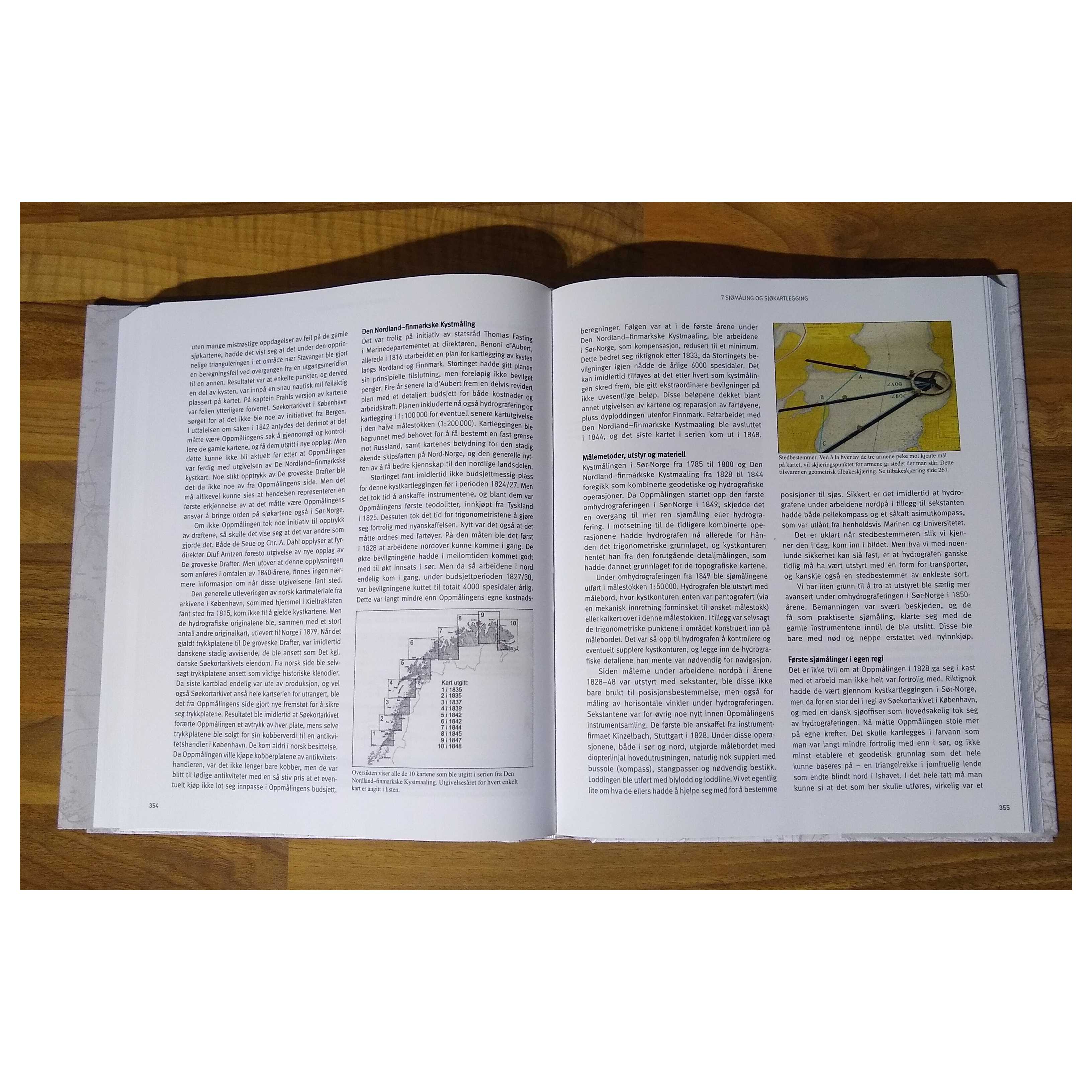
Title:Med kart skal landet bygges. Oppmaling og kartlegging av Norge 1773-2016
Author:Harsson (Bjorn Geirr) and Roald Aanrud
Price:GBP£140.00 (about USD$174.50)
Shipping:GBP£32.00 (about USD$39.90)
(To United States of America)
(To United States of America)
Signed:By Author
ISBN:8292596011
Item ID:TP01-92387
Quantity:1
Publisher:Kartverket, 1998
Binding:Hardcover (Original Cloth)
Condition:Almost as New
Dust Jacket:No
Kartverket, 1998, Hardcover (Original Cloth), Book Condition: Almost as New, Dust Jacket Condition: No, Signed by Author
Laminated boards with matching dustwrapper, illustrated in colour and black & white. Slight wear to wrapper. Signed by the author on the titlepage. Size: Small Quarto. 216 pages. Text is in Norwegian. Category: Geography & Maps; Milorg; Norwegian Language; Signed by Author. ISBN: 8292596011. ISBN/EAN: 9788292596012.
Laminated boards with matching dustwrapper, illustrated in colour and black & white. Slight wear to wrapper. Signed by the author on the titlepage. Size: Small Quarto. 216 pages. Text is in Norwegian. Category: Geography & Maps; Milorg; Norwegian Language; Signed by Author. ISBN: 8292596011. ISBN/EAN: 9788292596012.


Title:The Universal Gazetteer or Dictionary of Descriptive and Physical Geography, compiled from the Most Recent Authorities, Illustrate by Numerous Engravngs
Author:James Bryce (later Viscount Bryce)
Price:GBP£138.80 (about USD$173.00)
Shipping:GBP£26.00 (about USD$32.40)
(To United States of America)
(To United States of America)
Item ID:BB08-03111080015
Quantity:1
Publisher:Griffin, Bohn, and Company, London, 1862
Edition:Third , thoroughly revised
Binding:Hardcover
Condition:Fair
Dust Jacket:No
Griffin, Bohn, and Company, 1862, Hardcover, Book Condition: Fair, Dust Jacket Condition: No, Third , thoroughly revised
Includes annex at rear, Key to the Pronunciation by F A Wolski. Brown half-leather with black spine label and decorated spine, rear cover is detached, marbled end-papers, previous owner's name and date of 1866 on darkened front end-paper, internal binding is sound, pages and marbled blocks are darkened. No dust jacket, as published. Quantity Available: 1. Shipped Weight: 1-2kg. Pictures ... More Text...
Includes annex at rear, Key to the Pronunciation by F A Wolski. Brown half-leather with black spine label and decorated spine, rear cover is detached, marbled end-papers, previous owner's name and date of 1866 on darkened front end-paper, internal binding is sound, pages and marbled blocks are darkened. No dust jacket, as published. Quantity Available: 1. Shipped Weight: 1-2kg. Pictures ... More Text...
Title:World Regional Geography: A Development Approach: 11th Edition
Author:Johnson
Price:USD$172.00
Shipping:Set Shipping State/Province
(To United States of America)
(To United States of America)
ISBN:0321939654
Item ID:AZ00-1561062791
Quantity:1
Publisher:Pearson, Upper Saddle River, NJ, 2006
Edition:11th
Binding:Softcover
Condition:New
Pearson, 2006, Softcover, Book Condition: New, 11th
New condition, Looks great 571 pages. Quantity Available: 1. Shipped Weight: Under 1 kilo. Category: Geography & Maps; Education. ISBN: 0321939654. ISBN/EAN: 9780321939654. Pictures of this item not already displayed here available upon request. Inventory No: 1561062791.
New condition, Looks great 571 pages. Quantity Available: 1. Shipped Weight: Under 1 kilo. Category: Geography & Maps; Education. ISBN: 0321939654. ISBN/EAN: 9780321939654. Pictures of this item not already displayed here available upon request. Inventory No: 1561062791.
Title:Geography Toward History: Studies in the Mediterranean Basin, Mesopotamia and Central Asia ( Signed Copy)
Author:Huntington, Ellsworth
Price:USD$169.00
Shipping:Set Shipping State/Province
(To United States of America)
(To United States of America)
ISBN:1593338619
Item ID:AZ00-1561049746
Quantity:1
Publisher:Georgia Press, 2008
Edition:First
Binding:Hardcover
Condition:As New
Dust Jacket:No
Georgia Press, 2008, Hardcover, Book Condition: As New, Dust Jacket Condition: No, First
First Edition, First Printing, Signed Copy, minimal shelf wear from storage, Cover looks very nice, Inside text is in new condition, very crisp and clean. Collectable, Rare / Scarce Room #516 396 pages. Quantity Available: 1. Shipped Weight: Under 1 kilo. Category: Geography & Maps; History. ISBN: 1593338619. ISBN/EAN: 9781593338619. Pictures of this item not already displayed here available upon request. Inventory No: 1561049746.
First Edition, First Printing, Signed Copy, minimal shelf wear from storage, Cover looks very nice, Inside text is in new condition, very crisp and clean. Collectable, Rare / Scarce Room #516 396 pages. Quantity Available: 1. Shipped Weight: Under 1 kilo. Category: Geography & Maps; History. ISBN: 1593338619. ISBN/EAN: 9781593338619. Pictures of this item not already displayed here available upon request. Inventory No: 1561049746.
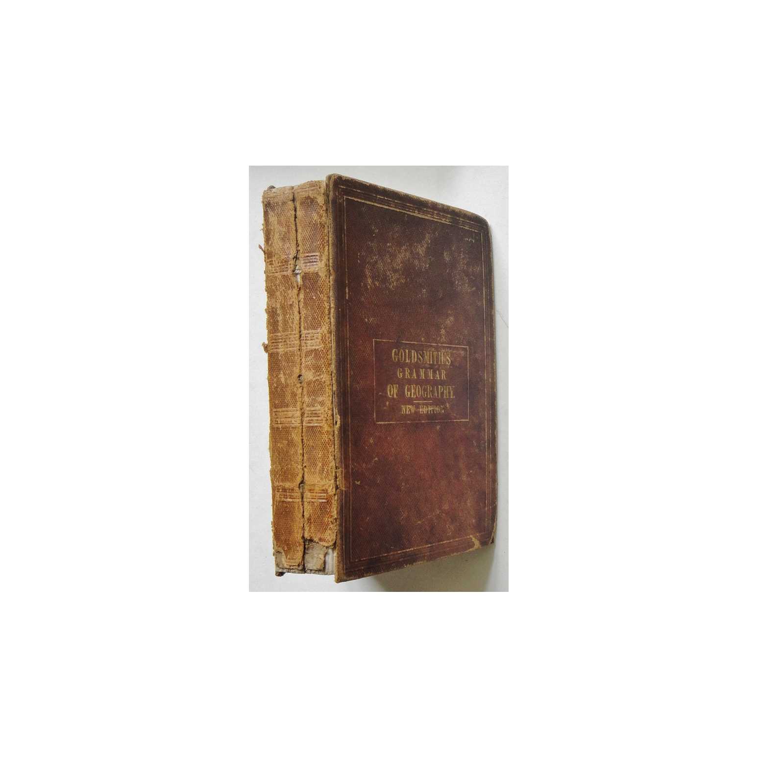
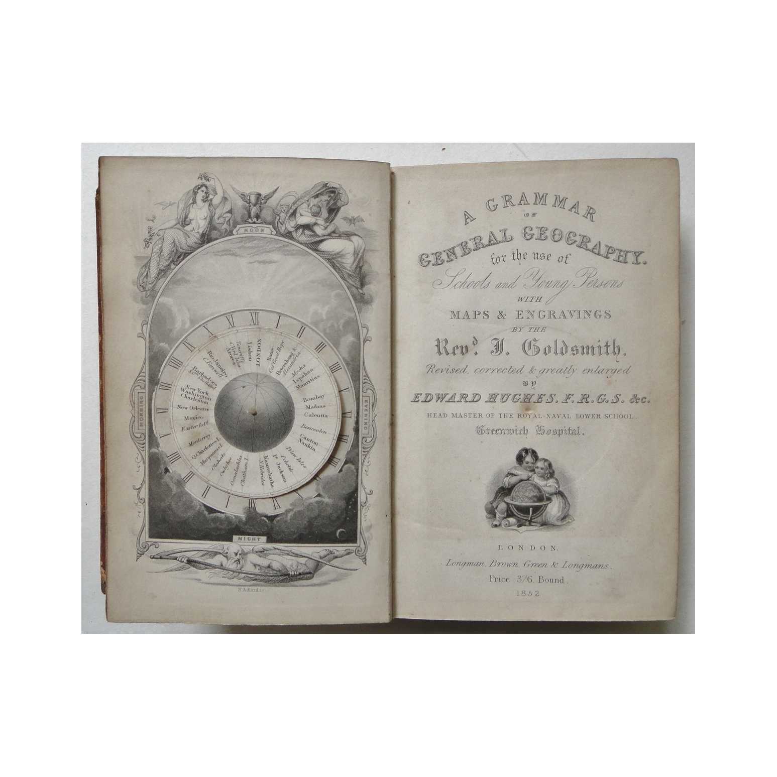
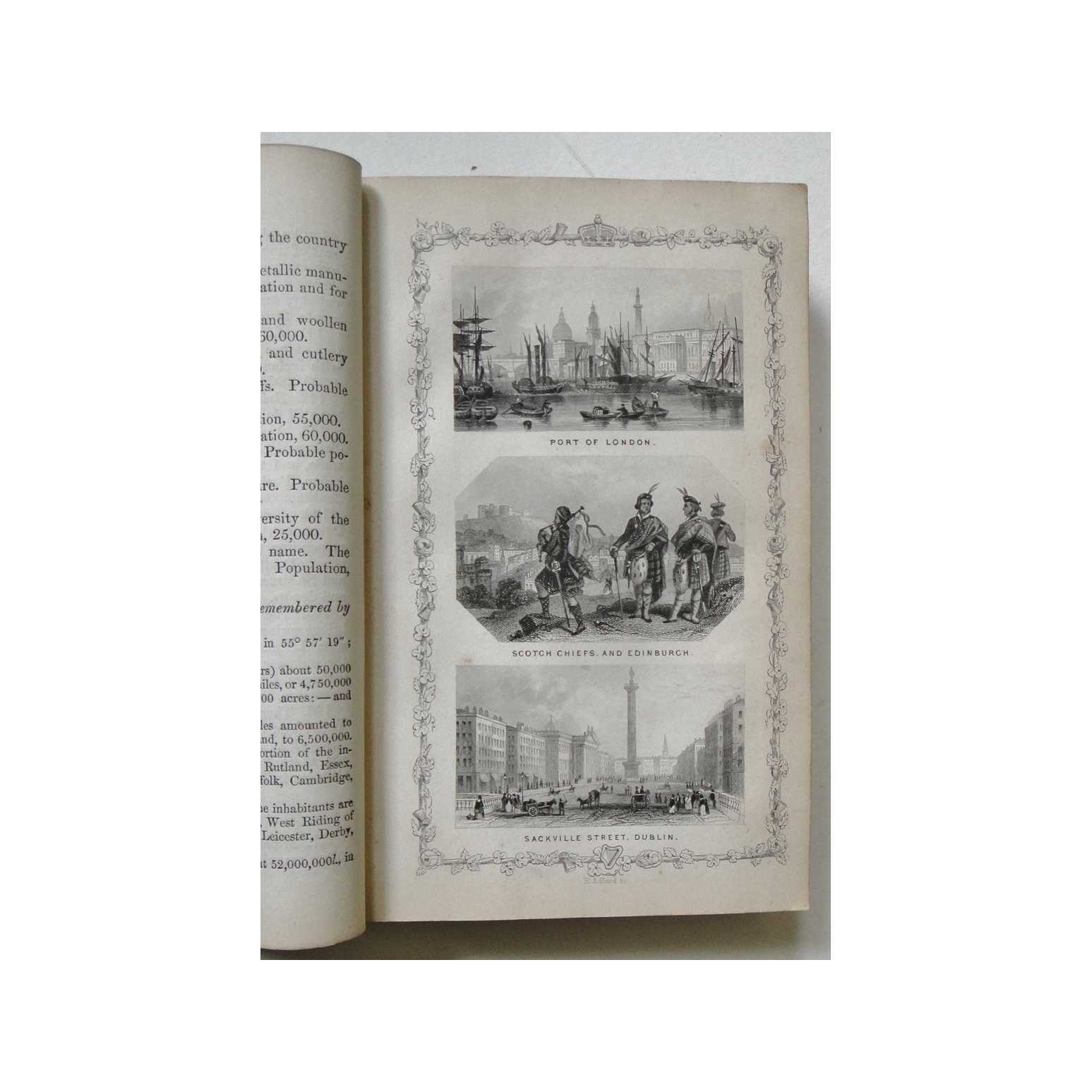
Title:A Grammar of General Geography for the use of Schools and Young Persons
Author:Goldsmith, Rev. J.
Price:GBP£129.95 (about USD$161.90)
Shipping:GBP£9.80 (about USD$12.30)
(To United States of America)
(To United States of America)
Item ID:M002-03341
Quantity:1
Publisher:Longman, Brown, Green & Longmans, UK, 1852
Edition:New
Binding:Hardcover
Condition:Good
Longman, Brown, Green & Longmans, 1852, Hardcover, Book Condition: Good, New
Mostly well-preserved, with fold-out maps and rotating diagrammatic frontispiece bearing only minor signs of wear, lightly toned towards page edges and faint scattered foxing. Some small repairs with preservation tape. Boards have come loose from the binding, which has split near the centre, but pages remain firmly-bound together. Why on Amazon do most sellers not describe their actual book? Buy with confidence and support a ... More Text...
Mostly well-preserved, with fold-out maps and rotating diagrammatic frontispiece bearing only minor signs of wear, lightly toned towards page edges and faint scattered foxing. Some small repairs with preservation tape. Boards have come loose from the binding, which has split near the centre, but pages remain firmly-bound together. Why on Amazon do most sellers not describe their actual book? Buy with confidence and support a ... More Text...

Title:Cassell's Map of Africa (Dispatch Atlas 1863)
Author:Weller, Edward
Price:GBP£129.95 (about USD$161.90)
Shipping:GBP£9.80 (about USD$12.30)
(To United States of America)
(To United States of America)
Item ID:M002-10655
Quantity:1
Publisher:Cassell, UK, 1863
Edition:First
Binding:Softcover
Condition:Very Good
Cassell, 1863, Softcover, Book Condition: Very Good, First
An original hand-coloured lithograph taken from Cassell's Weekly Dispatch Atlas, 1863. Overall a very presentable copy, with some minor browning to margins, but barely encroaching onto the actual print, with lines and colouring remaining clear and bold across the entire surface. One vertical fold line, as originally presented. Small nicks and creases around edges, not encroaching greatly upon the image, reinforced with high-quality conservation ... More Text...
An original hand-coloured lithograph taken from Cassell's Weekly Dispatch Atlas, 1863. Overall a very presentable copy, with some minor browning to margins, but barely encroaching onto the actual print, with lines and colouring remaining clear and bold across the entire surface. One vertical fold line, as originally presented. Small nicks and creases around edges, not encroaching greatly upon the image, reinforced with high-quality conservation ... More Text...
Title:Gazetteer of the British Isles : Statistical and Topographical
Author:John Bartholomew (Editor)
Price:GBP£129.35 (about USD$161.20)
Shipping:GBP£41.90 (about USD$52.20)
(To United States of America)
(To United States of America)
Item ID:B00B-220928TRX062018
Quantity:1
Publisher:Adam and Charles Black, Edinburgh, 1887
Binding:Hardcover
Condition:Good
Adam and Charles Black, 1887, Hardcover, Book Condition: Good
No dust jacket. Scattered foxing, especially on first few pages. Spine intact, bindings firm. A presentable used copy with no significant flaws. Size: 26 x 19 x 6 cm. 912 pp.. Shipped Weight: 2-3 kilos. Category: Geography & Maps; Great Britain; Ireland; 0. Add. Inventory No: 220928TRX062018.
No dust jacket. Scattered foxing, especially on first few pages. Spine intact, bindings firm. A presentable used copy with no significant flaws. Size: 26 x 19 x 6 cm. 912 pp.. Shipped Weight: 2-3 kilos. Category: Geography & Maps; Great Britain; Ireland; 0. Add. Inventory No: 220928TRX062018.
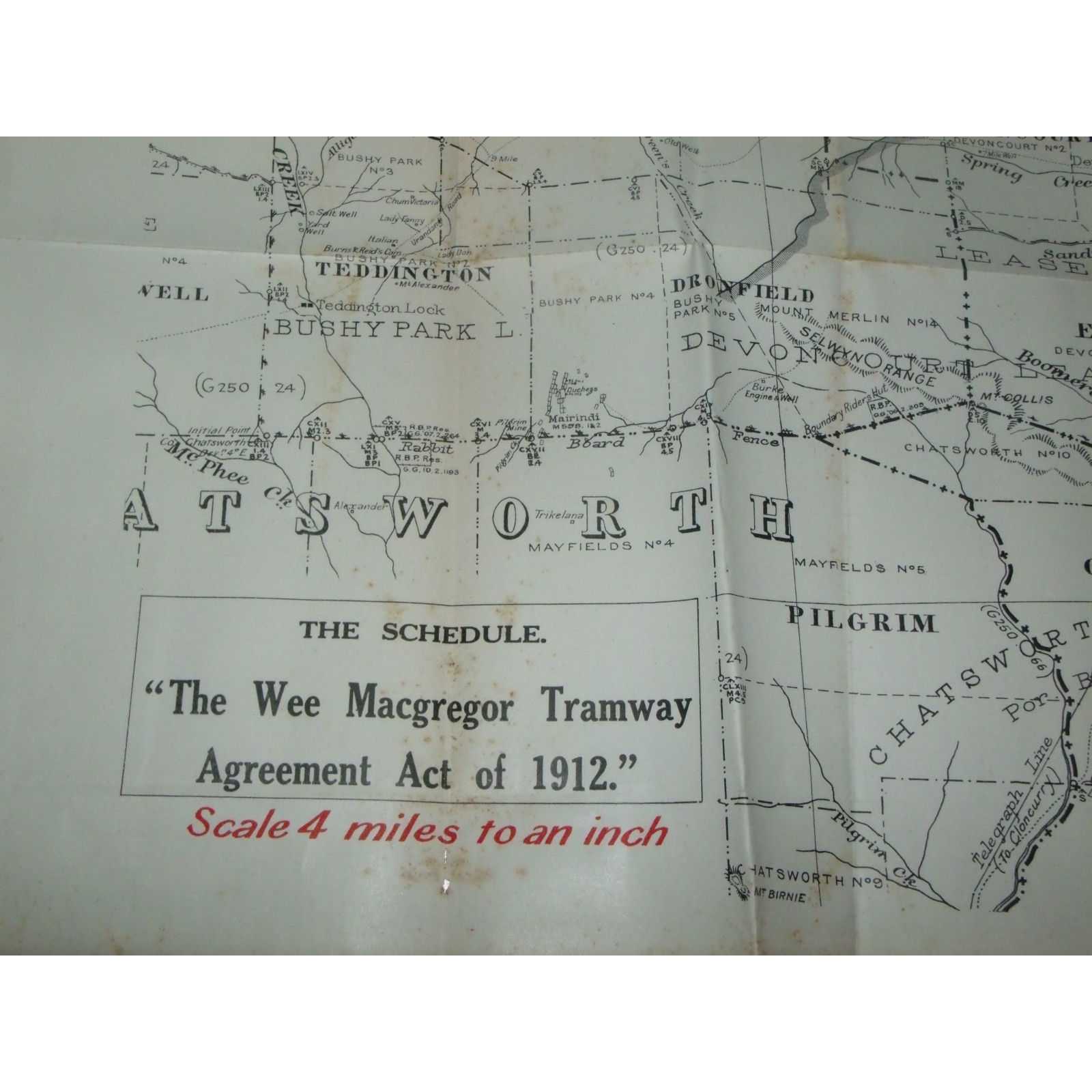
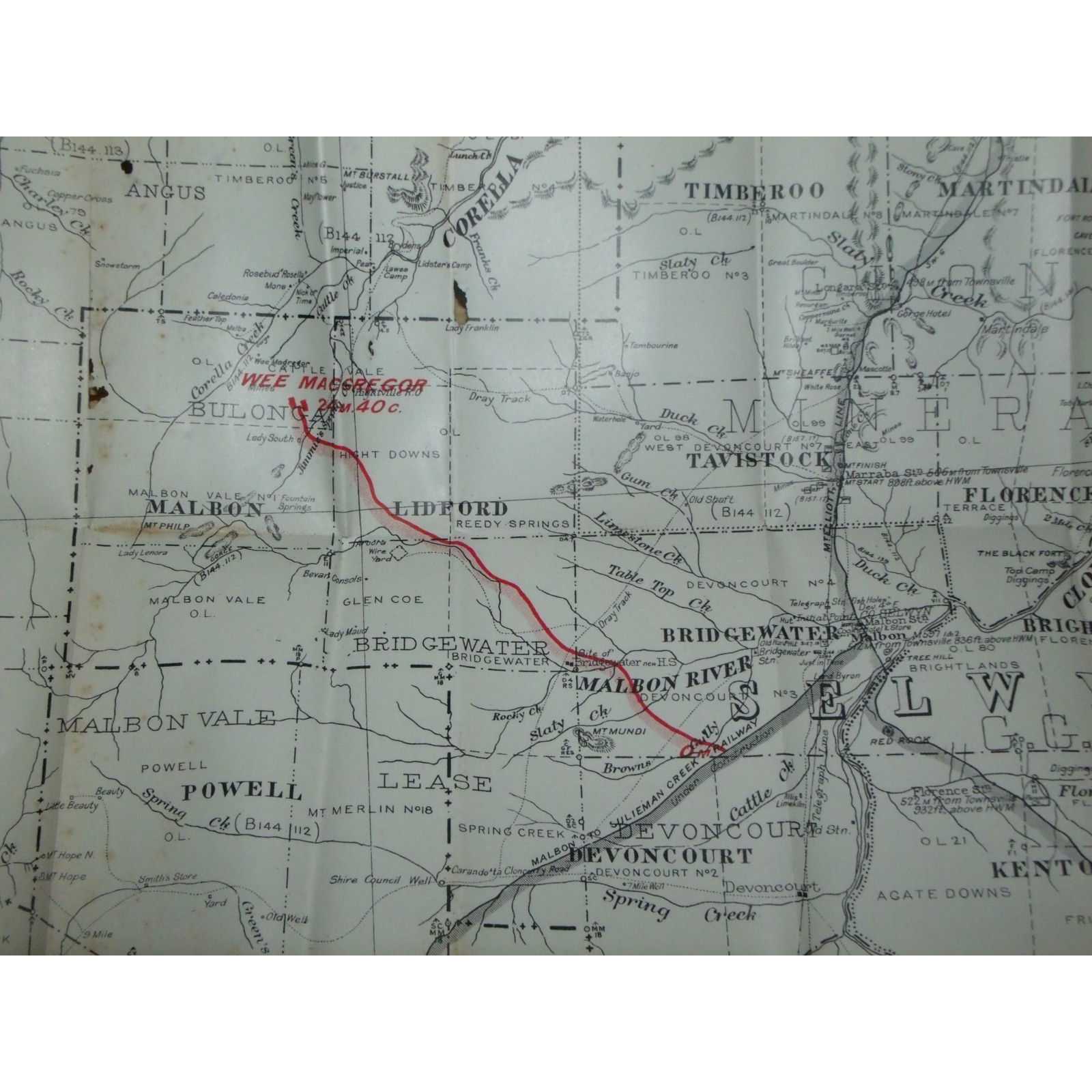
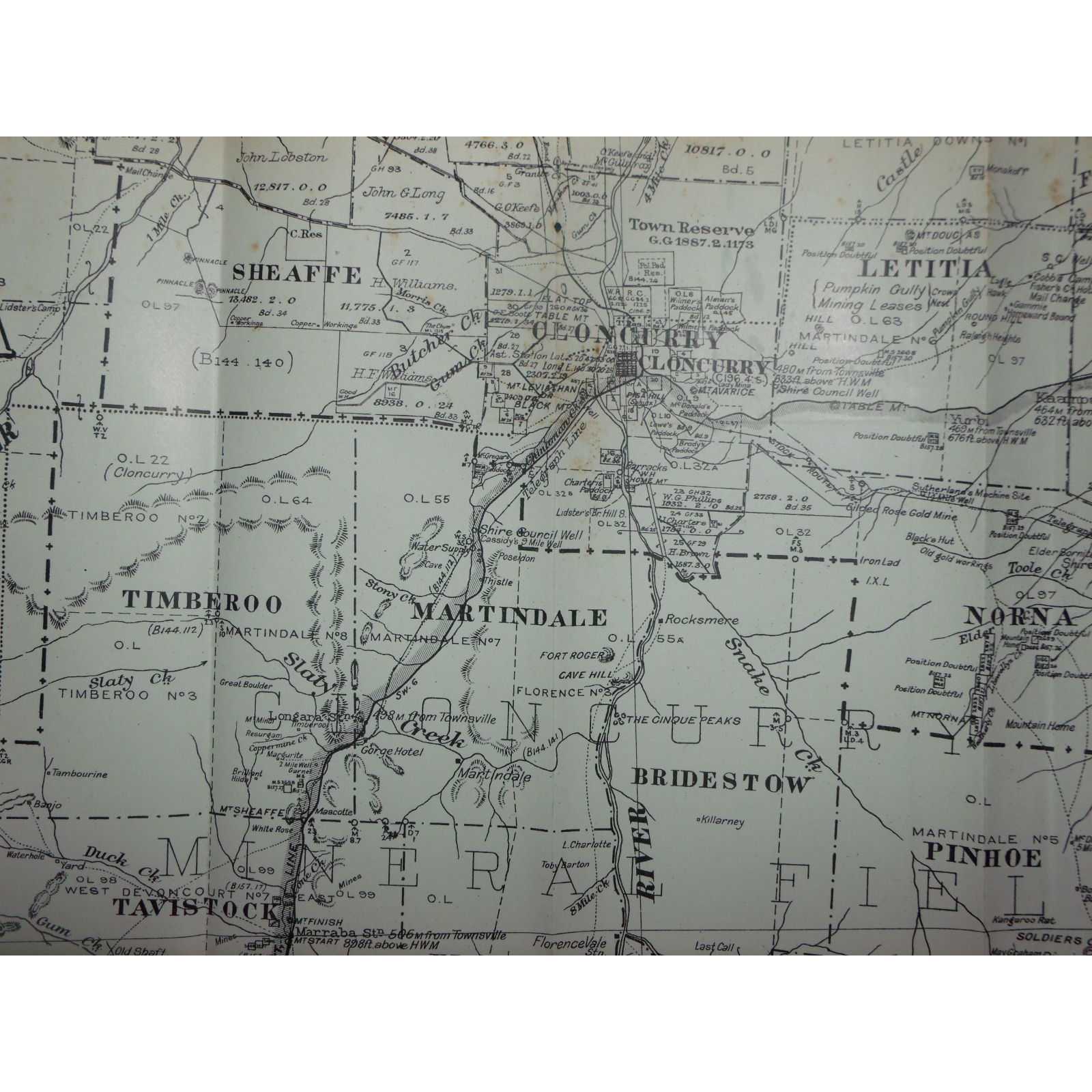
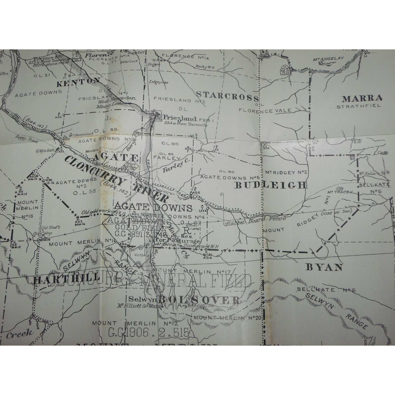
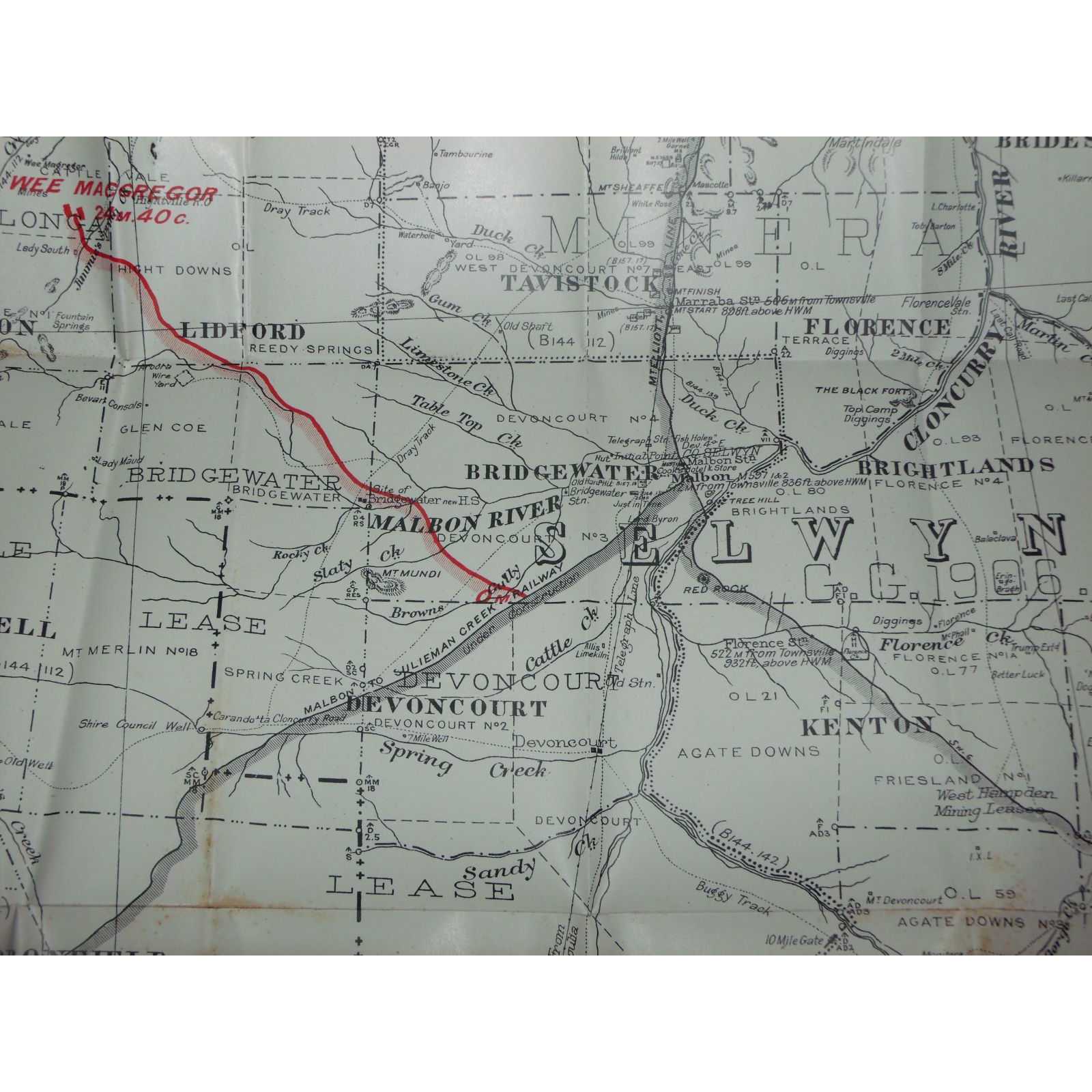
Title:The Wee Macgregor Tramway Agreement Act of 1912
Author:Queensland Government
Price:AUD$245.00 (about USD$159.20)
Shipping:AUD$40.00 (about USD$26.00)
(To United States of America)
(To United States of America)
Item ID:SI00-005566
Quantity:1
Publisher:Queensland Government, Brisbane, 1916
Edition:First
Queensland Government, 1916, First
1 map. 530mm by 500mm. Map is in good condition with some wear and holes; light foxing. Map ex 1916 Queensland Government Statutes. Elephant Folio - over 15" - 23" tall. Quantity Available: 1. Category: Maps; Pictures of this item not already displayed here available upon request. Inventory No: 005566.
1 map. 530mm by 500mm. Map is in good condition with some wear and holes; light foxing. Map ex 1916 Queensland Government Statutes. Elephant Folio - over 15" - 23" tall. Quantity Available: 1. Category: Maps; Pictures of this item not already displayed here available upon request. Inventory No: 005566.
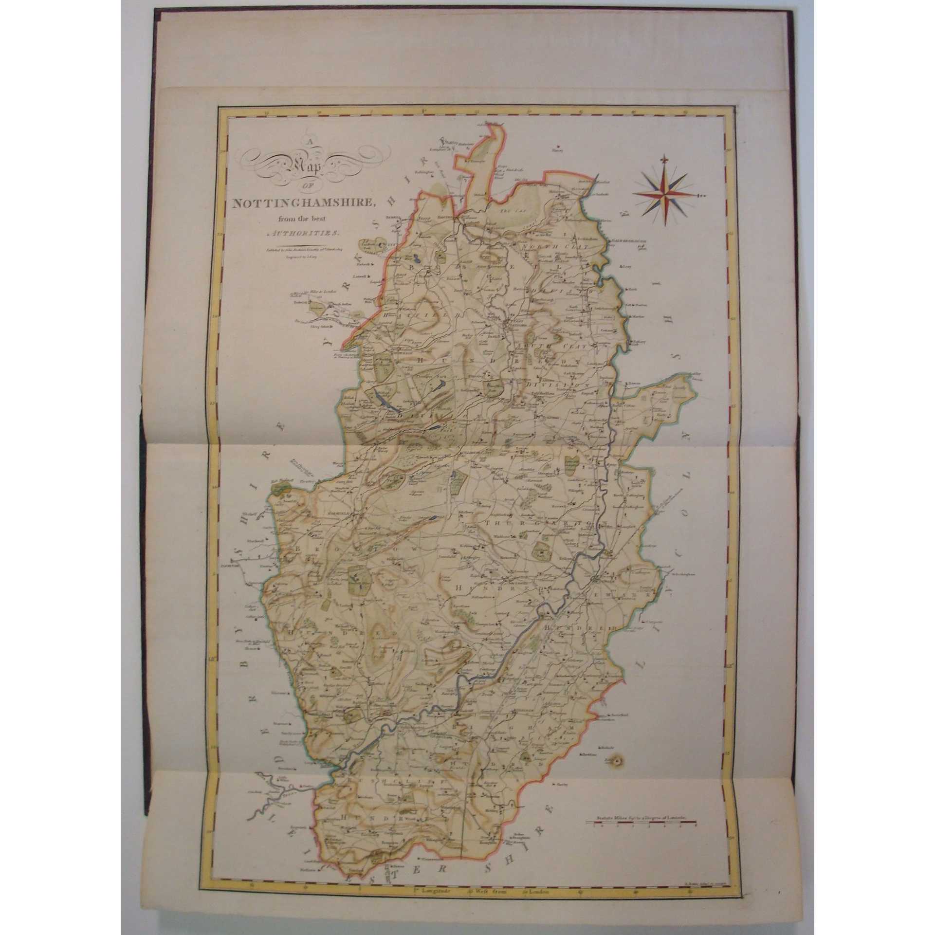
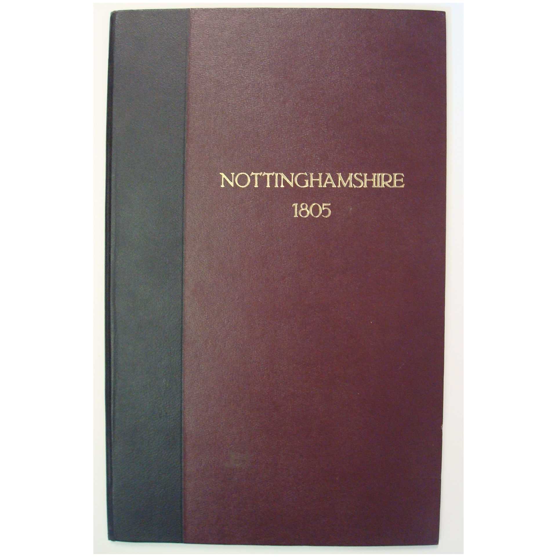
Title:Nottinghamshire Map 1805 Complete section Ex Gough Camden's Britannia
Author:John Cary
Price:GBP£125.00 (about USD$155.80)
Shipping:GBP£9.80 (about USD$12.30)
(To United States of America)
(To United States of America)
Item ID:M002-13369
Quantity:1
Publisher:John Cary, Gough, London, 1805
Edition:1805
Binding:Hardcover
Condition:Near Fine
Dust Jacket:No Jacket as issued
John Cary, Gough, 1805, Hardcover, Book Condition: Near Fine, Dust Jacket Condition: No Jacket as issued, 1805
1805 A Beautifully Hand Coloured JOHN CARY map of Nottinghamshire and 2 engravings. Quarter bound in crushed black morocco with burgundy textured cloth backed boards and gilt titles 270 x 430 mm.. MAP IS LARGER! A little shelf rubbed o/w vg. 18pp text Why on Amazon do most sellers not describe their actual book? Buy with confidence and support a genuine Independent Bricks & Mortar Real Bookshop. We ... More Text...
1805 A Beautifully Hand Coloured JOHN CARY map of Nottinghamshire and 2 engravings. Quarter bound in crushed black morocco with burgundy textured cloth backed boards and gilt titles 270 x 430 mm.. MAP IS LARGER! A little shelf rubbed o/w vg. 18pp text Why on Amazon do most sellers not describe their actual book? Buy with confidence and support a genuine Independent Bricks & Mortar Real Bookshop. We ... More Text...
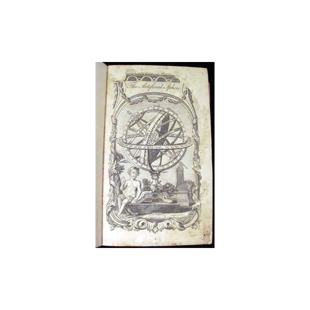
30cm x 20cm. [20], 230, [2] pages, 2 double page maps, 18 maps in the text. Full vellum, manuscript lettering, housed in a custom quarter leather clamshell. Text is in Latin. The Second Isingrin Edition with commentary and woodcut maps by Sebastian Munster. A significant work of geography containing "the earliest representation of the north-west coast of America on a printed map" (Burden), as well as one of the earliest printed works to with a ... More Text...